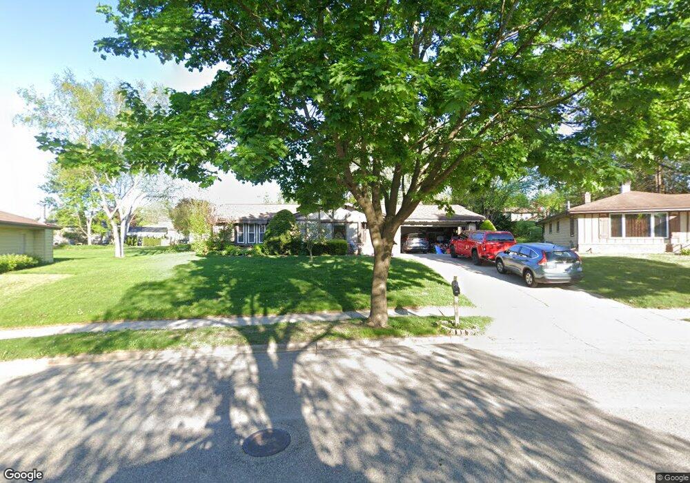
1933 Chapman Dr Waukesha, WI 53189
Estimated Value: $385,000 - $427,000
3
Beds
2
Baths
1,704
Sq Ft
$239/Sq Ft
Est. Value
About This Home
This home is located at 1933 Chapman Dr, Waukesha, WI 53189 and is currently estimated at $407,374, approximately $239 per square foot. 1933 Chapman Dr is a home located in Waukesha County with nearby schools including Prairie Elementary School, Les Paul Middle School - Central Campus, and West High School.
Ownership History
Date
Name
Owned For
Owner Type
Purchase Details
Closed on
Feb 1, 2007
Sold by
Bennett Michael R and Bennett Leanne J
Bought by
Schroeder Stephen P
Current Estimated Value
Home Financials for this Owner
Home Financials are based on the most recent Mortgage that was taken out on this home.
Original Mortgage
$210,000
Outstanding Balance
$125,991
Interest Rate
6.19%
Mortgage Type
Purchase Money Mortgage
Estimated Equity
$281,383
Purchase Details
Closed on
May 17, 1999
Sold by
Blaedow Karl R and Blaedow Robyn J
Bought by
Bennett Michael R and Bennett Leanne J
Home Financials for this Owner
Home Financials are based on the most recent Mortgage that was taken out on this home.
Original Mortgage
$73,000
Interest Rate
6.94%
Create a Home Valuation Report for This Property
The Home Valuation Report is an in-depth analysis detailing your home's value as well as a comparison with similar homes in the area
Home Values in the Area
Average Home Value in this Area
Purchase History
| Date | Buyer | Sale Price | Title Company |
|---|---|---|---|
| Schroeder Stephen P | $230,000 | Gatewood Title Services | |
| Bennett Michael R | $145,000 | -- |
Source: Public Records
Mortgage History
| Date | Status | Borrower | Loan Amount |
|---|---|---|---|
| Open | Schroeder Stephen P | $210,000 | |
| Previous Owner | Bennett Michael R | $73,000 |
Source: Public Records
Tax History Compared to Growth
Tax History
| Year | Tax Paid | Tax Assessment Tax Assessment Total Assessment is a certain percentage of the fair market value that is determined by local assessors to be the total taxable value of land and additions on the property. | Land | Improvement |
|---|---|---|---|---|
| 2024 | $5,436 | $393,500 | $89,100 | $304,400 |
| 2023 | $5,720 | $393,500 | $89,100 | $304,400 |
| 2022 | $4,587 | $239,400 | $77,100 | $162,300 |
| 2021 | $4,695 | $239,400 | $77,100 | $162,300 |
| 2020 | $4,537 | $239,400 | $77,100 | $162,300 |
| 2019 | $4,395 | $239,400 | $77,100 | $162,300 |
| 2018 | $4,035 | $215,700 | $68,000 | $147,700 |
| 2017 | $4,024 | $215,700 | $68,000 | $147,700 |
| 2016 | $3,821 | $192,600 | $65,800 | $126,800 |
| 2015 | $3,799 | $192,600 | $65,800 | $126,800 |
| 2014 | $3,963 | $192,600 | $65,800 | $126,800 |
| 2013 | $3,963 | $192,600 | $65,800 | $126,800 |
Source: Public Records
Map
Nearby Homes
- 2010 Dixie Dr
- 1909 Mallard Pointe Cir
- 1722 Sycamore Dr
- 1210 Woodbury Common Unit C
- 1203 Woodbury Common Unit D
- 1101 Dogwood Ln
- 1706 Haymarket Rd
- 1277 Market Place
- LtD59 White Deer Trail
- 812 Timber Ridge Ct Unit 10
- 1523 David Ln
- S54W25487 Pebble Brook Ct
- S54W25436 Pebble Brook Ct
- Lt6 Finch Ct
- 801 Timber Ridge Dr
- 2415 Fox River Pkwy Unit H
- 300 Darlene Dr
- 2426 Fox River Pkwy Unit G
- 1906 Marliz Dr
- 2708 Fox Hill Dr
- 1930 Chapman Dr
- 1929 Chapman Dr
- 1937 Chapman Dr
- 1941 Chapman Dr
- 1924 Chapman Dr
- 1925 Chapman Dr
- 1948 Chapman Dr
- 1945 Chapman Dr
- 1949 Chapman Dr
- 1932 Dixie Dr
- 1928 Dixie Dr
- 1920 Chapman Dr
- 1921 Chapman Dr
- 1936 Dixie Dr
- 2014 Chapman Dr
- 2020 Chapman Dr
- 1960 Dixie Dr
- 1924 Dixie Dr
- 2002 Dixie Dr
- 2024 Chapman Dr