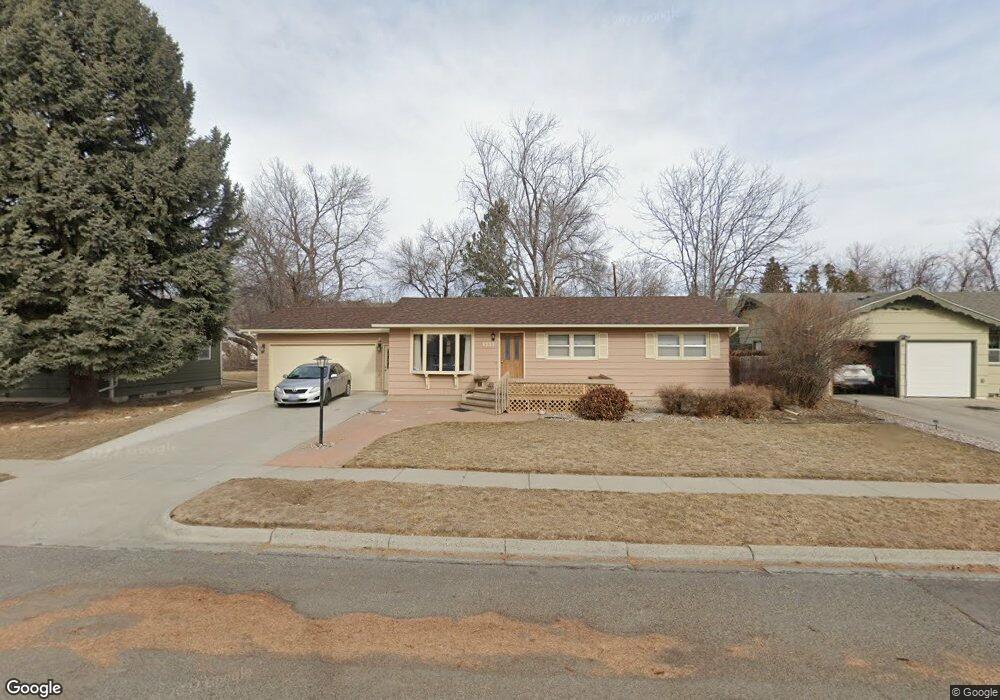
1933 Parkhill Dr Billings, MT 59102
North Central Billings NeighborhoodEstimated Value: $356,000 - $386,000
4
Beds
3
Baths
2,708
Sq Ft
$138/Sq Ft
Est. Value
About This Home
This home is located at 1933 Parkhill Dr, Billings, MT 59102 and is currently estimated at $374,558, approximately $138 per square foot. 1933 Parkhill Dr is a home located in Yellowstone County with nearby schools including Rose Park School, Lewis & Clark Junior High School, and Billings Senior High School.
Ownership History
Date
Name
Owned For
Owner Type
Purchase Details
Closed on
Nov 25, 2024
Sold by
Gilbertson Leanne
Bought by
Olson Edward D and Olson Jeannine L
Current Estimated Value
Purchase Details
Closed on
Mar 28, 2016
Sold by
Ward Leslie Julla St Claire
Bought by
Gilbertson Leanne
Home Financials for this Owner
Home Financials are based on the most recent Mortgage that was taken out on this home.
Original Mortgage
$187,920
Interest Rate
3.62%
Mortgage Type
New Conventional
Purchase Details
Closed on
Oct 9, 2015
Sold by
Leslie William M
Bought by
Leslie Claire W and Leslie Julia S
Home Financials for this Owner
Home Financials are based on the most recent Mortgage that was taken out on this home.
Interest Rate
3.76%
Purchase Details
Closed on
Jun 17, 2010
Sold by
Leslie William A and Leslie Claire W
Bought by
Leslie William M and Leslie Claire W
Create a Home Valuation Report for This Property
The Home Valuation Report is an in-depth analysis detailing your home's value as well as a comparison with similar homes in the area
Home Values in the Area
Average Home Value in this Area
Purchase History
| Date | Buyer | Sale Price | Title Company |
|---|---|---|---|
| Olson Edward D | -- | First Montana Title | |
| Olson Edward D | -- | First Montana Title | |
| Gilbertson Leanne | -- | Chicago Title | |
| Leslie Claire W | -- | -- | |
| Leslie William M | -- | None Available |
Source: Public Records
Mortgage History
| Date | Status | Borrower | Loan Amount |
|---|---|---|---|
| Previous Owner | Gilbertson Leanne | $187,920 | |
| Previous Owner | Leslie Claire W | -- |
Source: Public Records
Tax History Compared to Growth
Tax History
| Year | Tax Paid | Tax Assessment Tax Assessment Total Assessment is a certain percentage of the fair market value that is determined by local assessors to be the total taxable value of land and additions on the property. | Land | Improvement |
|---|---|---|---|---|
| 2025 | $3,170 | $355,300 | $54,363 | $300,937 |
| 2024 | $3,170 | $330,400 | $51,699 | $278,701 |
| 2023 | $3,169 | $330,400 | $51,699 | $278,701 |
| 2022 | $3,012 | $276,500 | $49,083 | $227,417 |
| 2021 | $2,547 | $243,400 | $0 | $0 |
| 2020 | $2,615 | $240,200 | $0 | $0 |
| 2019 | $2,495 | $240,200 | $0 | $0 |
| 2018 | $2,212 | $207,300 | $0 | $0 |
| 2017 | $1,919 | $207,300 | $0 | $0 |
| 2016 | $2,060 | $201,200 | $0 | $0 |
| 2015 | $2,034 | $201,200 | $0 | $0 |
| 2014 | $1,826 | $95,559 | $0 | $0 |
Source: Public Records
Map
Nearby Homes
- 1944 Colton Blvd
- 2021 Beverly Hill Blvd
- 2124 Dahlia Ln
- 2035 Avenue D
- 1745 Parkhill Dr
- 1734 Mariposa Ln
- 1833 Iris Ln
- 1823 Alderson Ave
- 1811 Alderson Ave
- 1723 Alderson Ave
- 1921 Eastridge Dr
- 46 Shadow Place Unit 6B
- 56 Shadow Place
- 1119 21st St W
- 1444 Colton Blvd
- 1147 18th St W Unit 3
- 1436 Parkhill Dr
- 2042 Green Terrace Dr
- 1704 Burlington Ave
- 2060 Edgewood Dr
- 1931 Parkhill Dr
- 1937 Parkhill Dr
- 1945 Parkhill Dr
- 1932 Beverly Hill Blvd
- 1926 Beverly Hill Blvd
- 1921 Parkhill Dr
- 1938 Beverly Hill Blvd
- 1932 Parkhill Dr
- 1926 Parkhill Dr
- 1920 Beverly Hill Blvd
- 1944 Beverly Hill Blvd
- 1938 Parkhill Dr
- 1942 Parkhill Dr
- 1915 Parkhill Dr
- 1918 Parkhill Dr
- 1916 Beverly Hill Blvd
- 2001 Parkhill Dr
- 1907 Parkhill Dr
- 1933 Beverly Hill Blvd
- 1927 Beverly Hill Blvd