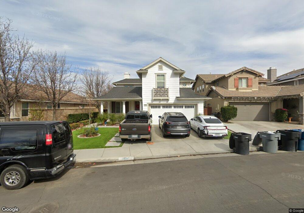
1934 Mount Verdugo Ln Perris, CA 92571
North Perris NeighborhoodEstimated Value: $587,000 - $631,000
5
Beds
3
Baths
2,924
Sq Ft
$207/Sq Ft
Est. Value
About This Home
This home is located at 1934 Mount Verdugo Ln, Perris, CA 92571 and is currently estimated at $604,770, approximately $206 per square foot. 1934 Mount Verdugo Ln is a home located in Riverside County with nearby schools including Avalon Elementary School, Lakeside Middle School, and Rancho Verde High School.
Ownership History
Date
Name
Owned For
Owner Type
Purchase Details
Closed on
Aug 24, 2005
Sold by
Baratt American Inc
Bought by
Real Rogelio and Real Cecilia
Current Estimated Value
Home Financials for this Owner
Home Financials are based on the most recent Mortgage that was taken out on this home.
Original Mortgage
$343,950
Interest Rate
5.75%
Mortgage Type
New Conventional
Create a Home Valuation Report for This Property
The Home Valuation Report is an in-depth analysis detailing your home's value as well as a comparison with similar homes in the area
Home Values in the Area
Average Home Value in this Area
Purchase History
| Date | Buyer | Sale Price | Title Company |
|---|---|---|---|
| Real Rogelio | $430,000 | Commonwealth Land Title Co |
Source: Public Records
Mortgage History
| Date | Status | Borrower | Loan Amount |
|---|---|---|---|
| Previous Owner | Real Rogelio | $343,950 |
Source: Public Records
Tax History Compared to Growth
Tax History
| Year | Tax Paid | Tax Assessment Tax Assessment Total Assessment is a certain percentage of the fair market value that is determined by local assessors to be the total taxable value of land and additions on the property. | Land | Improvement |
|---|---|---|---|---|
| 2025 | $8,968 | $587,608 | $95,647 | $491,961 |
| 2023 | $8,968 | $534,143 | $87,207 | $446,936 |
| 2022 | $7,894 | $485,584 | $79,279 | $406,305 |
| 2021 | $6,893 | $411,513 | $67,186 | $344,327 |
| 2020 | $6,357 | $367,421 | $59,987 | $307,434 |
| 2019 | $6,027 | $356,720 | $58,240 | $298,480 |
| 2018 | $5,865 | $343,000 | $56,000 | $287,000 |
| 2017 | $5,491 | $313,000 | $51,000 | $262,000 |
| 2016 | $5,331 | $298,000 | $49,000 | $249,000 |
| 2015 | $5,146 | $283,000 | $46,000 | $237,000 |
| 2014 | $4,964 | $265,000 | $43,000 | $222,000 |
Source: Public Records
Map
Nearby Homes
- 1886 Mount Verdugo Ln
- 1931 Brockstone Dr
- 1979 Mount Verdugo Ln
- 3294 Treehouse Dr
- 3613 Whieldon Dr
- 1717 Ropehaven Ct
- 3315 Andreas Palms Way
- 3353 Wind Chime Ln
- 3012 Zara Cir
- 27342 Dunite Dr
- 27354 Dunite Dr
- 27330 Dunite Dr
- 27318 Dunite Dr
- Plan 1800 at Rockridge
- Plan 2763 Modeled at Rockridge
- Plan 2026 Modeled at Rockridge
- Plan 2533 at Rockridge
- Plan 2378 Modeled at Rockridge
- 27379 Dunite Dr
- 27365 Dunite Dr
- 1942 Mount Verdugo Ln
- 1910 Mount Verdugo Ln
- 1950 Mount Verdugo Ln
- 1902 Mount Verdugo Ln
- 1958 Mount Verdugo Ln
- 1894 Mount Verdugo Ln
- 1947 Mount Verdugo Ln
- 1939 Mount Verdugo Ln
- 1966 Mount Verdugo Ln
- 1955 Mount Verdugo Ln
- 1963 Mount Verdugo Ln
- 1907 Mount Verdugo Ln
- 1974 Mount Verdugo Ln
- 1899 Mount Verdugo Ln
- 1971 Mount Verdugo Ln
- 1939 Brockstone Dr
- 1878 Mount Verdugo Ln
- 1923 Brockstone Dr
- 3366 Treehouse Dr
- 1947 Brockstone Dr