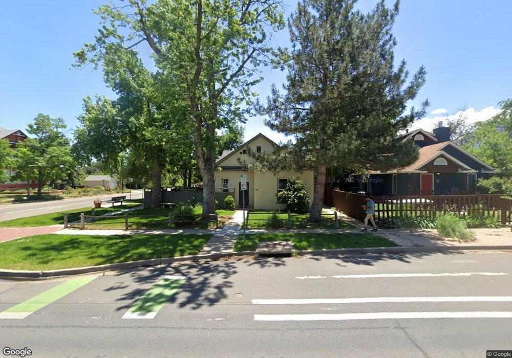
1934 Pine St Boulder, CO 80302
Whittier NeighborhoodEstimated Value: $1,889,000 - $2,265,000
10
Beds
4
Baths
3,227
Sq Ft
$641/Sq Ft
Est. Value
About This Home
This home is located at 1934 Pine St, Boulder, CO 80302 and is currently estimated at $2,068,173, approximately $640 per square foot. 1934 Pine St is a home located in Boulder County with nearby schools including Whittier Elementary School, Casey Middle School, and Boulder High School.
Ownership History
Date
Name
Owned For
Owner Type
Purchase Details
Closed on
Aug 8, 2019
Sold by
Hermsmeyer Norris W and Hermsmeyer Teri L
Bought by
Epstein Phillip
Current Estimated Value
Home Financials for this Owner
Home Financials are based on the most recent Mortgage that was taken out on this home.
Original Mortgage
$50,000
Outstanding Balance
$43,791
Interest Rate
3.7%
Mortgage Type
Purchase Money Mortgage
Estimated Equity
$2,024,382
Purchase Details
Closed on
Oct 8, 1992
Bought by
Hermsmeyer Norris W and Hermsmeyer Teri L
Purchase Details
Closed on
Aug 23, 1991
Bought by
Hermsmeyer Norris W and Hermsmeyer Teri L
Purchase Details
Closed on
Mar 1, 1991
Bought by
Hermsmeyer Norris W and Hermsmeyer Teri L
Purchase Details
Closed on
Jun 1, 1982
Bought by
Hermsmeyer Norris W and Hermsmeyer Teri L
Create a Home Valuation Report for This Property
The Home Valuation Report is an in-depth analysis detailing your home's value as well as a comparison with similar homes in the area
Home Values in the Area
Average Home Value in this Area
Purchase History
| Date | Buyer | Sale Price | Title Company |
|---|---|---|---|
| Epstein Phillip | $1,500,000 | Land Title Guarantee Company | |
| Hermsmeyer Norris W | -- | -- | |
| Hermsmeyer Norris W | $185,700 | -- | |
| Hermsmeyer Norris W | -- | -- | |
| Hermsmeyer Norris W | -- | -- |
Source: Public Records
Mortgage History
| Date | Status | Borrower | Loan Amount |
|---|---|---|---|
| Open | Epstein Phillip | $50,000 |
Source: Public Records
Tax History
| Year | Tax Paid | Tax Assessment Tax Assessment Total Assessment is a certain percentage of the fair market value that is determined by local assessors to be the total taxable value of land and additions on the property. | Land | Improvement |
|---|---|---|---|---|
| 2025 | $10,685 | $115,113 | $53,113 | $62,000 |
| 2024 | $10,685 | $115,113 | $53,113 | $62,000 |
| 2023 | $10,492 | $118,892 | $63,925 | $58,652 |
| 2022 | $7,866 | $82,280 | $39,916 | $42,364 |
| 2021 | $7,672 | $86,516 | $41,971 | $44,545 |
| 2020 | $8,530 | $97,998 | $41,971 | $56,027 |
| 2019 | $8,400 | $97,998 | $41,971 | $56,027 |
| 2018 | $7,778 | $89,712 | $38,592 | $51,120 |
| 2017 | $7,535 | $99,182 | $42,666 | $56,516 |
| 2016 | $6,644 | $76,750 | $29,372 | $47,378 |
| 2015 | $6,291 | $73,073 | $31,840 | $41,233 |
| 2014 | $6,144 | $73,073 | $31,840 | $41,233 |
Source: Public Records
Map
Nearby Homes
- 2324 19th St
- 1938 Spruce St
- 1709 Pine St Unit 3
- 2447 20th St
- 1843 Walnut St Unit B
- 1837 Walnut St Unit E
- 2225 Pine St
- 1707 Walnut St Unit 203
- 1707 Walnut St Unit 209
- 1707 Walnut St Unit 307
- 1707 Walnut St Unit 208
- 1707 Walnut St Unit 308
- 1707 Walnut St Unit 101
- 1707 Walnut St Unit 103
- 1707 Walnut St Unit 207
- 1707 Walnut St Unit 206
- 1707 Walnut St Unit 202
- 2201 Pearl St Unit 224
- 2201 Pearl St Unit 118
- 2240 Bluff St