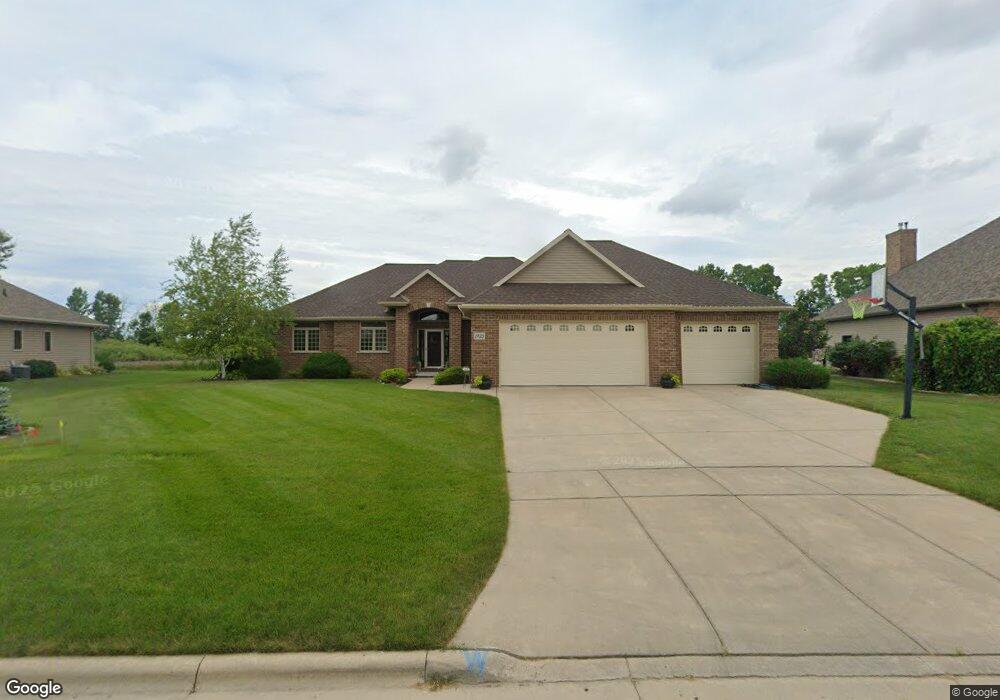
1935 Pheasant Run Trail de Pere, WI 54115
Estimated Value: $484,098 - $659,000
--
Bed
--
Bath
--
Sq Ft
0.63
Acres
About This Home
This home is located at 1935 Pheasant Run Trail, de Pere, WI 54115 and is currently estimated at $584,525. 1935 Pheasant Run Trail is a home located in Brown County with nearby schools including Susie C. Altmayer Elementary School, De Pere Middle School, and Foxview Intermediate School.
Ownership History
Date
Name
Owned For
Owner Type
Purchase Details
Closed on
Apr 16, 2012
Sold by
Donlou Suzanne R
Bought by
Donlon Brian M
Current Estimated Value
Purchase Details
Closed on
Sep 19, 2005
Sold by
Garot Land Development Llc
Bought by
Donlon Suzanne Ruth and Donlon Brian Michael
Create a Home Valuation Report for This Property
The Home Valuation Report is an in-depth analysis detailing your home's value as well as a comparison with similar homes in the area
Home Values in the Area
Average Home Value in this Area
Purchase History
| Date | Buyer | Sale Price | Title Company |
|---|---|---|---|
| Donlon Brian M | -- | None Available | |
| Donlon Suzanne Ruth | $48,900 | Land Title & Closing Svcs |
Source: Public Records
Tax History Compared to Growth
Tax History
| Year | Tax Paid | Tax Assessment Tax Assessment Total Assessment is a certain percentage of the fair market value that is determined by local assessors to be the total taxable value of land and additions on the property. | Land | Improvement |
|---|---|---|---|---|
| 2024 | $4,983 | $346,200 | $53,300 | $292,900 |
| 2023 | $4,376 | $346,200 | $53,300 | $292,900 |
| 2022 | $4,097 | $346,200 | $53,300 | $292,900 |
| 2021 | $3,913 | $339,500 | $53,300 | $286,200 |
| 2020 | $4,132 | $339,500 | $53,300 | $286,200 |
| 2019 | $4,202 | $272,200 | $42,600 | $229,600 |
| 2018 | $4,610 | $272,200 | $42,600 | $229,600 |
| 2017 | $4,419 | $272,200 | $42,600 | $229,600 |
| 2016 | $4,551 | $272,200 | $42,600 | $229,600 |
| 2015 | $4,535 | $272,200 | $42,600 | $229,600 |
| 2014 | $947 | $272,200 | $42,600 | $229,600 |
| 2013 | $947 | $42,600 | $42,600 | $0 |
Source: Public Records
Map
Nearby Homes
- 1987 Kettle Creek Dr
- 0 County Road Gv
- 2966 Monroe Rd
- 3728 Rustic Ledge Way
- 3754 Lyla May Ct
- 1553 Red Hawk Landing Trail
- 1541 Red Hawk Landing Trail
- 3749 Rustic Ledge Way
- 1790 Dallas Ln
- 1774 Dallas Ln
- 3200 Monroe Rd
- 0 Dallas Unit 50318709
- 1582 Red Hawk Landing Trail
- 1585 Red Hawk Landing Trail
- 1526 Red Hawk Landing Trail
- 1841 Ridgemont Cir
- 1769 Dollar Rd
- 2133 Palmer Ct
- 1535 Brayden Ln
- 1568 Brayden Ln
- 1931 Pheasant Run Trail
- 1939 Pheasant Run Trail
- 1929 Pheasant Run Trail
- 1943 Pheasant Run Trail
- 1936 Pheasant Run Trail
- 1936 1936 Pheasant Run Trail
- 1932 Pheasant Run Trail
- 1940 Pheasant Run Trail
- 1927 Pheasant Run Trail
- 1947 Pheasant Run Trail
- 1928 Pheasant Run Trail
- 1944 Pheasant Run Trail
- 1949 Copper Top Way
- 1945 Copper Top Way
- 1924 Pheasant Run Trail
- 1925 Pheasant Run Trail
- 1951 Pheasant Run Trail
- 1951 Pheasant Run Trail Unit TR
- 1953 Copper Top Way
- 1948 Pheasant Run Trail