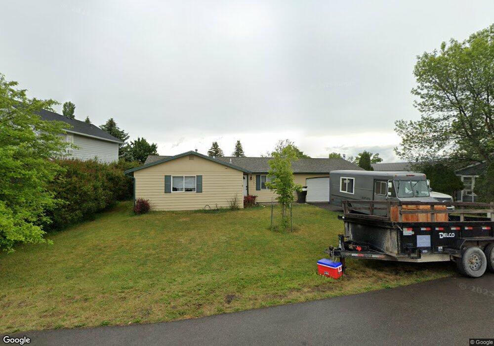
1937 Belmar Dr Kalispell, MT 59901
Estimated Value: $415,621 - $448,000
3
Beds
2
Baths
1,200
Sq Ft
$355/Sq Ft
Est. Value
About This Home
This home is located at 1937 Belmar Dr, Kalispell, MT 59901 and is currently estimated at $426,155, approximately $355 per square foot. 1937 Belmar Dr is a home located in Flathead County with nearby schools including Elrod School, Kalispell Middle School, and Flathead High School.
Ownership History
Date
Name
Owned For
Owner Type
Purchase Details
Closed on
Jun 4, 2024
Sold by
Evinrude Jeffrey
Bought by
Tenberge Steven and Peters Haileah
Current Estimated Value
Home Financials for this Owner
Home Financials are based on the most recent Mortgage that was taken out on this home.
Original Mortgage
$416,320
Outstanding Balance
$411,088
Interest Rate
7.1%
Mortgage Type
FHA
Estimated Equity
$15,067
Purchase Details
Closed on
Feb 21, 2017
Sold by
Gregory Dale G and Gregory Joy P
Bought by
Evinrude Jeffrey
Home Financials for this Owner
Home Financials are based on the most recent Mortgage that was taken out on this home.
Original Mortgage
$187,878
Interest Rate
4.2%
Mortgage Type
New Conventional
Create a Home Valuation Report for This Property
The Home Valuation Report is an in-depth analysis detailing your home's value as well as a comparison with similar homes in the area
Home Values in the Area
Average Home Value in this Area
Purchase History
| Date | Buyer | Sale Price | Title Company |
|---|---|---|---|
| Tenberge Steven | -- | None Listed On Document | |
| Evinrude Jeffrey | -- | Atec |
Source: Public Records
Mortgage History
| Date | Status | Borrower | Loan Amount |
|---|---|---|---|
| Open | Tenberge Steven | $416,320 | |
| Previous Owner | Evinrude Jeffrey | $187,878 |
Source: Public Records
Tax History Compared to Growth
Tax History
| Year | Tax Paid | Tax Assessment Tax Assessment Total Assessment is a certain percentage of the fair market value that is determined by local assessors to be the total taxable value of land and additions on the property. | Land | Improvement |
|---|---|---|---|---|
| 2025 | $2,016 | $414,000 | $0 | $0 |
| 2024 | $2,809 | $360,700 | $0 | $0 |
| 2023 | $3,611 | $360,700 | $0 | $0 |
| 2022 | $2,418 | $240,700 | $0 | $0 |
| 2021 | $2,590 | $240,700 | $0 | $0 |
| 2020 | $2,759 | $212,100 | $0 | $0 |
| 2019 | $2,762 | $212,100 | $0 | $0 |
| 2018 | $2,492 | $179,500 | $0 | $0 |
| 2017 | $2,498 | $179,500 | $0 | $0 |
| 2016 | $1,860 | $138,900 | $0 | $0 |
| 2015 | $1,856 | $138,900 | $0 | $0 |
| 2014 | $1,775 | $79,712 | $0 | $0 |
Source: Public Records
Map
Nearby Homes
- 1971 Bluestone Dr
- 1814 N Belmar Dr
- 1996/1998 Greatview
- 2035 Teal Dr
- 2252 Canvasback Ct
- 7 and 9 Stratford Dr
- 135 Rimrock Ct
- 2224 Pintail Ct
- 31 Austin St
- 1517 5th Ave W
- 304 Bismark St
- 305 Bismark St
- 1418 6th Ave W
- 1483 & 1485 Western Dr
- 1313 7th Ave W
- 877 Batavia Ln
- 1308 7th Ave W
- 908 Ashley Dr
- 605 Valley View Dr
- 1045 2nd Ave W
- 1937 Belmar Dr
- 1933 Belmar Dr
- 1941 Belmar Dr
- 1929 Belmar Dr
- 1945 Belmar Dr
- 1998 Chevy Chase Dr
- 1941 Garden Way
- 1942 Belmar Dr
- 1925 Belmar Dr
- 1944 Darlington Dr
- 1949 Belmar Dr
- 1992 Chevy Chase Dr
- 1938 Garden Way
- 1966 Bluestone Dr
- 2014 Green Cove
- 1940 Darlington Dr
- 1962 Bluestone Dr
- 1935 Garden Way
- 2012 Green Cove
- 1990 Bluestone Dr