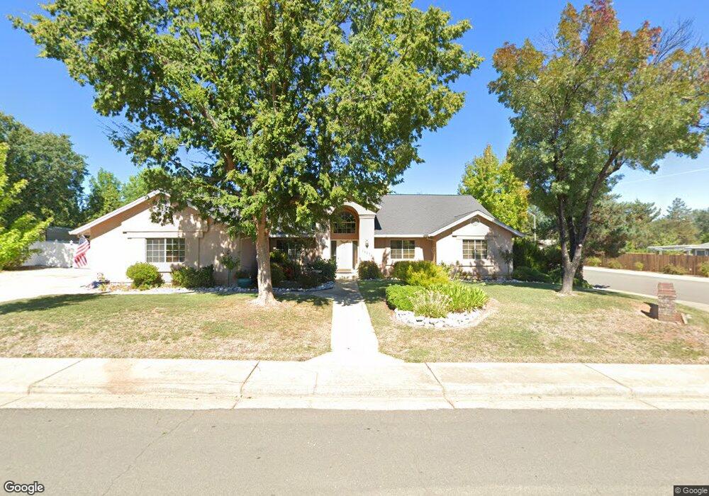
19374 Carnegie Ct Redding, CA 96003
Hawley NeighborhoodEstimated Value: $495,887 - $566,000
3
Beds
3
Baths
2,174
Sq Ft
$245/Sq Ft
Est. Value
About This Home
This home is located at 19374 Carnegie Ct, Redding, CA 96003 and is currently estimated at $531,972, approximately $244 per square foot. 19374 Carnegie Ct is a home located in Shasta County with nearby schools including Columbia Elementary School, Mountain View Middle School, and Foothill High School.
Ownership History
Date
Name
Owned For
Owner Type
Purchase Details
Closed on
Apr 12, 2012
Sold by
Scott Michael Frederick and Scott Arlyce Kabanuk
Bought by
Scott Michael F and Scott Arlyce K
Current Estimated Value
Create a Home Valuation Report for This Property
The Home Valuation Report is an in-depth analysis detailing your home's value as well as a comparison with similar homes in the area
Home Values in the Area
Average Home Value in this Area
Purchase History
| Date | Buyer | Sale Price | Title Company |
|---|---|---|---|
| Scott Michael F | -- | None Available |
Source: Public Records
Tax History
| Year | Tax Paid | Tax Assessment Tax Assessment Total Assessment is a certain percentage of the fair market value that is determined by local assessors to be the total taxable value of land and additions on the property. | Land | Improvement |
|---|---|---|---|---|
| 2025 | $3,649 | $339,854 | $63,948 | $275,906 |
| 2024 | $3,660 | $333,192 | $62,695 | $270,497 |
| 2023 | $3,660 | $326,660 | $61,466 | $265,194 |
| 2022 | $3,528 | $320,256 | $60,261 | $259,995 |
| 2021 | $3,530 | $313,978 | $59,080 | $254,898 |
| 2020 | $3,483 | $310,760 | $58,475 | $252,285 |
| 2019 | $3,401 | $304,668 | $57,329 | $247,339 |
| 2018 | $3,445 | $298,695 | $56,205 | $242,490 |
| 2017 | $3,483 | $292,839 | $55,103 | $237,736 |
| 2016 | $3,263 | $287,098 | $54,023 | $233,075 |
| 2015 | $3,212 | $282,786 | $53,212 | $229,574 |
| 2014 | $3,125 | $277,247 | $52,170 | $225,077 |
Source: Public Records
Map
Nearby Homes
- 19340 Carnegie Ct
- 1102 Hope Ln
- 11632 Ridgewood Rd
- 19424 Posey Ln
- 1546 Gold Hills Dr
- 2132 Hope Ln
- 19219 Nike Ct
- 6260 Carmel Dr
- 19226 Snowburst Ct
- 1779 Player Ct
- 000 Wintu Way
- 1672 Saint Andrews Dr
- 948 & 950 Hawley
- 6050 Gleneagles Ct
- 5890 Shadow Glen Dr
- 6040 Constitution Way
- 61 Tidmore Ln
- 5961 Sierra Dr
- 5808 Constitution Way
- 5976 Sierra Dr
- 19366 Carnegie Ct
- 19383 Lexington Ln
- 19371 Lexington Ln
- 19402 Carnegie Dr Unit Lot 1
- 19402 Carnegie Dr
- 19373 Carnegie Ct
- 19365 Carnegie Ct
- 19358 Carnegie Ct
- 19355 Lexington Ln
- 19351 Lexington Ln
- 19420 Carnegie Dr Unit Lot 2
- 19420 Carnegie Dr
- 19409 Carnegie Dr Unit Lot 20
- 19409 Carnegie Dr
- 19409 Carnegie Ct
- 1255 Hope Ln
- 19357 Carnegie Ct
- 19438 Carnegie Dr Unit Lot 3
- 19438 Carnegie Dr
- 19392 Lexington Ln
Your Personal Tour Guide
Ask me questions while you tour the home.