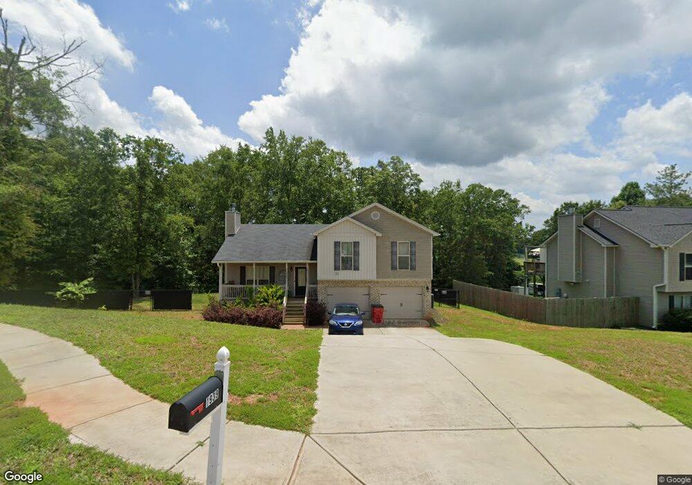
1939 Paynes Point Unit 74 Winder, GA 30680
Estimated Value: $284,000 - $344,000
3
Beds
3
Baths
1,800
Sq Ft
$180/Sq Ft
Est. Value
About This Home
This home is located at 1939 Paynes Point Unit 74, Winder, GA 30680 and is currently estimated at $324,383, approximately $180 per square foot. 1939 Paynes Point Unit 74 is a home located in Barrow County with nearby schools including Statham Elementary School, Bear Creek Middle School, and Winder-Barrow High School.
Ownership History
Date
Name
Owned For
Owner Type
Purchase Details
Closed on
Aug 31, 2018
Sold by
Southfork Homes Llc
Bought by
Hornsby Kimberly and Hornsby Kevin
Current Estimated Value
Home Financials for this Owner
Home Financials are based on the most recent Mortgage that was taken out on this home.
Original Mortgage
$173,695
Outstanding Balance
$153,127
Interest Rate
5.12%
Mortgage Type
FHA
Estimated Equity
$171,256
Purchase Details
Closed on
Jan 3, 2018
Sold by
Sugarloaf East Llc
Bought by
Southfork Homes Llc
Purchase Details
Closed on
Dec 22, 2010
Sold by
State Bank & Trust Co
Bought by
Sugarloaf East Llc
Purchase Details
Closed on
Dec 7, 2009
Sold by
Lcs Llc
Bought by
State Bank & Trust Co
Purchase Details
Closed on
Aug 2, 2006
Sold by
Reece Deborah P
Bought by
Lcs Llc
Create a Home Valuation Report for This Property
The Home Valuation Report is an in-depth analysis detailing your home's value as well as a comparison with similar homes in the area
Home Values in the Area
Average Home Value in this Area
Purchase History
| Date | Buyer | Sale Price | Title Company |
|---|---|---|---|
| Hornsby Kimberly | $176,900 | -- | |
| Southfork Homes Llc | $121,500 | -- | |
| Sugarloaf East Llc | $3,700 | -- | |
| State Bank & Trust Co | -- | -- | |
| Lcs Llc | -- | -- |
Source: Public Records
Mortgage History
| Date | Status | Borrower | Loan Amount |
|---|---|---|---|
| Open | Hornsby Kimberly | $173,695 |
Source: Public Records
Tax History Compared to Growth
Tax History
| Year | Tax Paid | Tax Assessment Tax Assessment Total Assessment is a certain percentage of the fair market value that is determined by local assessors to be the total taxable value of land and additions on the property. | Land | Improvement |
|---|---|---|---|---|
| 2024 | $2,496 | $97,382 | $19,200 | $78,182 |
| 2023 | $2,503 | $97,982 | $19,200 | $78,782 |
| 2022 | $2,591 | $87,714 | $19,200 | $68,514 |
| 2021 | $2,377 | $75,586 | $19,200 | $56,386 |
| 2020 | $2,144 | $67,536 | $16,000 | $51,536 |
| 2019 | $2,181 | $67,536 | $16,000 | $51,536 |
| 2018 | $277 | $6,144 | $6,144 | $0 |
| 2017 | $224 | $7,680 | $7,680 | $0 |
| 2016 | $323 | $7,680 | $7,680 | $0 |
| 2015 | $233 | $7,680 | $7,680 | $0 |
| 2014 | $82 | $2,600 | $2,600 | $0 |
| 2013 | -- | $2,600 | $2,600 | $0 |
Source: Public Records
Map
Nearby Homes
- 1295 Double Bridges Rd
- 113 Platte St
- 207 Cedar Grove Church Rd
- 670 Cedar Grove Church Rd
- 1453 Solomon Dr
- 1431 Solomon Dr
- 1023 Solomon Ct
- 670 Cedar Grove Church Rd
- 385 Finch Landing Rd
- 212 Rainbow Ln
- 1415 Red Oak Way
- 1724 Cedar Grove Church Rd
- 1642 White Oak Dr
- 1914 Hearthstone Ct
- 330 Anchors Way
- 51 Brockton Way Unit 2
- 1212 Highway 211 NE
- 1226 Highway 211 NE
- 315 Paige Way
- 1593 Highway 82
- 1939 Paynes Point
- 1937 Paynes Point Unit 75
- 1937 Paynes Point
- 1941 Paynes Point Unit 73
- 1941 Paynes Point
- 1943 Paynes Point Unit LOT 72
- 1943 Paynes Point
- 1944 Paynes Point Unit 38
- 1944 Paynes Point
- 1935 Paynes Point Unit 76
- 1935 Paynes Point
- 1945 Paynes Point
- 1945 Paynes Point Unit 71
- 1933 Paynes Point
- 1933 Paynes Point Unit 77
- 1946 Paynes Point Unit 39
- 1946 Paynes Point
- 1934 Paynes Point
- 1934 Paynes Point Unit 37
- 1934 Paynes Point