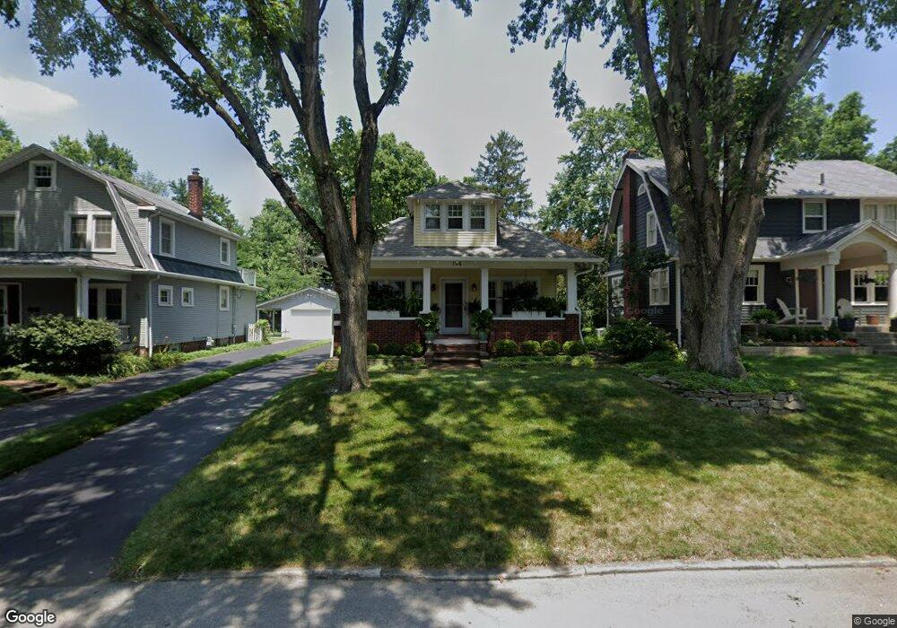
194 Winthrop Rd Columbus, OH 43214
Clintonville NeighborhoodEstimated Value: $495,000 - $588,000
3
Beds
1
Bath
1,693
Sq Ft
$315/Sq Ft
Est. Value
About This Home
This home is located at 194 Winthrop Rd, Columbus, OH 43214 and is currently estimated at $533,274, approximately $314 per square foot. 194 Winthrop Rd is a home located in Franklin County with nearby schools including Clinton Elementary School, Dominion Middle School, and Whetstone High School.
Ownership History
Date
Name
Owned For
Owner Type
Purchase Details
Closed on
Nov 20, 2000
Sold by
Street Craig R
Bought by
Palmer Kathryn L
Current Estimated Value
Purchase Details
Closed on
Mar 26, 1996
Sold by
Romine Susan K
Bought by
Craig R Street
Home Financials for this Owner
Home Financials are based on the most recent Mortgage that was taken out on this home.
Original Mortgage
$118,750
Interest Rate
7.06%
Mortgage Type
New Conventional
Purchase Details
Closed on
Sep 1, 1985
Create a Home Valuation Report for This Property
The Home Valuation Report is an in-depth analysis detailing your home's value as well as a comparison with similar homes in the area
Home Values in the Area
Average Home Value in this Area
Purchase History
| Date | Buyer | Sale Price | Title Company |
|---|---|---|---|
| Palmer Kathryn L | $180,000 | Title First Agency Inc | |
| Craig R Street | $125,000 | -- | |
| -- | -- | -- |
Source: Public Records
Mortgage History
| Date | Status | Borrower | Loan Amount |
|---|---|---|---|
| Previous Owner | Craig R Street | $118,750 |
Source: Public Records
Tax History Compared to Growth
Tax History
| Year | Tax Paid | Tax Assessment Tax Assessment Total Assessment is a certain percentage of the fair market value that is determined by local assessors to be the total taxable value of land and additions on the property. | Land | Improvement |
|---|---|---|---|---|
| 2024 | $6,013 | $133,990 | $54,290 | $79,700 |
| 2023 | $5,937 | $133,990 | $54,290 | $79,700 |
| 2022 | $10,449 | $134,230 | $23,870 | $110,360 |
| 2021 | $6,974 | $134,230 | $23,870 | $110,360 |
| 2020 | $6,983 | $134,230 | $23,870 | $110,360 |
| 2019 | $6,561 | $108,160 | $19,080 | $89,080 |
| 2018 | $6,007 | $108,160 | $19,080 | $89,080 |
| 2017 | $6,691 | $121,420 | $19,080 | $102,340 |
| 2016 | $6,021 | $90,900 | $33,880 | $57,020 |
| 2015 | $5,466 | $90,900 | $33,880 | $57,020 |
| 2014 | $5,480 | $90,900 | $33,880 | $57,020 |
| 2013 | $2,457 | $82,635 | $30,800 | $51,835 |
Source: Public Records
Map
Nearby Homes
- 3726 N High St
- 88 W Kenworth Rd
- 36 Brighton Rd
- 220 Ceramic Dr
- 174 W Como Ave
- 128 Blenheim Rd
- 217 Arden Rd
- 724 Drummond Ct
- 39 W Lakeview Ave
- 148 Deland Ave
- 374 Acton Rd
- 44 W Pacemont Rd
- 713 Marburn Dr
- 197 E Cooke Rd
- 15 W California Ave
- 340 Canyon Dr S
- 110 W Tulane Rd
- 126 W Tulane Rd
- 118 W Tulane Rd
- 49 W Henderson Rd