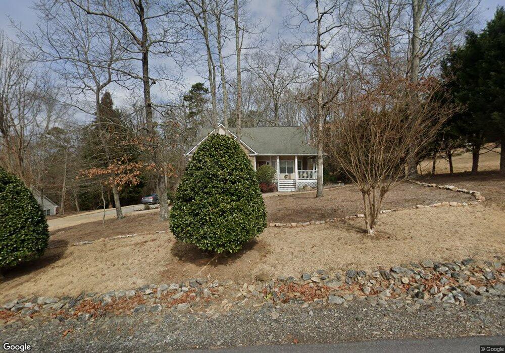
1940 Millers Path Cumming, GA 30041
Estimated Value: $492,000 - $587,000
4
Beds
3
Baths
1,675
Sq Ft
$324/Sq Ft
Est. Value
About This Home
This home is located at 1940 Millers Path, Cumming, GA 30041 and is currently estimated at $542,946, approximately $324 per square foot. 1940 Millers Path is a home located in Forsyth County with nearby schools including Mashburn Elementary School, Lakeside Middle School, and Forsyth Central High School.
Ownership History
Date
Name
Owned For
Owner Type
Purchase Details
Closed on
Dec 19, 2008
Sold by
Walter John J
Bought by
Klosinski Kenneth T and Klosinski Patricia
Current Estimated Value
Home Financials for this Owner
Home Financials are based on the most recent Mortgage that was taken out on this home.
Original Mortgage
$140,000
Outstanding Balance
$91,687
Interest Rate
5.95%
Mortgage Type
New Conventional
Estimated Equity
$451,259
Purchase Details
Closed on
Aug 5, 2008
Sold by
Boland Timothy R and Boland Tammy E
Bought by
Walter John J
Purchase Details
Closed on
Jul 16, 2001
Sold by
Welch Susan J
Bought by
Boland Tammy E and Boland Timothy R
Home Financials for this Owner
Home Financials are based on the most recent Mortgage that was taken out on this home.
Original Mortgage
$192,600
Interest Rate
7.16%
Mortgage Type
New Conventional
Purchase Details
Closed on
Aug 28, 1995
Sold by
Bjc Homes Inc
Bought by
Christian Susan
Create a Home Valuation Report for This Property
The Home Valuation Report is an in-depth analysis detailing your home's value as well as a comparison with similar homes in the area
Home Values in the Area
Average Home Value in this Area
Purchase History
| Date | Buyer | Sale Price | Title Company |
|---|---|---|---|
| Klosinski Kenneth T | $244,900 | -- | |
| Walter John J | $185,000 | -- | |
| Boland Tammy E | $214,000 | -- | |
| Christian Susan | $160,400 | -- |
Source: Public Records
Mortgage History
| Date | Status | Borrower | Loan Amount |
|---|---|---|---|
| Open | Klosinski Kenneth T | $140,000 | |
| Previous Owner | Boland Tammy E | $192,600 | |
| Closed | Christian Susan | $0 |
Source: Public Records
Tax History Compared to Growth
Tax History
| Year | Tax Paid | Tax Assessment Tax Assessment Total Assessment is a certain percentage of the fair market value that is determined by local assessors to be the total taxable value of land and additions on the property. | Land | Improvement |
|---|---|---|---|---|
| 2025 | $768 | $211,600 | $64,000 | $147,600 |
| 2024 | $768 | $201,764 | $58,000 | $143,764 |
| 2023 | $673 | $194,248 | $44,000 | $150,248 |
| 2022 | $753 | $119,928 | $24,000 | $95,928 |
| 2021 | $729 | $119,928 | $24,000 | $95,928 |
| 2020 | $724 | $114,668 | $24,000 | $90,668 |
| 2019 | $2,951 | $114,444 | $20,000 | $94,444 |
| 2018 | $2,591 | $96,904 | $20,000 | $76,904 |
| 2017 | $2,412 | $90,068 | $20,000 | $70,068 |
| 2016 | $2,412 | $90,068 | $20,000 | $70,068 |
| 2015 | $2,305 | $86,068 | $16,000 | $70,068 |
| 2014 | $2,115 | $83,168 | $16,000 | $67,168 |
Source: Public Records
Map
Nearby Homes
- 2340 Manor Pointe Dr
- 2020 Manor Pointe Dr
- 2020 Manor Pointe Dr Unit 19
- Farley Plan at High Pointe View
- 2105 Kemp Dr
- 2130 Manor Pointe Dr
- 1820 Ridge Rd
- 2300 Habersham Marina Rd Unit 103
- 2300 Habersham Marina Rd Unit 102
- 1950 Buford Dam Rd Unit 801
- 1950 Buford Dam Rd Unit 202
- 1950 Stonewyck Ct Unit 4
- 2220 Forest Dr
- 1515 Lockridge Dr
- 2840 Waverly Walk Point
- 2130 Hickory Cove Unit 5
- 1915 Habersham Trace
- LOT 52 Brook Valley Dr
- LOT 54 Brook Valley Dr
- LOT 47 Brook Valley Dr
- 0 Millers Path
- 1960 Millers Path
- 2015 Habersham Marina Rd
- 1975 Habersham Marina Rd
- 1925 Millers Path
- 2025 Habersham Marina Rd
- 1915 Millers Path Unit 36
- 1915 Millers Path
- 2045 Habersham Marina Rd
- 1990 Habersham Marina Rd
- 1986 Millers Path
- 1970 Habersham Marina Rd
- 2010 Habersham Marina Rd
- 2020 Millers Path
- 1990 Millers Path
- 2065 Habersham Marina Rd
- 2030 Habersham Marina Rd
- 2030 Habersham Marina Rd Unit PH 1
- 2000 Millers Path
- 2050 Habersham Marina Rd