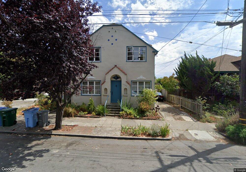
1940 Russell St Berkeley, CA 94703
South Berkeley NeighborhoodEstimated Value: $1,025,000 - $1,422,000
Studio
--
Bath
2,333
Sq Ft
$545/Sq Ft
Est. Value
About This Home
This home is located at 1940 Russell St, Berkeley, CA 94703 and is currently estimated at $1,271,169, approximately $544 per square foot. 1940 Russell St is a home located in Alameda County with nearby schools including Malcolm X Elementary School, Emerson Elementary School, and John Muir Elementary School.
Ownership History
Date
Name
Owned For
Owner Type
Purchase Details
Closed on
Aug 9, 2022
Sold by
Josephine Piccolo
Bought by
Josephine Beatrice Piccolo Living Trust
Current Estimated Value
Create a Home Valuation Report for This Property
The Home Valuation Report is an in-depth analysis detailing your home's value as well as a comparison with similar homes in the area
Home Values in the Area
Average Home Value in this Area
Purchase History
| Date | Buyer | Sale Price | Title Company |
|---|---|---|---|
| Josephine Beatrice Piccolo Living Trust | -- | -- |
Source: Public Records
Tax History
| Year | Tax Paid | Tax Assessment Tax Assessment Total Assessment is a certain percentage of the fair market value that is determined by local assessors to be the total taxable value of land and additions on the property. | Land | Improvement |
|---|---|---|---|---|
| 2025 | $10,039 | $344,887 | $105,566 | $246,321 |
| 2024 | $10,039 | $337,987 | $103,496 | $241,491 |
| 2023 | $9,674 | $331,224 | $101,467 | $236,757 |
| 2022 | $9,292 | $324,593 | $99,478 | $232,115 |
| 2021 | $9,255 | $318,091 | $97,527 | $227,564 |
| 2020 | $8,609 | $321,758 | $96,527 | $225,231 |
| 2019 | $8,086 | $315,450 | $94,635 | $220,815 |
| 2018 | $7,877 | $309,265 | $92,779 | $216,486 |
| 2017 | $7,580 | $303,201 | $90,960 | $212,241 |
| 2016 | $7,189 | $297,257 | $89,177 | $208,080 |
| 2015 | $7,055 | $292,794 | $87,838 | $204,956 |
| 2014 | $6,966 | $287,058 | $86,117 | $200,941 |
Source: Public Records
Map
Nearby Homes
- 2045 Emerson St
- 2057 Emerson St
- 2110 Ashby Ave
- 2926 Ellis St
- 2923 Wheeler St
- 2701 Grant St
- 2124 Prince St
- 1646 Ashby Ave
- 2727 McGee Ave
- 6555 Shattuck Ave
- 1901 Parker St Unit 3
- 3046 Deakin St
- 2243 Ashby Ave
- 629 66th St
- 2018 Blake St
- 1535 Julia St
- 1530 Stuart St
- 3233 Ellis St
- 1612 Carleton St
- 3110 California St
- 1942 Russell St
- 1930 Russell St
- 1946 Russell St
- 2910 Adeline St
- 2905 Otis St
- 2914 Adeline St
- 2901 Otis St
- 2909 Otis St
- 2908 Adeline St
- 2915 Otis St Unit 1/2
- 2915 Otis St
- 2915 Otis St Unit 2915
- 2917 Otis St
- 2919 Otis St
- 1937 Russell St Unit A
- 1937 Russell St
- 1937 Russell St
- 1933 Russell St
- 1931 Russell St
- 1943 Russell St
Your Personal Tour Guide
Ask me questions while you tour the home.