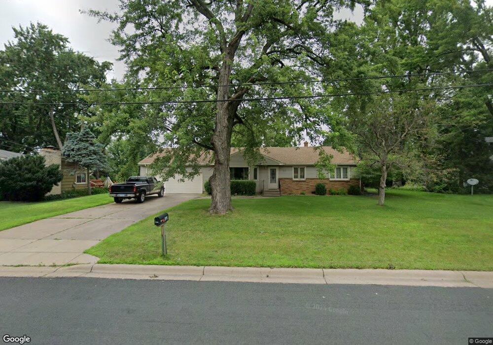
1941 Birch St Saint Paul, MN 55110
Estimated Value: $385,000 - $488,000
3
Beds
2
Baths
568
Sq Ft
$755/Sq Ft
Est. Value
About This Home
This home is located at 1941 Birch St, Saint Paul, MN 55110 and is currently estimated at $428,667, approximately $754 per square foot. 1941 Birch St is a home located in Ramsey County with nearby schools including Lakeaires Elementary School, Sunrise Park Middle School, and Liberty Classical Academy.
Ownership History
Date
Name
Owned For
Owner Type
Purchase Details
Closed on
Jun 29, 2010
Sold by
Fleming Family Trust
Bought by
Christopherson Jay R and Christopherson Judy M
Current Estimated Value
Home Financials for this Owner
Home Financials are based on the most recent Mortgage that was taken out on this home.
Original Mortgage
$148,333
Outstanding Balance
$96,829
Interest Rate
4.37%
Mortgage Type
Land Contract Argmt. Of Sale
Estimated Equity
$331,838
Create a Home Valuation Report for This Property
The Home Valuation Report is an in-depth analysis detailing your home's value as well as a comparison with similar homes in the area
Home Values in the Area
Average Home Value in this Area
Purchase History
| Date | Buyer | Sale Price | Title Company |
|---|---|---|---|
| Christopherson Jay R | $148,333 | -- |
Source: Public Records
Mortgage History
| Date | Status | Borrower | Loan Amount |
|---|---|---|---|
| Open | Christopherson Jay R | $148,333 |
Source: Public Records
Tax History Compared to Growth
Tax History
| Year | Tax Paid | Tax Assessment Tax Assessment Total Assessment is a certain percentage of the fair market value that is determined by local assessors to be the total taxable value of land and additions on the property. | Land | Improvement |
|---|---|---|---|---|
| 2025 | $4,442 | $376,200 | $105,600 | $270,600 |
| 2023 | $4,442 | $341,100 | $105,600 | $235,500 |
| 2022 | $4,050 | $354,700 | $105,600 | $249,100 |
| 2021 | $3,468 | $309,200 | $105,600 | $203,600 |
| 2020 | $3,596 | $275,000 | $105,600 | $169,400 |
| 2019 | $2,900 | $267,200 | $105,600 | $161,600 |
| 2018 | $2,986 | $234,700 | $105,600 | $129,100 |
| 2017 | $2,750 | $247,000 | $105,600 | $141,400 |
| 2016 | $2,568 | $0 | $0 | $0 |
| 2015 | $2,564 | $203,300 | $99,200 | $104,100 |
| 2014 | $2,578 | $0 | $0 | $0 |
Source: Public Records
Map
Nearby Homes
- 4035 Highland Ave
- 4107 White Bear Ave N
- 1795 Cheri Ct
- 4181 White Bear Ave N
- 1794 Cheri Ct
- 1792 Cheri Ct
- 3823 Linden Ave
- 3750 Van Dyke St
- 2075 Dorothy Ave
- 2184 Floral Dr
- 2086 Dorothy Ave
- 1778 Linden Cove
- 3979 Mcknight Rd N
- 3915 Mcknight Rd N
- 3620 Highland Ave
- 3982 Mcknight Rd N
- 1827 County Road E E Unit 18
- 3743 Kenny Ln
- 2314 Birch St
- 3644 Linden Ave Unit 11