Estimated Value: $2,824,656
Studio
--
Bath
14,693
Sq Ft
$192/Sq Ft
Est. Value
About This Home
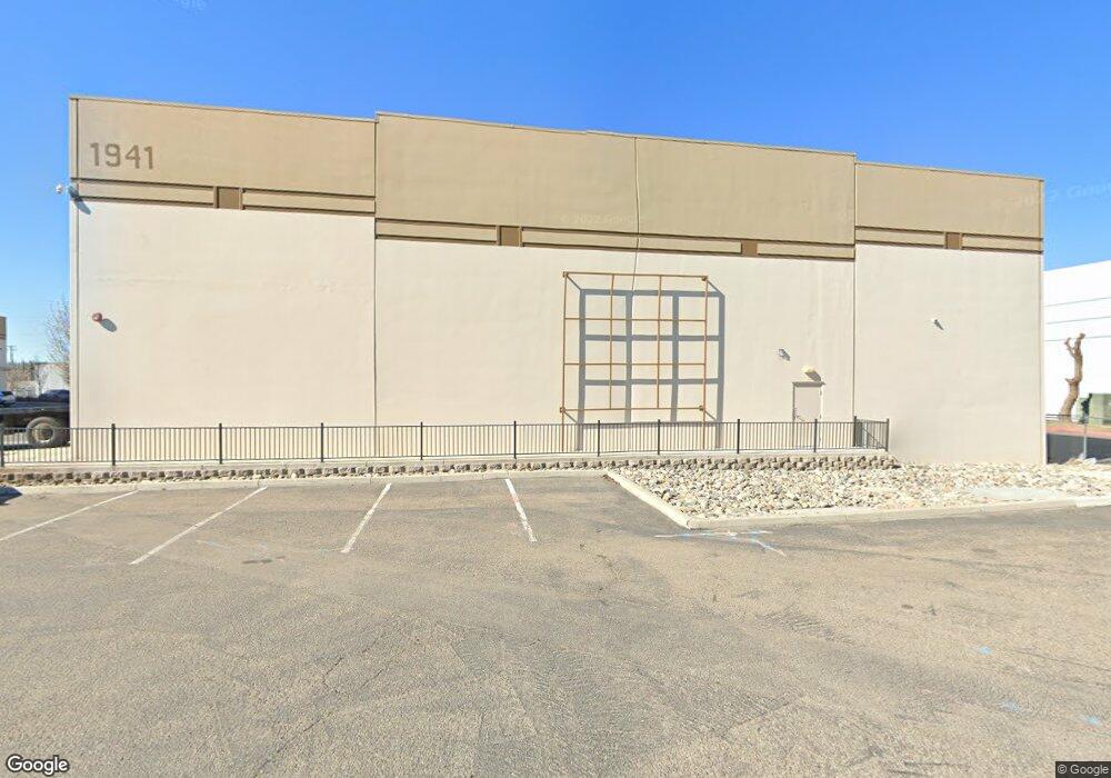
This home is located at 1941 N Macarthur Dr, Tracy, CA 95376 and is currently estimated at $2,824,656, approximately $192 per square foot. 1941 N Macarthur Dr is a home located in San Joaquin County with nearby schools including Central Elementary School, Tracy High School, and Banta Charter School.
Ownership History
Date
Name
Owned For
Owner Type
Purchase Details
Closed on
Dec 10, 2015
Sold by
Dmj Real Estate Lp
Bought by
Danann Investments Llc
Current Estimated Value
Home Financials for this Owner
Home Financials are based on the most recent Mortgage that was taken out on this home.
Original Mortgage
$1,914,500
Outstanding Balance
$1,505,908
Interest Rate
3.71%
Mortgage Type
Construction
Estimated Equity
$1,318,748
Create a Home Valuation Report for This Property
The Home Valuation Report is an in-depth analysis detailing your home's value as well as a comparison with similar homes in the area
Home Values in the Area
Average Home Value in this Area
Purchase History
| Date | Buyer | Sale Price | Title Company |
|---|---|---|---|
| Danann Investments Llc | $1,895,000 | First American Title Company |
Source: Public Records
Mortgage History
| Date | Status | Borrower | Loan Amount |
|---|---|---|---|
| Open | Danann Investments Llc | $1,914,500 |
Source: Public Records
Tax History
| Year | Tax Paid | Tax Assessment Tax Assessment Total Assessment is a certain percentage of the fair market value that is determined by local assessors to be the total taxable value of land and additions on the property. | Land | Improvement |
|---|---|---|---|---|
| 2025 | $15,812 | $1,341,991 | $215,446 | $1,126,545 |
| 2024 | $14,585 | $1,315,678 | $211,222 | $1,104,456 |
| 2023 | $14,354 | $1,289,881 | $207,081 | $1,082,800 |
| 2022 | $14,061 | $1,264,590 | $203,021 | $1,061,569 |
| 2021 | $13,890 | $1,239,795 | $199,041 | $1,040,754 |
| 2020 | $13,797 | $1,227,084 | $197,001 | $1,030,083 |
| 2019 | $13,575 | $1,203,025 | $193,139 | $1,009,886 |
| 2018 | $13,344 | $1,179,437 | $189,352 | $990,085 |
| 2017 | $11,612 | $1,056,312 | $185,640 | $870,672 |
| 2016 | $11,736 | $1,035,600 | $182,000 | $853,600 |
Source: Public Records
Map
Nearby Homes
- 379 E 22nd St
- 1704 East St
- 360 E Grant Line Rd Unit 11
- 360 E Grant Line Rd Unit 19 A
- 305 Portola Way
- 445 Royal Ct
- 2929 N Macarthur Dr Unit 173
- 2734 Balboa Dr
- 206 W 20th St
- 613 Carol Louise Ln
- 262 W Lowell Ave
- 1636 Parker Ave
- 125 E 12th St
- 2935 Holly Dr
- 251 Ramona Way
- 1930 Wall St
- 1823 Wall St
- 445 W Lowell Ave
- 206 W 12th St
- 539 W Lowell Ave
- 2210 N Macarthur Dr
- 2227 N Macarthur Dr
- 357 Acacia St
- 378 E 21st St
- 425 Acacia St Unit 1
- 425 Acacia St Unit 2
- 374 E 21st St
- 382 E 21st St
- 359 Acacia St Unit 2
- 415 Acacia St
- 370 E 21st St
- 413 Acacia St
- 2104 Deborah St
- 366 E 21st St
- 1630 Franklin Ave
- 2108 Deborah St
- 1828 Deborah St
- 1900 Deborah St
- 362 E 21st St
Your Personal Tour Guide
Ask me questions while you tour the home.