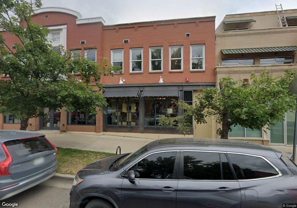
1941 Pearl St Unit 201 Boulder, CO 80302
Downtown NeighborhoodEstimated Value: $682,000 - $878,000
2
Beds
2
Baths
1,050
Sq Ft
$734/Sq Ft
Est. Value
About This Home
This home is located at 1941 Pearl St Unit 201, Boulder, CO 80302 and is currently estimated at $771,145, approximately $734 per square foot. 1941 Pearl St Unit 201 is a home located in Boulder County with nearby schools including Whittier Elementary School, Casey Middle School, and Boulder High School.
Ownership History
Date
Name
Owned For
Owner Type
Purchase Details
Closed on
Apr 19, 2000
Sold by
12 Maples Llc
Bought by
Schwartz Bruce S
Current Estimated Value
Home Financials for this Owner
Home Financials are based on the most recent Mortgage that was taken out on this home.
Original Mortgage
$233,881
Outstanding Balance
$79,896
Interest Rate
8.19%
Estimated Equity
$691,249
Create a Home Valuation Report for This Property
The Home Valuation Report is an in-depth analysis detailing your home's value as well as a comparison with similar homes in the area
Home Values in the Area
Average Home Value in this Area
Purchase History
| Date | Buyer | Sale Price | Title Company |
|---|---|---|---|
| Schwartz Bruce S | $292,851 | -- |
Source: Public Records
Mortgage History
| Date | Status | Borrower | Loan Amount |
|---|---|---|---|
| Open | Schwartz Bruce S | $233,881 |
Source: Public Records
Tax History Compared to Growth
Tax History
| Year | Tax Paid | Tax Assessment Tax Assessment Total Assessment is a certain percentage of the fair market value that is determined by local assessors to be the total taxable value of land and additions on the property. | Land | Improvement |
|---|---|---|---|---|
| 2025 | $4,354 | $50,163 | -- | $50,163 |
| 2024 | $4,354 | $50,163 | -- | $50,163 |
| 2023 | $4,276 | $48,647 | -- | $52,332 |
| 2022 | $4,319 | $45,703 | $0 | $45,703 |
| 2021 | $4,122 | $47,018 | $0 | $47,018 |
| 2020 | $4,093 | $47,018 | $0 | $47,018 |
| 2019 | $4,030 | $47,018 | $0 | $47,018 |
| 2018 | $3,701 | $42,689 | $0 | $42,689 |
| 2017 | $3,585 | $47,195 | $0 | $47,195 |
| 2016 | $3,804 | $43,947 | $0 | $43,947 |
| 2015 | $3,602 | $37,969 | $0 | $37,969 |
| 2014 | $3,264 | $37,969 | $0 | $37,969 |
Source: Public Records
Map
Nearby Homes
- 1837 Walnut St Unit E
- 1934 18th St Unit 14
- 2201 Pearl St Unit 224
- 1945 Canyon Blvd
- 1707 Walnut St Unit 203
- 1707 Walnut St Unit 209
- 1707 Walnut St Unit 307
- 1707 Walnut St Unit 208
- 1707 Walnut St Unit 308
- 1707 Walnut St Unit 101
- 1707 Walnut St Unit 103
- 1707 Walnut St Unit 207
- 1707 Walnut St Unit 206
- 1707 Walnut St Unit 202
- 1707 Walnut St Unit 210
- 2304 Pearl St Unit 2
- 1916 23rd St
- 2225 Pine St
- 1842 Canyon Blvd Unit 105
- 1842 Canyon Blvd Unit 202
- 1941 Pearl St Unit 304
- 1941 Pearl St Unit 302
- 1941 Pearl St Unit 301
- 1941 Pearl St Unit 205
- 1941 Pearl St Unit 204
- 1941 Pearl St Unit 203
- 1941 Pearl St Unit 202
- 1933 Pearl St Unit 7
- 1918 Spruce St
- 1949 Pearl St Unit RG
- 1949 Pearl St Unit RE
- 1949 Pearl St
- 1949 Pearl St Unit RC
- 1949 Pearl St Unit RB
- 1949 Pearl St Unit RA
- 1949 Pearl St Unit 100
- 1949 Pearl St Unit 1949-G
- 1949 Pearl St Unit A
- 1949 Pearl St Unit E
- 1949 Pearl St Unit C-1