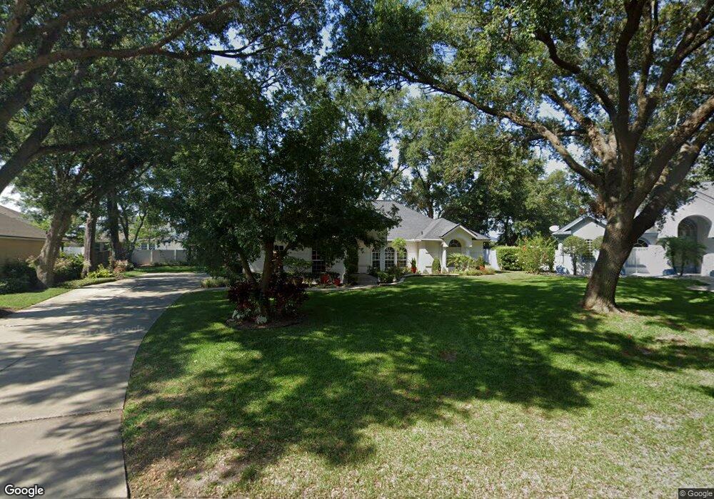
19417 Spring Oak Dr Eustis, FL 32736
Estimated Value: $426,000 - $497,000
4
Beds
2
Baths
2,534
Sq Ft
$178/Sq Ft
Est. Value
About This Home
This home is located at 19417 Spring Oak Dr, Eustis, FL 32736 and is currently estimated at $449,867, approximately $177 per square foot. 19417 Spring Oak Dr is a home located in Lake County with nearby schools including Triangle Elementary School, Eustis Middle School, and Eustis High School.
Ownership History
Date
Name
Owned For
Owner Type
Purchase Details
Closed on
Jan 27, 2012
Sold by
Goudreau Mark J
Bought by
Goudreau Leticia L
Current Estimated Value
Purchase Details
Closed on
May 24, 1996
Sold by
Howard Herbert W and Howard Valerie L
Bought by
Goudreau Mark J and Goudreau Leticia L
Home Financials for this Owner
Home Financials are based on the most recent Mortgage that was taken out on this home.
Original Mortgage
$138,650
Outstanding Balance
$5,926
Interest Rate
7.93%
Estimated Equity
$443,941
Create a Home Valuation Report for This Property
The Home Valuation Report is an in-depth analysis detailing your home's value as well as a comparison with similar homes in the area
Home Values in the Area
Average Home Value in this Area
Purchase History
| Date | Buyer | Sale Price | Title Company |
|---|---|---|---|
| Goudreau Leticia L | -- | Attorney | |
| Goudreau Mark J | $184,900 | -- |
Source: Public Records
Mortgage History
| Date | Status | Borrower | Loan Amount |
|---|---|---|---|
| Open | Goudreau Mark J | $138,650 |
Source: Public Records
Tax History
| Year | Tax Paid | Tax Assessment Tax Assessment Total Assessment is a certain percentage of the fair market value that is determined by local assessors to be the total taxable value of land and additions on the property. | Land | Improvement |
|---|---|---|---|---|
| 2026 | $3,500 | $228,590 | -- | -- |
| 2025 | $3,348 | $222,360 | -- | -- |
| 2024 | $3,348 | $222,360 | -- | -- |
| 2023 | $3,348 | $209,610 | $0 | $0 |
| 2022 | $3,292 | $203,510 | $0 | $0 |
| 2021 | $3,164 | $197,590 | $0 | $0 |
| 2020 | $3,260 | $194,862 | $0 | $0 |
| 2019 | $3,215 | $190,481 | $0 | $0 |
| 2018 | $3,086 | $186,930 | $0 | $0 |
| 2017 | $3,019 | $183,086 | $0 | $0 |
| 2016 | $2,982 | $179,321 | $0 | $0 |
| 2015 | $3,031 | $178,075 | $0 | $0 |
| 2014 | $3,019 | $176,662 | $0 | $0 |
Source: Public Records
Map
Nearby Homes
- 19337 Spring Oak Dr
- 4030 Brookshire Cir
- 4058 Brookshire Cir
- 19655 Spring Oak Dr
- 19146 Park Place Blvd
- 4040 Casterly Rock Ct
- 19624 Spring Oak Dr
- 3964 Mayhill Loop
- 3984 Mayhill Loop
- 33943 E Lake Joanna Dr
- 201 W Blue Water Edge Dr
- 413 W Blue Water Edge Dr
- 425 W Blue Water Edge Dr
- 421 W Blue Water Edge Dr
- 535 Darshire Ave
- 519 W Blue Water Edge Dr
- 527 W Blue Water Edge Dr
- 1701 Strathmore Cir
- 8045 Waterbury Way
- 1689 Strathmore Cir
- 19411 Spring Oak Dr
- 4000 Brookshire Cir
- 4002 Brookshire Cir
- 4004 Brookshire Cir
- 19407 Spring Oak Dr
- 4006 Brookshire Cir
- 19429 Spring Oak Dr
- 19430 Spring Oak Dr
- 4008 Brookshire Cir
- 19403 Spring Oak Dr
- 34252 Woodridge Ln
- 19433 Spring Oak Dr
- 19432 Spring Oak Dr
- 4007 Brookshire Cir
- 19351 Spring Oak Dr
- 4012 Brookshire Cir
- 34246 Woodridge Ln
- 4076 Brookshire Cir
- 4009 Brookshire Cir
- 19437 Spring Oak Dr
Your Personal Tour Guide
Ask me questions while you tour the home.