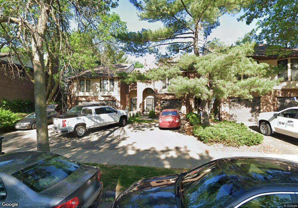
1942 Dupont Ave S Minneapolis, MN 55403
Lowry Hill NeighborhoodEstimated Value: $364,000 - $558,000
2
Beds
3
Baths
1,247
Sq Ft
$371/Sq Ft
Est. Value
About This Home
This home is located at 1942 Dupont Ave S, Minneapolis, MN 55403 and is currently estimated at $462,936, approximately $371 per square foot. 1942 Dupont Ave S is a home located in Hennepin County with nearby schools including Kenwood Elementary School, Anwatin Middle School, and North High School.
Ownership History
Date
Name
Owned For
Owner Type
Purchase Details
Closed on
Aug 5, 2016
Sold by
Weaver Bret H and Weaver Kacey L
Bought by
Noyes Russell S and Noyes Marcelle J
Current Estimated Value
Home Financials for this Owner
Home Financials are based on the most recent Mortgage that was taken out on this home.
Original Mortgage
$234,500
Outstanding Balance
$187,104
Interest Rate
3.48%
Mortgage Type
New Conventional
Estimated Equity
$275,832
Purchase Details
Closed on
Apr 2, 2010
Sold by
Ciresi Dominic M and Ciresi Chanpen
Bought by
Weaver Bret H and Weaver Kacey L
Purchase Details
Closed on
May 29, 2001
Sold by
Walburn Roberta B
Bought by
Ciresi Dominic M
Create a Home Valuation Report for This Property
The Home Valuation Report is an in-depth analysis detailing your home's value as well as a comparison with similar homes in the area
Home Values in the Area
Average Home Value in this Area
Purchase History
| Date | Buyer | Sale Price | Title Company |
|---|---|---|---|
| Noyes Russell S | $389,500 | Titlesmart Inc | |
| Weaver Bret H | $345,388 | -- | |
| Ciresi Dominic M | $270,000 | -- |
Source: Public Records
Mortgage History
| Date | Status | Borrower | Loan Amount |
|---|---|---|---|
| Open | Noyes Russell S | $234,500 |
Source: Public Records
Tax History Compared to Growth
Tax History
| Year | Tax Paid | Tax Assessment Tax Assessment Total Assessment is a certain percentage of the fair market value that is determined by local assessors to be the total taxable value of land and additions on the property. | Land | Improvement |
|---|---|---|---|---|
| 2024 | $6,962 | $471,000 | $10,000 | $461,000 |
| 2023 | $6,172 | $471,000 | $10,000 | $461,000 |
| 2022 | $6,135 | $442,000 | $10,000 | $432,000 |
| 2021 | $5,342 | $440,000 | $9,000 | $431,000 |
| 2020 | $5,981 | $400,000 | $11,500 | $388,500 |
| 2019 | $5,845 | $412,500 | $11,500 | $401,000 |
| 2018 | $5,281 | $393,000 | $11,500 | $381,500 |
| 2017 | $4,937 | $327,500 | $11,500 | $316,000 |
| 2016 | $5,514 | $352,000 | $11,500 | $340,500 |
| 2015 | $5,460 | $334,000 | $11,500 | $322,500 |
| 2014 | -- | $334,000 | $11,500 | $322,500 |
Source: Public Records
Map
Nearby Homes
- 1940 Dupont Ave S
- 1912 Dupont Ave S Unit 407
- 1932 Dupont Ave S
- 1820 Colfax Ave S
- 910 Lincoln Ave Unit B4
- 1785 Dupont Ave S
- 2112 Emerson Ave S Unit 3
- 821 Douglas Ave Unit 304
- 821 Douglas Ave Unit 204
- 1767 Fremont Ave S
- 1212 Douglas Ave
- 2209 Aldrich Ave S
- 2100 Garfield Ave Unit 3
- 520 Ridgewood Ave Unit 4
- 520 Ridgewood Ave Unit 107
- 2316 Aldrich Ave S
- 1721 Humboldt Ave S Unit 1
- 440 Ridgewood Ave Unit 203
- 511 W 22nd St
- 510 Groveland Ave Unit 522
- 1944 Dupont Ave S
- 1936 Dupont Ave S
- 1938 Dupont Ave S
- 1922 Dupont Ave S
- 1924 Dupont Ave S
- 1920 Dupont Ave S
- 1926 Dupont Ave S
- 1928 Dupont Ave S
- 1930 Dupont Ave S
- 1946 Dupont Ave S
- 1934 Dupont Ave S
- 1948 Dupont Ave S
- 1950 Dupont Ave S
- 1912 1912 Dupont-Avenue-s
- 1925 Emerson Ave S
- 1933 Emerson Ave S
- 1931 Emerson Ave S
- 1931 Dupont Ave S
- 1929 Dupont Ave S
- 1952 Dupont Ave S