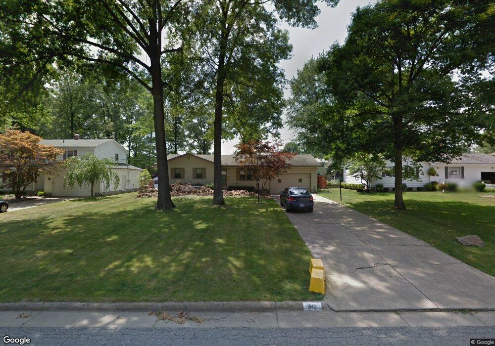
1942 Elm Trace St Youngstown, OH 44515
Austintown NeighborhoodEstimated Value: $245,000 - $262,762
3
Beds
3
Baths
1,852
Sq Ft
$136/Sq Ft
Est. Value
About This Home
This home is located at 1942 Elm Trace St, Youngstown, OH 44515 and is currently estimated at $251,941, approximately $136 per square foot. 1942 Elm Trace St is a home located in Mahoning County with nearby schools including Austintown Elementary School, Austintown Intermediate School, and Austintown Middle School.
Ownership History
Date
Name
Owned For
Owner Type
Purchase Details
Closed on
Apr 1, 2015
Sold by
Kalaher Abigail L
Bought by
Kalaher Abilgail L and Edmiston Elizabeth
Current Estimated Value
Home Financials for this Owner
Home Financials are based on the most recent Mortgage that was taken out on this home.
Original Mortgage
$79,900
Outstanding Balance
$61,486
Interest Rate
3.73%
Mortgage Type
New Conventional
Estimated Equity
$190,455
Purchase Details
Closed on
Sep 11, 2009
Sold by
Hagg Daniel S and Zitella Deborah A
Bought by
Kalaher Abigail L
Home Financials for this Owner
Home Financials are based on the most recent Mortgage that was taken out on this home.
Original Mortgage
$98,286
Interest Rate
4.68%
Mortgage Type
FHA
Purchase Details
Closed on
Jun 7, 1972
Bought by
Hagg Daniel S and Hagg Deborah A
Create a Home Valuation Report for This Property
The Home Valuation Report is an in-depth analysis detailing your home's value as well as a comparison with similar homes in the area
Home Values in the Area
Average Home Value in this Area
Purchase History
| Date | Buyer | Sale Price | Title Company |
|---|---|---|---|
| Kalaher Abilgail L | -- | Attorney | |
| Kalaher Abigail L | $100,100 | Attorney | |
| Hagg Daniel S | -- | -- |
Source: Public Records
Mortgage History
| Date | Status | Borrower | Loan Amount |
|---|---|---|---|
| Open | Kalaher Abilgail L | $79,900 | |
| Closed | Kalaher Abigail L | $98,286 |
Source: Public Records
Tax History Compared to Growth
Tax History
| Year | Tax Paid | Tax Assessment Tax Assessment Total Assessment is a certain percentage of the fair market value that is determined by local assessors to be the total taxable value of land and additions on the property. | Land | Improvement |
|---|---|---|---|---|
| 2024 | $3,432 | $74,570 | $8,700 | $65,870 |
| 2023 | $3,374 | $74,570 | $8,700 | $65,870 |
| 2022 | $2,737 | $48,490 | $7,930 | $40,560 |
| 2021 | $2,739 | $48,490 | $7,930 | $40,560 |
| 2020 | $2,749 | $48,490 | $7,930 | $40,560 |
| 2019 | $2,730 | $43,690 | $7,150 | $36,540 |
| 2018 | $2,626 | $43,690 | $7,150 | $36,540 |
| 2017 | $2,432 | $43,690 | $7,150 | $36,540 |
| 2016 | $2,251 | $37,240 | $7,150 | $30,090 |
| 2015 | $2,183 | $37,240 | $7,150 | $30,090 |
| 2014 | $2,192 | $37,240 | $7,150 | $30,090 |
| 2013 | $2,168 | $37,240 | $7,150 | $30,090 |
Source: Public Records
Map
Nearby Homes
- 4815 New Rd
- 2211 Penny Ln
- 4689 Crabwood Dr
- 1707 Westhampton Dr
- 1339 Cavalcade Dr
- 4674 Barrington Dr
- 2493 Frostwood Dr
- 1228 Cavalcade Dr
- 5256 S Saratoga Ave
- 5179 Willow Crest Ave
- 316 S Inglewood Ave
- 5192 Pinecrest Ave
- 4314 Kerrybrook Dr
- 5318 Pinecrest Ave
- 40 Woodleigh Ct
- 4289 Wedgewood Dr
- 4263 Patricia Ave
- 2792 S Canfield Niles Rd
- 170 Idaho Rd
- 5678 Cider Mill Crossing
- 1918 Elm Trace St
- 1966 Elm Trace St
- 1943 Woodland Trace
- 1894 Elm Trace St
- 1990 Elm Trace St
- 1919 Woodland Trace
- 1967 Woodland Trace
- 1943 Elm Trace St
- 1895 Woodland Trace
- 1967 Elm Trace St
- 1991 Woodland Trace
- 1919 Elm Trace St
- 2014 Elm Trace St
- 1870 Elm Trace St
- 1895 Elm Trace St
- 1991 Elm Trace St
- 2015 Woodland Trace
- 1871 Woodland Trace
- 2035 Elm Trace St
- 2038 Elm Trace St