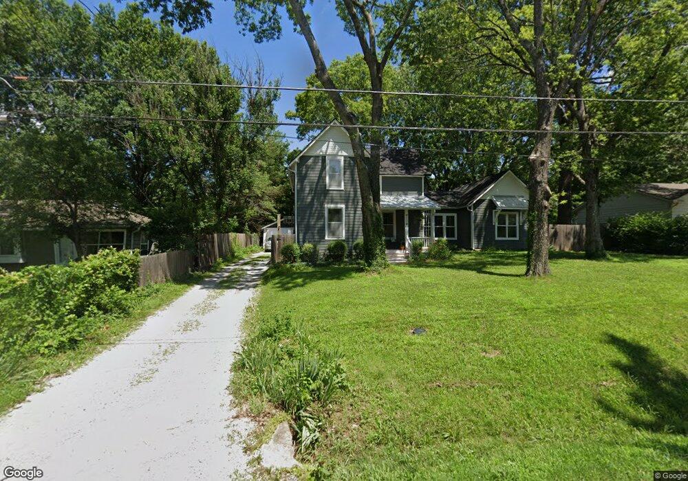
1942 Learnard Ave Lawrence, KS 66046
Barker NeighborhoodEstimated Value: $428,000 - $454,267
4
Beds
2
Baths
2,523
Sq Ft
$176/Sq Ft
Est. Value
About This Home
This home is located at 1942 Learnard Ave, Lawrence, KS 66046 and is currently estimated at $443,567, approximately $175 per square foot. 1942 Learnard Ave is a home located in Douglas County with nearby schools including Cordley Elementary School, Liberty Memorial Central Middle School, and Lawrence High School.
Ownership History
Date
Name
Owned For
Owner Type
Purchase Details
Closed on
Jun 22, 2023
Sold by
Crook Christopher G
Bought by
Crook Molly A
Current Estimated Value
Create a Home Valuation Report for This Property
The Home Valuation Report is an in-depth analysis detailing your home's value as well as a comparison with similar homes in the area
Home Values in the Area
Average Home Value in this Area
Purchase History
| Date | Buyer | Sale Price | Title Company |
|---|---|---|---|
| Crook Molly A | -- | None Listed On Document |
Source: Public Records
Tax History Compared to Growth
Tax History
| Year | Tax Paid | Tax Assessment Tax Assessment Total Assessment is a certain percentage of the fair market value that is determined by local assessors to be the total taxable value of land and additions on the property. | Land | Improvement |
|---|---|---|---|---|
| 2025 | $6,462 | $51,739 | $9,200 | $42,539 |
| 2024 | $5,932 | $47,578 | $8,625 | $38,953 |
| 2023 | $5,689 | $44,126 | $6,900 | $37,226 |
| 2022 | $5,375 | $41,415 | $6,325 | $35,090 |
| 2021 | $4,734 | $35,397 | $5,175 | $30,222 |
| 2020 | $3,350 | $25,277 | $5,175 | $20,102 |
| 2019 | $2,572 | $19,504 | $4,947 | $14,557 |
| 2018 | $2,184 | $16,491 | $4,720 | $11,771 |
| 2017 | $2,082 | $15,560 | $4,720 | $10,840 |
| 2016 | $1,840 | $14,398 | $4,884 | $9,514 |
| 2015 | -- | $15,203 | $4,884 | $10,319 |
| 2014 | -- | $15,203 | $4,884 | $10,319 |
Source: Public Records
Map
Nearby Homes
- 331 E 19th St
- 5701 Johnson Ave
- 2028 New Hampshire St
- 2045 Massachusetts St
- 1625 Pennsylvania St
- 2046 Kentucky St
- 2116 Kentucky St
- 1103 E 18th St
- 923 Ward Ave
- 2301 Massachusetts St
- 1829 Brook St
- 1736 Brook St
- 1424 New York St
- 2014 Maple Ln
- 0 Delaware St
- 1327 New Jersey St
- 1616 Louisiana St
- 1320 Pennsylvania St
- 1320 Pennsylvania St Unit apartment above gara
- 1316 E 16th St
- 1934 Learnard Ave
- 1944 Learnard Ave
- 1941 Learnard Ave
- 1937 Learnard Ave
- 1933 Learnard Ave
- 1930 Learnard Ave
- 2000 Learnard Ave
- 2006 Learnard Ave
- 1926 Learnard Ave
- 1931 Learnard Ave
- 1919 Delaware St
- 2005 Learnard Ave
- 1927 Learnard Ave
- 1922 Learnard Ave
- 533 E 19th St
- 533 E 19th St Unit 3
- 2010 Learnard Ave
- 502 Liberty St
- 1911 Learnard Ave
- 2013 Learnard Ave