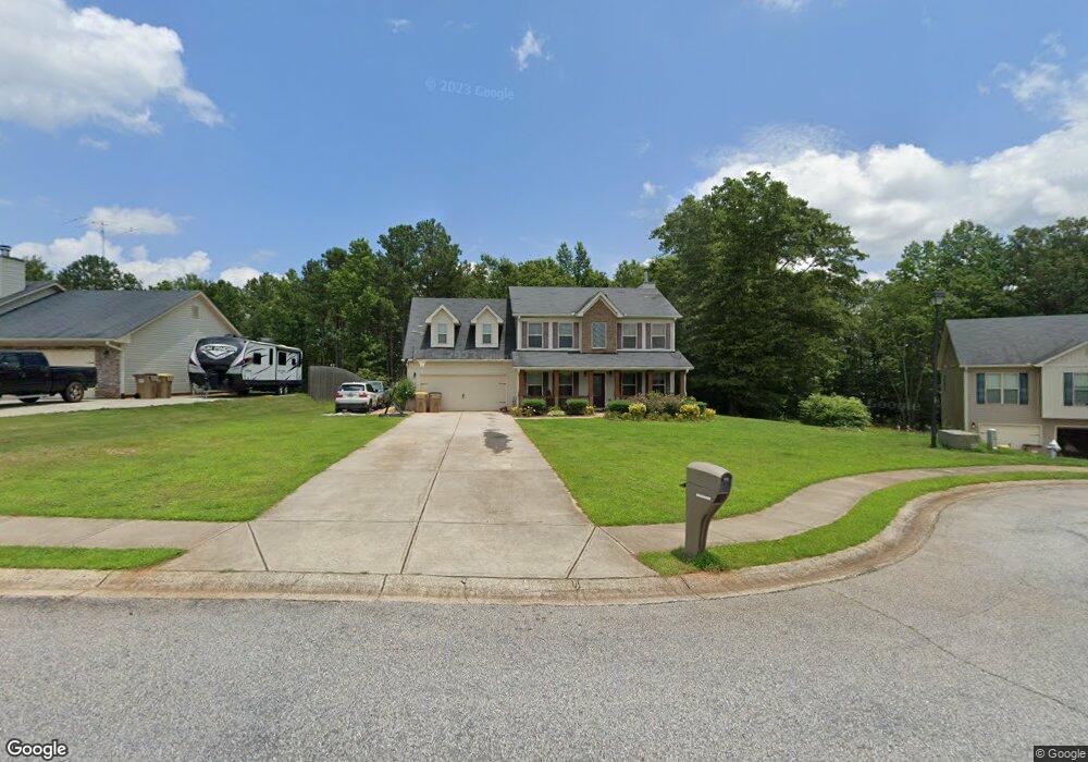
1943 Paynes Point Unit LOT 72 Winder, GA 30680
Estimated Value: $357,775 - $380,000
4
Beds
3
Baths
2,000
Sq Ft
$185/Sq Ft
Est. Value
About This Home
This home is located at 1943 Paynes Point Unit LOT 72, Winder, GA 30680 and is currently estimated at $370,694, approximately $185 per square foot. 1943 Paynes Point Unit LOT 72 is a home located in Barrow County with nearby schools including Statham Elementary School, Bear Creek Middle School, and Winder-Barrow High School.
Ownership History
Date
Name
Owned For
Owner Type
Purchase Details
Closed on
Mar 25, 2014
Sold by
Southfork Homes Llc
Bought by
Phillip Kurt S
Current Estimated Value
Home Financials for this Owner
Home Financials are based on the most recent Mortgage that was taken out on this home.
Original Mortgage
$158,230
Outstanding Balance
$120,205
Interest Rate
4.4%
Mortgage Type
VA
Estimated Equity
$250,489
Purchase Details
Closed on
Dec 5, 2013
Sold by
Sugarloaf East Llc
Bought by
Southfork Homes Llc
Purchase Details
Closed on
Dec 22, 2010
Sold by
State Bank & Trust Co
Bought by
Sugarloaf East Llc
Purchase Details
Closed on
Dec 7, 2009
Sold by
Lcs Llc
Bought by
State Bank & Trust Co
Purchase Details
Closed on
Aug 2, 2006
Sold by
Reece Deborah P
Bought by
Lcs Llc
Create a Home Valuation Report for This Property
The Home Valuation Report is an in-depth analysis detailing your home's value as well as a comparison with similar homes in the area
Home Values in the Area
Average Home Value in this Area
Purchase History
| Date | Buyer | Sale Price | Title Company |
|---|---|---|---|
| Phillip Kurt S | $154,900 | -- | |
| Southfork Homes Llc | $75,000 | -- | |
| Sugarloaf East Llc | $3,700 | -- | |
| State Bank & Trust Co | -- | -- | |
| Lcs Llc | -- | -- |
Source: Public Records
Mortgage History
| Date | Status | Borrower | Loan Amount |
|---|---|---|---|
| Open | Phillip Kurt S | $158,230 |
Source: Public Records
Tax History Compared to Growth
Tax History
| Year | Tax Paid | Tax Assessment Tax Assessment Total Assessment is a certain percentage of the fair market value that is determined by local assessors to be the total taxable value of land and additions on the property. | Land | Improvement |
|---|---|---|---|---|
| 2024 | $2,659 | $107,252 | $19,200 | $88,052 |
| 2023 | $2,251 | $107,652 | $19,200 | $88,452 |
| 2022 | $2,863 | $100,658 | $19,200 | $81,458 |
| 2021 | $2,592 | $86,183 | $19,200 | $66,983 |
| 2020 | $2,432 | $77,193 | $16,000 | $61,193 |
| 2019 | $2,475 | $77,193 | $16,000 | $61,193 |
| 2018 | $2,266 | $71,098 | $12,800 | $58,298 |
| 2017 | $1,950 | $66,986 | $16,000 | $50,986 |
| 2016 | $1,988 | $62,296 | $16,000 | $46,296 |
| 2015 | $1,906 | $62,296 | $16,000 | $46,296 |
| 2014 | $82 | $2,600 | $2,600 | $0 |
| 2013 | -- | $2,600 | $2,600 | $0 |
Source: Public Records
Map
Nearby Homes
- 1295 Double Bridges Rd
- 113 Platte St
- 207 Cedar Grove Church Rd
- 670 Cedar Grove Church Rd
- 670 Cedar Grove Church Rd
- 1453 Solomon Dr
- 1431 Solomon Dr
- 1023 Solomon Ct
- 385 Finch Landing Rd
- 212 Rainbow Ln
- 1415 Red Oak Way
- 1724 Cedar Grove Church Rd
- 1642 White Oak Dr
- 1914 Hearthstone Ct
- 51 Brockton Way Unit 2
- 330 Anchors Way
- 1212 Highway 211 NE
- 1226 Highway 211 NE
- 315 Paige Way
- 1593 Highway 82
- 1943 Paynes Point
- 1945 Paynes Point
- 1945 Paynes Point Unit 71
- 1941 Paynes Point Unit 73
- 1941 Paynes Point
- 1947 Paynes Point Unit 70
- 1947 Paynes Point
- 1939 Paynes Point
- 1939 Paynes Point Unit 74
- 1368 Oak Grove Rd
- 1944 Paynes Point Unit 38
- 1944 Paynes Point
- 1949 Paynes Point Unit 69
- 1949 Paynes Point
- 1946 Paynes Point Unit 39
- 1946 Paynes Point
- 1937 Paynes Point Unit 75
- 1937 Paynes Point
- 1951 Paynes Point Unit 68
- 1951 Paynes Point