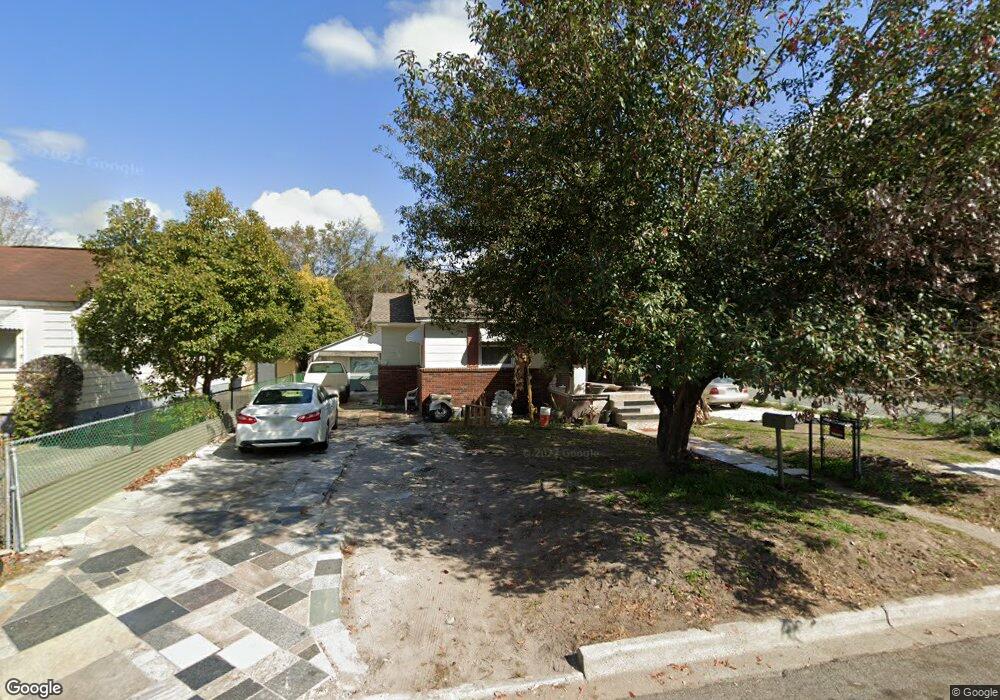
1944 Causton Bluff Rd Savannah, GA 31404
East Savannah NeighborhoodEstimated Value: $189,000 - $215,238
2
Beds
1
Bath
931
Sq Ft
$214/Sq Ft
Est. Value
About This Home
This home is located at 1944 Causton Bluff Rd, Savannah, GA 31404 and is currently estimated at $199,560, approximately $214 per square foot. 1944 Causton Bluff Rd is a home located in Chatham County with nearby schools including Shuman Elementary School, Hubert Middle School, and Savannah Arts Academy.
Ownership History
Date
Name
Owned For
Owner Type
Purchase Details
Closed on
Oct 16, 2009
Sold by
Porras Urena Felix
Bought by
Porras Urena Felix and Porras Urena Porras Mary Lynne
Current Estimated Value
Home Financials for this Owner
Home Financials are based on the most recent Mortgage that was taken out on this home.
Original Mortgage
$54,003
Outstanding Balance
$35,191
Interest Rate
5.04%
Mortgage Type
FHA
Estimated Equity
$164,369
Purchase Details
Closed on
Jan 13, 2005
Sold by
Not Provided
Bought by
Urena Porras and Porras Felix
Create a Home Valuation Report for This Property
The Home Valuation Report is an in-depth analysis detailing your home's value as well as a comparison with similar homes in the area
Home Values in the Area
Average Home Value in this Area
Purchase History
| Date | Buyer | Sale Price | Title Company |
|---|---|---|---|
| Porras Urena Felix | -- | -- | |
| Porras Urena Felix | $55,000 | -- | |
| Urena Porras | -- | -- |
Source: Public Records
Mortgage History
| Date | Status | Borrower | Loan Amount |
|---|---|---|---|
| Open | Porras Urena Felix | $54,003 |
Source: Public Records
Tax History Compared to Growth
Tax History
| Year | Tax Paid | Tax Assessment Tax Assessment Total Assessment is a certain percentage of the fair market value that is determined by local assessors to be the total taxable value of land and additions on the property. | Land | Improvement |
|---|---|---|---|---|
| 2025 | $1,752 | $62,160 | $14,000 | $48,160 |
| 2024 | $1,752 | $63,280 | $14,000 | $49,280 |
| 2023 | $804 | $65,920 | $14,000 | $51,920 |
| 2022 | $514 | $42,120 | $6,800 | $35,320 |
| 2021 | $1,458 | $31,720 | $3,400 | $28,320 |
| 2020 | $826 | $26,160 | $3,400 | $22,760 |
| 2019 | $1,162 | $26,160 | $3,400 | $22,760 |
| 2018 | $982 | $21,840 | $3,400 | $18,440 |
| 2017 | $710 | $20,400 | $3,400 | $17,000 |
| 2016 | $455 | $15,600 | $3,400 | $12,200 |
| 2015 | $587 | $14,080 | $3,400 | $10,680 |
| 2014 | $816 | $14,680 | $0 | $0 |
Source: Public Records
Map
Nearby Homes
- 1940 Utah St
- 1915 Hawthorne St
- 284 Pennsylvania Ave
- 1911 Greenwood St
- 41 Lawton Ave
- 2103 New Mexico St
- 1901 Duval St
- 202 Forrest Ave
- 2216 Capital St
- 228 Forrest Ave
- 2231 Causton Bluff Rd
- 0 Lawton Ave Unit SA333383
- 320 Forrest Ave
- 311 Lawton Ave
- 2230 Iowa St
- 501 Atkinson Ave
- 519 Vinson Ave
- 1809 Hale St
- 1812 E Gwinnett St
- 2232 E Gwinnett St
- 1940 Causton Bluff Rd
- 1943 New Mexico St
- 1936 Causton Bluff Rd
- 1939 New Mexico St
- 2004 Causton Bluff Rd
- 1935 New Mexico St
- 1932 Causton Bluff Rd
- 2003 New Mexico St
- 1931 New Mexico St
- 1935 Causton Bluff Rd
- 2008 Causton Bluff Rd
- 2003 Causton Bluff Rd
- 1928 Causton Bluff Rd
- 1931 Causton Bluff Rd
- 2007 New Mexico St
- 1944 New Mexico St
- 2007 Causton Bluff Rd
- 1927 New Mexico St
- 1940 New Mexico St
- 1936 New Mexico St
