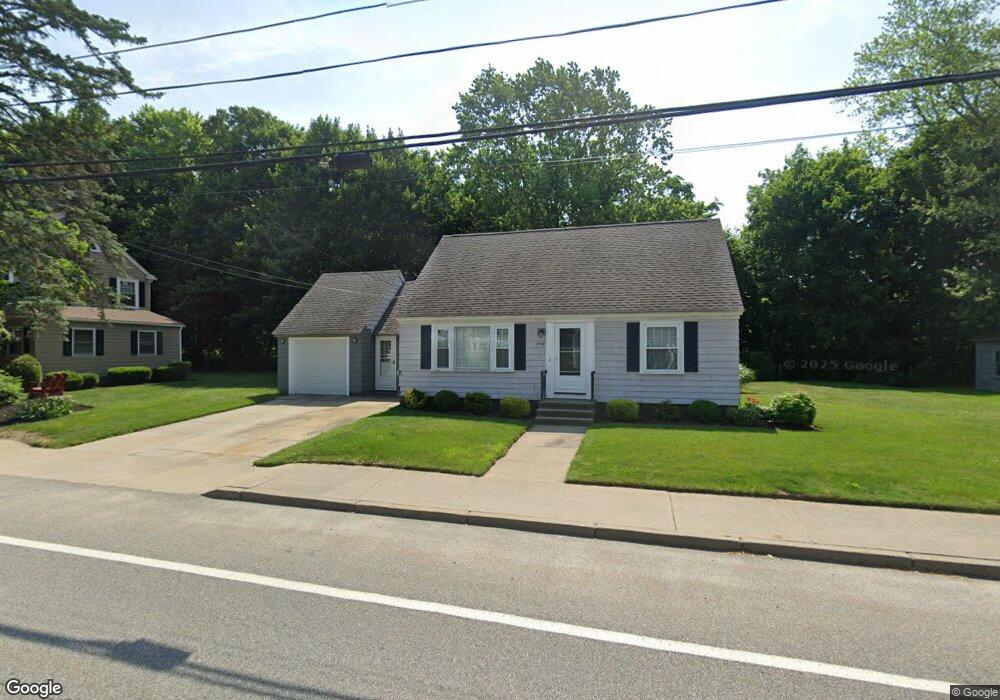
1944 Cranston St Cranston, RI 02920
Meshanticut NeighborhoodEstimated Value: $383,000 - $411,000
2
Beds
1
Bath
884
Sq Ft
$448/Sq Ft
Est. Value
About This Home
This home is located at 1944 Cranston St, Cranston, RI 02920 and is currently estimated at $396,202, approximately $448 per square foot. 1944 Cranston St is a home located in Providence County with nearby schools including George J. Peters School, Western Hills Middle School, and Cranston High School West.
Ownership History
Date
Name
Owned For
Owner Type
Purchase Details
Closed on
Jun 1, 1994
Sold by
Taylor Christian B and Taylor Bethany
Bought by
Guglielmino Paul W
Current Estimated Value
Home Financials for this Owner
Home Financials are based on the most recent Mortgage that was taken out on this home.
Original Mortgage
$59,700
Interest Rate
8.49%
Purchase Details
Closed on
Sep 18, 1989
Sold by
Phillips Benjamin A
Bought by
Taylor Christian B
Home Financials for this Owner
Home Financials are based on the most recent Mortgage that was taken out on this home.
Original Mortgage
$83,900
Interest Rate
9.58%
Create a Home Valuation Report for This Property
The Home Valuation Report is an in-depth analysis detailing your home's value as well as a comparison with similar homes in the area
Home Values in the Area
Average Home Value in this Area
Purchase History
| Date | Buyer | Sale Price | Title Company |
|---|---|---|---|
| Guglielmino Paul W | $81,000 | -- | |
| Taylor Christian B | $105,000 | -- |
Source: Public Records
Mortgage History
| Date | Status | Borrower | Loan Amount |
|---|---|---|---|
| Closed | Taylor Christian B | $59,700 | |
| Previous Owner | Taylor Christian B | $83,900 |
Source: Public Records
Tax History Compared to Growth
Tax History
| Year | Tax Paid | Tax Assessment Tax Assessment Total Assessment is a certain percentage of the fair market value that is determined by local assessors to be the total taxable value of land and additions on the property. | Land | Improvement |
|---|---|---|---|---|
| 2025 | $4,265 | $307,300 | $101,800 | $205,500 |
| 2024 | $4,150 | $304,900 | $101,800 | $203,100 |
| 2023 | $4,062 | $214,900 | $70,200 | $144,700 |
| 2022 | $3,978 | $214,900 | $70,200 | $144,700 |
| 2021 | $3,868 | $214,900 | $70,200 | $144,700 |
| 2020 | $3,662 | $176,300 | $66,700 | $109,600 |
| 2019 | $3,662 | $176,300 | $66,700 | $109,600 |
| 2018 | $3,577 | $176,300 | $66,700 | $109,600 |
| 2017 | $3,225 | $140,600 | $49,200 | $91,400 |
| 2016 | $3,156 | $140,600 | $49,200 | $91,400 |
| 2015 | $3,156 | $140,600 | $49,200 | $91,400 |
| 2014 | $3,275 | $143,400 | $49,200 | $94,200 |
Source: Public Records
Map
Nearby Homes
- 71 Norton Ave
- 21 Charles St
- 210 Hyde St
- 34 Aldrich Ave
- 99 Salem Ave
- 69 W View Ave
- 0 Rutland St
- 80 Phenix Ave
- 333 Phenix Ave
- 56 Scituate Ave
- 0 Phenix Ave Unit 1384514
- 1455 Park Ave Unit 3
- 111 Belgium St
- 54 Randall St
- 46 Lilyana Way
- 141 Glen Ridge Rd
- 86 Sherwood St
- 00 Burton St
- 446 Budlong Rd
- 92 Rhode Island St
- 1952 Cranston St
- 1938 Cranston St
- 1945 Cranston St
- 1939 Cranston St
- 1956 Cranston St
- 1951 Cranston St
- 1958 Cranston St
- 1927 Cranston St
- 14 Blaine St
- 1928 Cranston St
- 1960 Cranston St
- 1961 Cranston St
- 20 Blaine St
- 15 Blaine St
- 1921 Cranston St
- 1968 Cranston St
- 17 Butler St
- 65 Oaklawn Ave Unit 75-114
- 65 Oaklawn Ave Unit 65-208
- 65-75 Oaklawn Ave