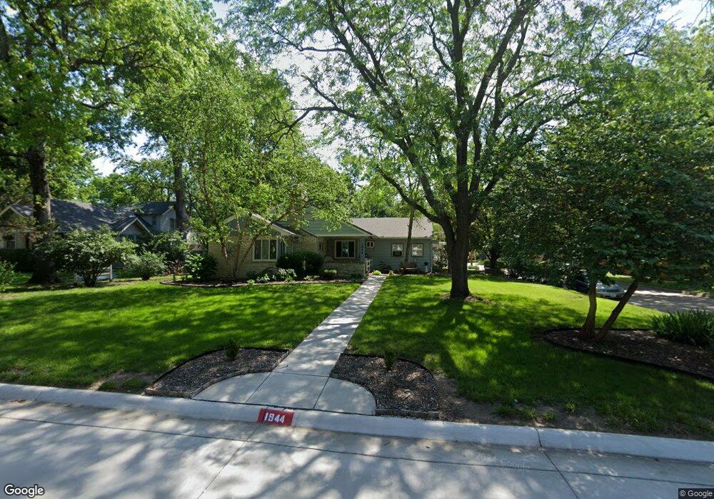
1944 SW High Ave Topeka, KS 66604
Central Topeka NeighborhoodEstimated Value: $194,000 - $201,000
2
Beds
2
Baths
1,590
Sq Ft
$124/Sq Ft
Est. Value
About This Home
This home is located at 1944 SW High Ave, Topeka, KS 66604 and is currently estimated at $197,440, approximately $124 per square foot. 1944 SW High Ave is a home located in Shawnee County with nearby schools including Randolph Elementary School, Robinson Middle School, and Topeka High School.
Ownership History
Date
Name
Owned For
Owner Type
Purchase Details
Closed on
Oct 8, 2008
Sold by
Mayer Jeffrey A and Mayer Gwendolyn M
Bought by
Mayer Jeffrey A
Current Estimated Value
Home Financials for this Owner
Home Financials are based on the most recent Mortgage that was taken out on this home.
Original Mortgage
$129,372
Outstanding Balance
$82,805
Interest Rate
6%
Mortgage Type
FHA
Estimated Equity
$114,635
Purchase Details
Closed on
Mar 3, 2005
Sold by
Kauffman Marlyne L and Estate Of Dorothea Lee Phelps
Bought by
Mayer Jeffrey A and Mayer Gwendolyn M
Home Financials for this Owner
Home Financials are based on the most recent Mortgage that was taken out on this home.
Original Mortgage
$82,000
Interest Rate
8.95%
Mortgage Type
Adjustable Rate Mortgage/ARM
Create a Home Valuation Report for This Property
The Home Valuation Report is an in-depth analysis detailing your home's value as well as a comparison with similar homes in the area
Home Values in the Area
Average Home Value in this Area
Purchase History
| Date | Buyer | Sale Price | Title Company |
|---|---|---|---|
| Mayer Jeffrey A | -- | Nations Title Agency Inc | |
| Mayer Jeffrey A | $102,500 | Capital Title Insurance Co | |
| Mayer Jeffrey A | $102,500 | None Available |
Source: Public Records
Mortgage History
| Date | Status | Borrower | Loan Amount |
|---|---|---|---|
| Open | Mayer Jeffrey A | $129,372 | |
| Closed | Mayer Jeffrey A | $82,000 |
Source: Public Records
Tax History
| Year | Tax Paid | Tax Assessment Tax Assessment Total Assessment is a certain percentage of the fair market value that is determined by local assessors to be the total taxable value of land and additions on the property. | Land | Improvement |
|---|---|---|---|---|
| 2025 | $2,866 | $21,015 | -- | -- |
| 2023 | $2,866 | $19,068 | $0 | $0 |
| 2022 | $2,472 | $16,581 | $0 | $0 |
| 2021 | $2,262 | $14,418 | $0 | $0 |
| 2020 | $2,128 | $13,731 | $0 | $0 |
| 2019 | $1,893 | $12,176 | $0 | $0 |
| 2018 | $1,839 | $11,822 | $0 | $0 |
| 2017 | $1,843 | $11,822 | $0 | $0 |
| 2014 | $1,910 | $12,122 | $0 | $0 |
Source: Public Records
Map
Nearby Homes
- 1721 SW High Ave
- 2212 SW Plass Ave
- 2 SW Westboro Place
- 1533 SW High Ave
- 1530 SW Wayne Ave
- 1350 SW Wayne Ave
- 1614 SW College Ave
- 1914 SW Arnold Ave
- 1501-1599 SW 17th St
- 2761 SW Plass Ave
- 2047 SW Lincoln St
- 1500 SW Mulvane St
- 1347 SW Campbell Ave
- 1800 SW Lincoln St
- 1259 SW High Ave
- 1303 SW Pembroke Ln
- 2058 SW Buchanan St
- 1928 SW Buchanan St
- 2516 SW Huntoon St
- 3030 SW Clark Ct
- 1936 SW High Ave
- 1934 SW High Ave
- 2400 SW 20th St
- 1939 SW Wayne Ave
- 2001 SW Wayne Ave
- 1932 SW High Ave
- 1945 SW High Ave
- 2008 SW High Ave
- 1935 SW Wayne Ave
- 2008 SW High Ave
- 1933 SW High Ave
- 1930 SW High Ave
- 2001 SW High Ave
- 1931 SW High Ave
- 2009 SW Wayne Ave
- 2005 SW High Ave
- 2012 SW High Ave
- 2322 SW 20th St
- 1925 SW Wayne Ave
- 2017 SW Wayne Ave
Your Personal Tour Guide
Ask me questions while you tour the home.