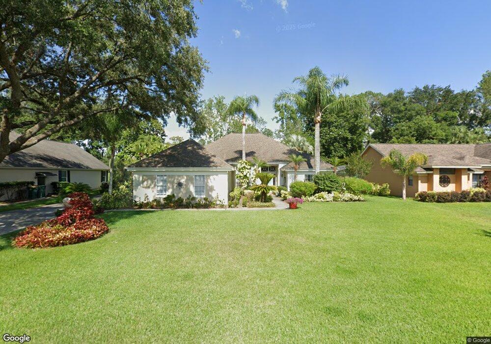
19441 Spring Oak Dr Eustis, FL 32736
Estimated Value: $384,000 - $491,000
3
Beds
3
Baths
2,204
Sq Ft
$196/Sq Ft
Est. Value
About This Home
This home is located at 19441 Spring Oak Dr, Eustis, FL 32736 and is currently estimated at $432,846, approximately $196 per square foot. 19441 Spring Oak Dr is a home located in Lake County with nearby schools including Triangle Elementary School, Eustis Middle School, and Eustis High School.
Ownership History
Date
Name
Owned For
Owner Type
Purchase Details
Closed on
Apr 13, 2004
Sold by
Allen Florence
Bought by
Allen Florence
Current Estimated Value
Purchase Details
Closed on
Jun 24, 1994
Sold by
Shamrock Dev Corp Lake Cty Inc
Bought by
Allen Florence
Home Financials for this Owner
Home Financials are based on the most recent Mortgage that was taken out on this home.
Original Mortgage
$95,000
Interest Rate
8.73%
Create a Home Valuation Report for This Property
The Home Valuation Report is an in-depth analysis detailing your home's value as well as a comparison with similar homes in the area
Home Values in the Area
Average Home Value in this Area
Purchase History
| Date | Buyer | Sale Price | Title Company |
|---|---|---|---|
| Allen Florence | -- | -- | |
| Allen Florence | $140,000 | -- |
Source: Public Records
Mortgage History
| Date | Status | Borrower | Loan Amount |
|---|---|---|---|
| Closed | Allen Florence | $95,000 |
Source: Public Records
Tax History
| Year | Tax Paid | Tax Assessment Tax Assessment Total Assessment is a certain percentage of the fair market value that is determined by local assessors to be the total taxable value of land and additions on the property. | Land | Improvement |
|---|---|---|---|---|
| 2026 | $3,055 | $205,200 | -- | -- |
| 2025 | $2,919 | $199,610 | -- | -- |
| 2024 | $2,919 | $199,610 | -- | -- |
| 2023 | $2,919 | $188,160 | $0 | $0 |
| 2022 | $2,866 | $182,680 | $0 | $0 |
| 2021 | $2,753 | $177,363 | $0 | $0 |
| 2020 | $2,834 | $174,915 | $0 | $0 |
| 2019 | $2,792 | $170,983 | $0 | $0 |
| 2018 | $2,677 | $167,795 | $0 | $0 |
| 2017 | $2,617 | $164,344 | $0 | $0 |
| 2016 | $2,583 | $160,964 | $0 | $0 |
| 2015 | $2,626 | $159,846 | $0 | $0 |
| 2014 | $2,614 | $158,578 | $0 | $0 |
Source: Public Records
Map
Nearby Homes
- 19655 Spring Oak Dr
- 19337 Spring Oak Dr
- 4030 Brookshire Cir
- 19624 Spring Oak Dr
- 19146 Park Place Blvd
- 4058 Brookshire Cir
- 4040 Casterly Rock Ct
- 33943 E Lake Joanna Dr
- 3964 Mayhill Loop
- 3984 Mayhill Loop
- 1701 Strathmore Cir
- 1689 Strathmore Cir
- 8045 Waterbury Way
- 201 W Blue Water Edge Dr
- 8923 Bridgeport Bay Cir
- 413 W Blue Water Edge Dr
- 425 W Blue Water Edge Dr
- 421 W Blue Water Edge Dr
- 5100 Ballark St
- 535 Darshire Ave
- 19445 Spring Oak Dr
- 19437 Spring Oak Dr
- 19433 Spring Oak Dr
- 19440 Spring Oak Dr
- 19436 Spring Oak Dr
- 19444 Spring Oak Dr
- 19451 Spring Oak Dr
- 19432 Spring Oak Dr
- 19446 Spring Oak Dr
- 19429 Spring Oak Dr
- 34236 Woodridge Ln
- 34230 Woodridge Ln
- 34240 Woodridge Ln
- 19430 Spring Oak Dr
- 19448 Spring Oak Dr
- 34246 Woodridge Ln
- 19144 State Road 44
- 34252 Woodridge Ln
- 19349 Park Place Blvd
- 34224 Woodridge Ln
Your Personal Tour Guide
Ask me questions while you tour the home.