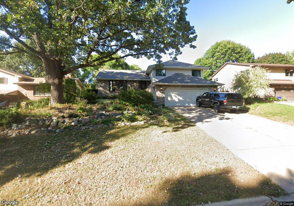
1945 N Park Dr Saint Paul, MN 55119
Battle Creek NeighborhoodEstimated Value: $389,000 - $408,000
3
Beds
3
Baths
2,080
Sq Ft
$190/Sq Ft
Est. Value
About This Home
This home is located at 1945 N Park Dr, Saint Paul, MN 55119 and is currently estimated at $394,573, approximately $189 per square foot. 1945 N Park Dr is a home located in Ramsey County with nearby schools including Battle Creek Elementary School, Battle Creek Middle School, and Harding Senior High School.
Ownership History
Date
Name
Owned For
Owner Type
Purchase Details
Closed on
Mar 21, 2022
Sold by
Wiebold Judith
Bought by
Beck Joseph
Current Estimated Value
Home Financials for this Owner
Home Financials are based on the most recent Mortgage that was taken out on this home.
Original Mortgage
$324,000
Outstanding Balance
$301,431
Interest Rate
3.55%
Mortgage Type
New Conventional
Estimated Equity
$93,142
Purchase Details
Closed on
Mar 14, 2022
Sold by
Wiebold Judith A
Bought by
Beck Joseph
Home Financials for this Owner
Home Financials are based on the most recent Mortgage that was taken out on this home.
Original Mortgage
$324,000
Outstanding Balance
$301,431
Interest Rate
3.55%
Mortgage Type
New Conventional
Estimated Equity
$93,142
Create a Home Valuation Report for This Property
The Home Valuation Report is an in-depth analysis detailing your home's value as well as a comparison with similar homes in the area
Home Values in the Area
Average Home Value in this Area
Purchase History
| Date | Buyer | Sale Price | Title Company |
|---|---|---|---|
| Beck Joseph | $405,000 | -- | |
| Beck Joseph | -- | Minnesota Title |
Source: Public Records
Mortgage History
| Date | Status | Borrower | Loan Amount |
|---|---|---|---|
| Open | Beck Joseph | $324,000 | |
| Closed | Beck Joseph | $324,000 |
Source: Public Records
Tax History Compared to Growth
Tax History
| Year | Tax Paid | Tax Assessment Tax Assessment Total Assessment is a certain percentage of the fair market value that is determined by local assessors to be the total taxable value of land and additions on the property. | Land | Improvement |
|---|---|---|---|---|
| 2025 | $5,850 | $358,500 | $39,400 | $319,100 |
| 2023 | $5,850 | $380,400 | $39,400 | $341,000 |
| 2022 | $4,620 | $335,800 | $39,400 | $296,400 |
| 2021 | $4,164 | $293,200 | $39,400 | $253,800 |
| 2020 | $4,518 | $275,400 | $39,400 | $236,000 |
| 2019 | $4,524 | $277,800 | $39,400 | $238,400 |
| 2018 | $4,090 | $274,100 | $39,400 | $234,700 |
| 2017 | $3,502 | $256,900 | $34,700 | $222,200 |
| 2016 | $3,474 | $0 | $0 | $0 |
| 2015 | $3,420 | $221,100 | $34,700 | $186,400 |
| 2014 | $3,060 | $0 | $0 | $0 |
Source: Public Records
Map
Nearby Homes
- 1989 N Park Dr
- 1935 Warbler Ln
- 2059 Parkside Dr Unit 29
- 2063 N Park Dr Unit 6
- 138 Ruth St N Unit 9
- 2069 Parkside Dr Unit G2
- 125 Battle Creek Place
- 136 White Bear Ave N
- 49 Battle Creek Place
- 1747 Louise Ave
- 125 Mcknight Rd N Unit K
- 2219 Cardinal Place
- 1821 Wilson Ave
- 465 Ruth St N
- 2169 Glenridge Ave
- 2243 Edgebrook Ave
- 237 Sigurd St
- 2250 Edgebrook Ave
- 267 Hazelwood St
- 1935 Fremont Ave E
- 1951 N Park Dr
- 1941 N Park Dr
- 1946 Foxridge Rd
- 1952 Foxridge Rd
- 1959 N Park Dr
- 1940 Foxridge Rd
- 1937 N Park Dr
- 1958 Foxridge Rd
- 1934 Foxridge Rd
- 1919 N Park Dr
- 1965 N Park Dr
- 1928 Foxridge Rd
- 1968 Foxridge Rd
- 1947 Foxridge Rd
- 1915 N Park Dr
- 1953 Foxridge Rd
- 1939 Foxridge Rd
- 1957 Foxridge Rd
- 1971 N Park Dr
- 1935 Foxridge Rd