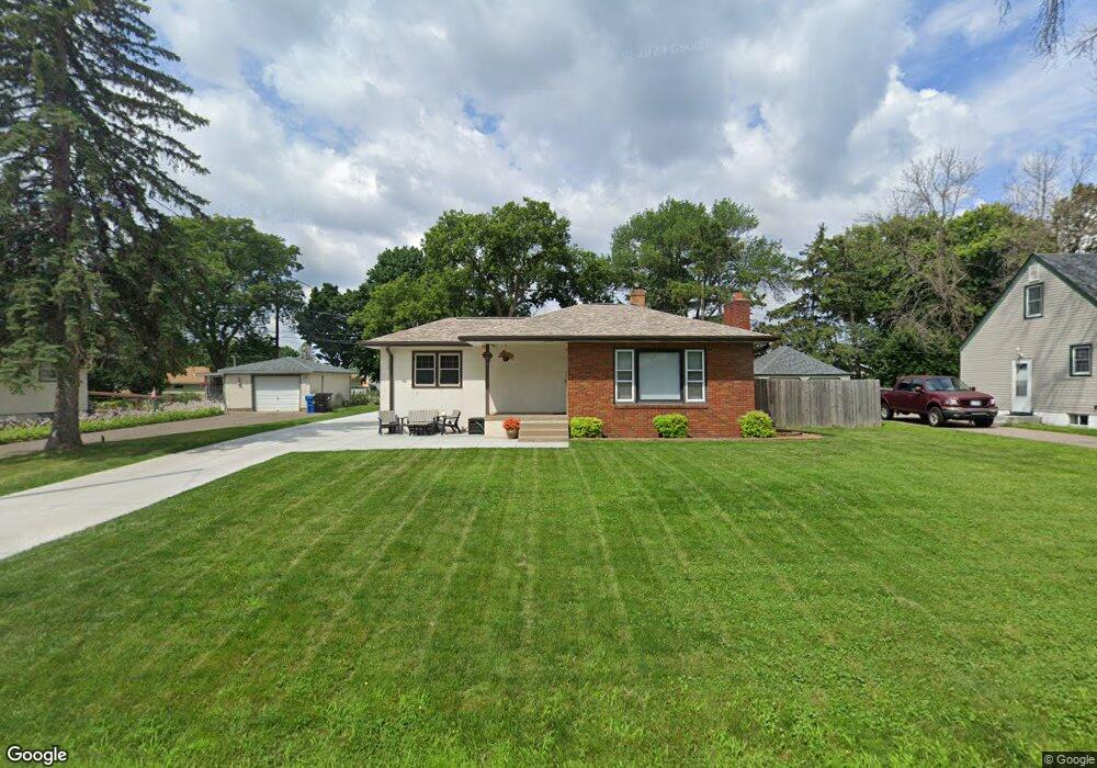
1947 Barclay St Saint Paul, MN 55109
Gladstone NeighborhoodEstimated Value: $288,000 - $327,000
2
Beds
2
Baths
886
Sq Ft
$341/Sq Ft
Est. Value
About This Home
This home is located at 1947 Barclay St, Saint Paul, MN 55109 and is currently estimated at $302,528, approximately $341 per square foot. 1947 Barclay St is a home located in Ramsey County with nearby schools including Weaver Elementary School, John Glenn Middle School, and Mounds Park Academy.
Ownership History
Date
Name
Owned For
Owner Type
Purchase Details
Closed on
Aug 21, 2015
Sold by
Denny Anthony and Denny Mesa
Bought by
Kieffer Jessica R and Kieffer Brandon L
Current Estimated Value
Home Financials for this Owner
Home Financials are based on the most recent Mortgage that was taken out on this home.
Original Mortgage
$175,650
Outstanding Balance
$138,429
Interest Rate
4.09%
Mortgage Type
New Conventional
Estimated Equity
$164,099
Purchase Details
Closed on
Oct 22, 1998
Sold by
Kasprzak Constance M
Bought by
Lindahl Darren
Create a Home Valuation Report for This Property
The Home Valuation Report is an in-depth analysis detailing your home's value as well as a comparison with similar homes in the area
Home Values in the Area
Average Home Value in this Area
Purchase History
| Date | Buyer | Sale Price | Title Company |
|---|---|---|---|
| Kieffer Jessica R | $190,503 | Liberty Title Inc | |
| Lindahl Darren | $107,500 | -- |
Source: Public Records
Mortgage History
| Date | Status | Borrower | Loan Amount |
|---|---|---|---|
| Open | Kieffer Jessica R | $175,650 |
Source: Public Records
Tax History Compared to Growth
Tax History
| Year | Tax Paid | Tax Assessment Tax Assessment Total Assessment is a certain percentage of the fair market value that is determined by local assessors to be the total taxable value of land and additions on the property. | Land | Improvement |
|---|---|---|---|---|
| 2025 | $4,112 | $300,200 | $60,000 | $240,200 |
| 2023 | $4,112 | $297,400 | $60,000 | $237,400 |
| 2022 | $3,278 | $264,400 | $60,000 | $204,400 |
| 2021 | $3,100 | $232,400 | $60,000 | $172,400 |
| 2020 | $2,806 | $225,500 | $60,000 | $165,500 |
| 2019 | $2,662 | $194,700 | $60,000 | $134,700 |
| 2018 | $2,538 | $188,700 | $60,000 | $128,700 |
| 2017 | $2,452 | $176,900 | $60,000 | $116,900 |
| 2016 | $1,932 | $0 | $0 | $0 |
| 2015 | $2,032 | $137,300 | $55,000 | $82,300 |
| 2014 | $1,572 | $0 | $0 | $0 |
Source: Public Records
Map
Nearby Homes
- 1940 Barclay St
- 1854 Barclay St
- 1869 Birmingham St
- 1984 Prosperity Rd
- 1870 Clarence St
- 1849 Kennard St
- 1467 County Road B E
- 1435 Price Ave
- 1937 Flandrau St
- 1751 Clarence St
- 1509 Sandhurst Ave E
- 1856 Flandrau St
- 1496 Laurie Rd E
- 1740 English St
- 1672 Manton St
- 1201 Frost Ave
- 1627 Christie Place
- 1730 Atlantic St
- 1666 Laurie Rd E
- 1639 Clarence St
- 1961 Barclay St
- 1939 Barclay St
- 1963 Barclay St
- 1948 Manton St
- 1950 Manton St
- 1929 Barclay St
- 1936 Manton St
- 1956 Manton St
- 1948 Barclay St
- 1965 Barclay St
- 1938 Barclay St
- 1974 Manton St
- 1964 Barclay St
- 1467 Frost Ave
- 1928 Manton St
- 1973 Barclay St
- 1970 Barclay St
- 1928 Barclay St
- 1972 Manton St
- 1945 Dieter St