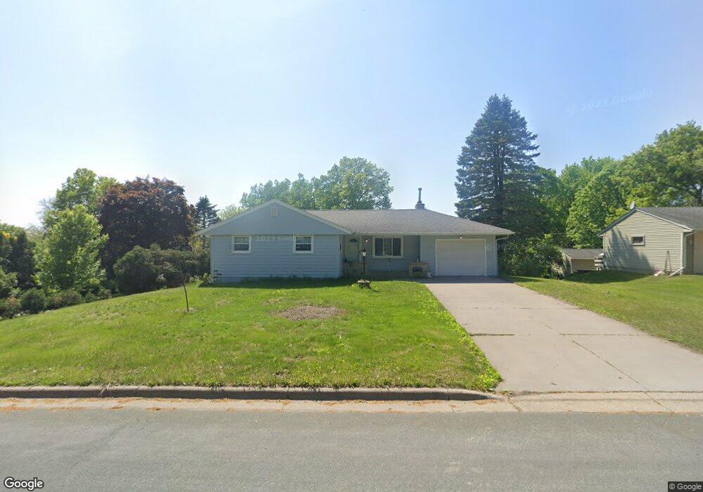
1947 Knob Rd Saint Paul, MN 55118
Estimated Value: $476,000 - $496,319
4
Beds
2
Baths
2,469
Sq Ft
$197/Sq Ft
Est. Value
About This Home
This home is located at 1947 Knob Rd, Saint Paul, MN 55118 and is currently estimated at $485,580, approximately $196 per square foot. 1947 Knob Rd is a home located in Dakota County with nearby schools including Somerset Elementary School, Heritage E-STEM Magnet School, and Two Rivers High School.
Ownership History
Date
Name
Owned For
Owner Type
Purchase Details
Closed on
Nov 16, 2015
Sold by
Baars Clofford J and Baars Naomie K
Bought by
Flannigan James
Current Estimated Value
Home Financials for this Owner
Home Financials are based on the most recent Mortgage that was taken out on this home.
Original Mortgage
$210,000
Outstanding Balance
$164,894
Interest Rate
3.74%
Mortgage Type
New Conventional
Estimated Equity
$320,686
Create a Home Valuation Report for This Property
The Home Valuation Report is an in-depth analysis detailing your home's value as well as a comparison with similar homes in the area
Home Values in the Area
Average Home Value in this Area
Purchase History
| Date | Buyer | Sale Price | Title Company |
|---|---|---|---|
| Flannigan James | $250,000 | Burnet Title |
Source: Public Records
Mortgage History
| Date | Status | Borrower | Loan Amount |
|---|---|---|---|
| Open | Flannigan James | $210,000 |
Source: Public Records
Tax History Compared to Growth
Tax History
| Year | Tax Paid | Tax Assessment Tax Assessment Total Assessment is a certain percentage of the fair market value that is determined by local assessors to be the total taxable value of land and additions on the property. | Land | Improvement |
|---|---|---|---|---|
| 2024 | $4,096 | $463,500 | $137,400 | $326,100 |
| 2023 | $4,096 | $440,600 | $134,300 | $306,300 |
| 2022 | $3,760 | $458,600 | $134,000 | $324,600 |
| 2021 | $3,536 | $378,800 | $116,500 | $262,300 |
| 2020 | $3,596 | $353,400 | $111,000 | $242,400 |
| 2019 | $3,424 | $347,000 | $105,700 | $241,300 |
| 2018 | $3,246 | $316,500 | $98,800 | $217,700 |
| 2017 | $3,606 | $311,800 | $94,100 | $217,700 |
| 2016 | $3,254 | $332,400 | $89,500 | $242,900 |
| 2015 | $3,354 | $295,428 | $86,634 | $208,794 |
| 2014 | -- | $293,248 | $81,726 | $211,522 |
| 2013 | -- | $276,135 | $78,759 | $197,376 |
Source: Public Records
Map
Nearby Homes
- 1912 South Ln
- 679 Marie Ave W
- 485 Preserve Path
- 1941 Dodd Rd
- 1774 Dodd Rd
- 614 Hidden Creek Trail
- 685 Hidden Creek Trail
- 792 Hilltop Rd
- 2122 Delaware Ave
- 795 Creek Ave
- 2148 Delaware Ave
- 600 Wentworth Ave
- 2194 Charlton Rd
- 2222 Apache St
- 884 Marie Ave W
- 912 Crown Ct
- 1860 Eagle Ridge Dr Unit W303
- 809 Wagon Wheel Trail
- 2360 Apache Ct
- 2300 Pagel Rd
- 1937 Knob Rd
- 1957 Knob Rd
- 1954 Knob Rd
- 1948 Knob Rd
- 1946 South Ln
- 1940 South Ln
- 1929 Knob Rd
- 1958 Knob Rd
- 1954 South Ln
- 1965 Knob Rd
- 1934 Knob Rd
- 701 Sibley Ct Unit 10
- 701 Sibley Ct Unit 3
- 701 Sibley Ct Unit 8
- 701 Sibley Ct Unit 2
- 1962 Knob Rd
- 596 High Ridge Cir
- 1919 Knob Rd
- 1926 South Ln
- 601 Sibley Ct