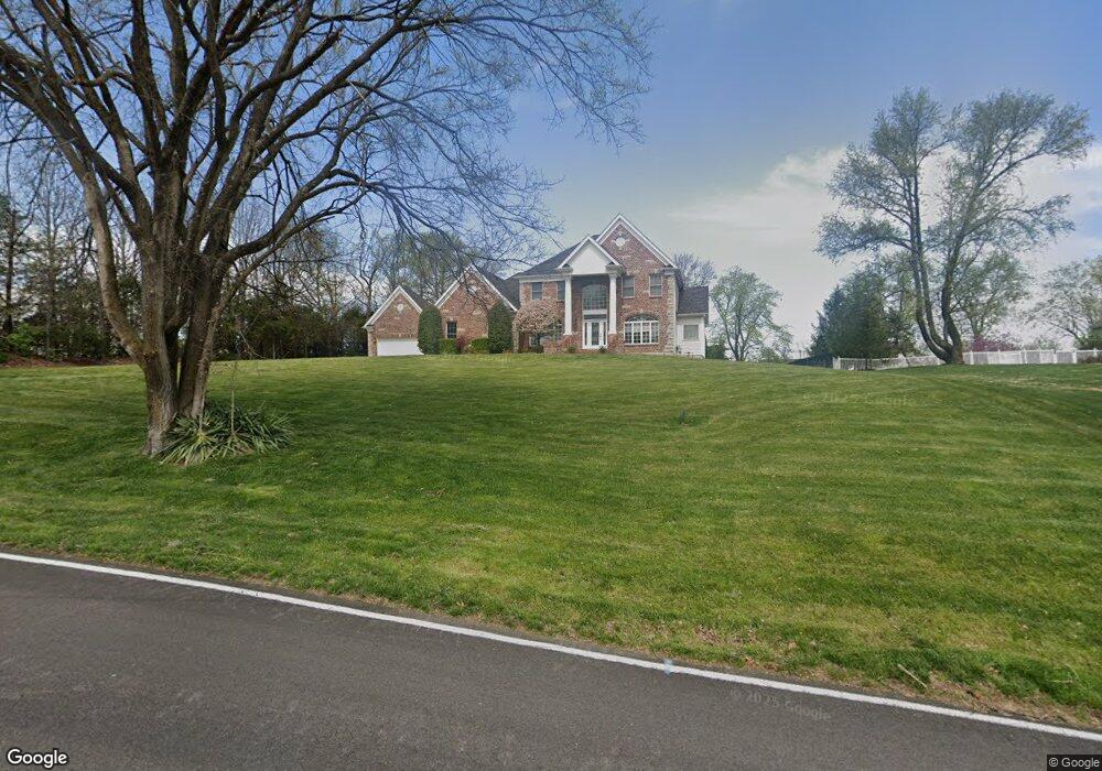
1947 Shepard Rd Glencoe, MO 63038
Estimated Value: $982,000 - $1,514,000
4
Beds
5
Baths
3,760
Sq Ft
$329/Sq Ft
Est. Value
About This Home
This home is located at 1947 Shepard Rd, Glencoe, MO 63038 and is currently estimated at $1,237,570, approximately $329 per square foot. 1947 Shepard Rd is a home located in St. Louis County with nearby schools including Babler Elementary School, Rockwood Valley Middle School, and Lafayette High School.
Ownership History
Date
Name
Owned For
Owner Type
Purchase Details
Closed on
May 31, 2012
Sold by
Amerson John R and Amerson Marvina Moore
Bought by
Downing Kurtis A and Downing Irasa L
Current Estimated Value
Home Financials for this Owner
Home Financials are based on the most recent Mortgage that was taken out on this home.
Original Mortgage
$417,000
Outstanding Balance
$289,402
Interest Rate
3.86%
Mortgage Type
New Conventional
Estimated Equity
$948,168
Purchase Details
Closed on
May 25, 2006
Sold by
Claymont Development Llc
Bought by
Amerson John R and Moore Marvina
Home Financials for this Owner
Home Financials are based on the most recent Mortgage that was taken out on this home.
Original Mortgage
$608,000
Interest Rate
6.5%
Mortgage Type
Fannie Mae Freddie Mac
Create a Home Valuation Report for This Property
The Home Valuation Report is an in-depth analysis detailing your home's value as well as a comparison with similar homes in the area
Home Values in the Area
Average Home Value in this Area
Purchase History
| Date | Buyer | Sale Price | Title Company |
|---|---|---|---|
| Downing Kurtis A | $625,000 | Investors Title Co Clayton | |
| Amerson John R | $760,000 | None Available |
Source: Public Records
Mortgage History
| Date | Status | Borrower | Loan Amount |
|---|---|---|---|
| Open | Downing Kurtis A | $417,000 | |
| Previous Owner | Amerson John R | $608,000 |
Source: Public Records
Tax History
| Year | Tax Paid | Tax Assessment Tax Assessment Total Assessment is a certain percentage of the fair market value that is determined by local assessors to be the total taxable value of land and additions on the property. | Land | Improvement |
|---|---|---|---|---|
| 2025 | $11,722 | $213,790 | $46,930 | $166,860 |
| 2024 | $11,722 | $168,580 | $29,750 | $138,830 |
| 2023 | $11,713 | $168,580 | $29,750 | $138,830 |
| 2022 | $11,756 | $157,150 | $29,750 | $127,400 |
| 2021 | $11,669 | $157,150 | $29,750 | $127,400 |
| 2020 | $12,425 | $159,540 | $22,060 | $137,480 |
| 2019 | $12,475 | $159,540 | $22,060 | $137,480 |
| 2018 | $12,365 | $149,110 | $25,310 | $123,800 |
| 2017 | $12,069 | $149,110 | $25,310 | $123,800 |
| 2016 | $12,227 | $145,280 | $27,840 | $117,440 |
Source: Public Records
Map
Nearby Homes
- 1605 Ridge Bend Dr
- 519 Black Canyon Ct
- 17824 Valley View Ln
- 2347 Paradise Peak Cir
- 16621 Green Pines Dr
- 17065 Sandalwood Creek Dr Unit C
- 1318 Pond Rd
- 1415 Prairie Rose Ln
- 2407 Sandalwood Creek Ct Unit A
- 16597 Clayton Rd
- 401 Thunderhead Canyon Dr
- 16532 Branchwood Dr
- 16537 Clayton Rd
- 2437 August Grove Ct
- 2479 August Grove Ct
- 17054 Cambury Ln
- 2400 Pond Rd
- 1839 Sullivan Pointe Dr
- 2550 Pond Rd
- 1021 Highway 109
- 1935 Shepard Rd
- 18144 Edgewood Cir
- 18138 Edgewood Cir
- 1728 Woods Bend Ln
- 2356 Dartmouth Bend Dr
- 1734 Woods Bend Ln
- 18132 Edgewood Cir
- 1931 Shepard Rd
- 2355 Dartmouth Bend Dr
- 2352 Dartmouth Bend Dr
- 1740 Woods Bend Ln
- 18126 Edgewood Cir
- 18141 Edgewood Cir
- 1723 Woods Bend Ln
- 2351 Dartmouth Bend Dr
- 2348 Dartmouth Bend Dr
- 18120 Edgewood Cir
- 1745 Woods Bend Ln
- 18133 Edgewood Cir
- 1746 Woods Bend Ln
Your Personal Tour Guide
Ask me questions while you tour the home.