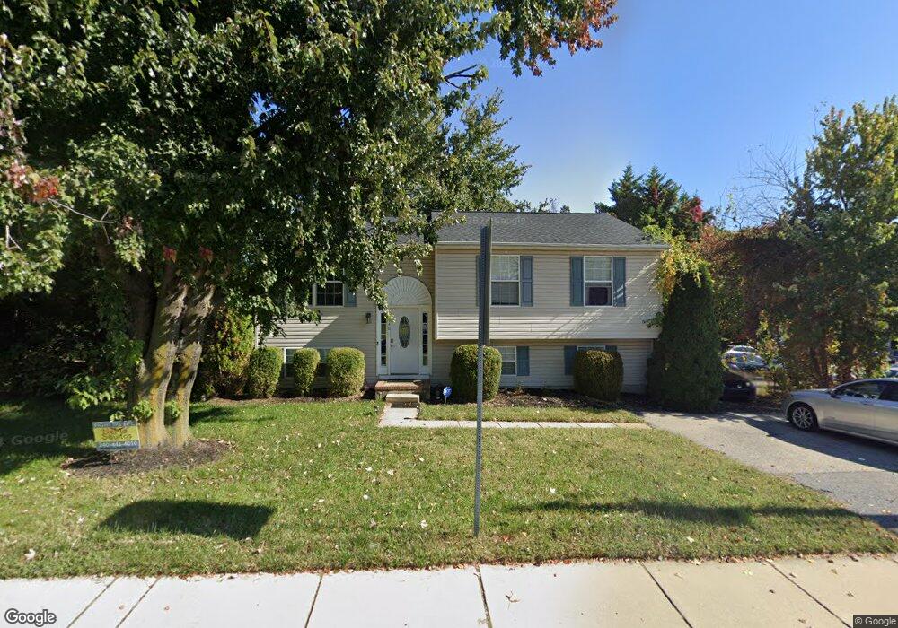
1948 Forest Dr Annapolis, MD 21401
Forest Villa NeighborhoodEstimated Value: $421,000 - $538,000
3
Beds
2
Baths
1,086
Sq Ft
$439/Sq Ft
Est. Value
About This Home
This home is located at 1948 Forest Dr, Annapolis, MD 21401 and is currently estimated at $476,827, approximately $439 per square foot. 1948 Forest Dr is a home located in Anne Arundel County with nearby schools including Walter S. Mills-Parole Elementary School, Annapolis Middle School, and Annapolis High School.
Ownership History
Date
Name
Owned For
Owner Type
Purchase Details
Closed on
Jul 9, 2009
Sold by
Trusty Kevin J
Bought by
Kelley Dawn M
Current Estimated Value
Home Financials for this Owner
Home Financials are based on the most recent Mortgage that was taken out on this home.
Original Mortgage
$258,523
Outstanding Balance
$168,729
Interest Rate
5.31%
Mortgage Type
FHA
Estimated Equity
$308,098
Purchase Details
Closed on
Aug 31, 1999
Sold by
Landfall Development Corp
Bought by
Trusty Kevin Juan and Trusty Lashon Lachelle
Create a Home Valuation Report for This Property
The Home Valuation Report is an in-depth analysis detailing your home's value as well as a comparison with similar homes in the area
Home Values in the Area
Average Home Value in this Area
Purchase History
| Date | Buyer | Sale Price | Title Company |
|---|---|---|---|
| Kelley Dawn M | $267,900 | -- | |
| Trusty Kevin Juan | $138,500 | -- |
Source: Public Records
Mortgage History
| Date | Status | Borrower | Loan Amount |
|---|---|---|---|
| Open | Kelley Dawn M | $258,523 |
Source: Public Records
Tax History Compared to Growth
Tax History
| Year | Tax Paid | Tax Assessment Tax Assessment Total Assessment is a certain percentage of the fair market value that is determined by local assessors to be the total taxable value of land and additions on the property. | Land | Improvement |
|---|---|---|---|---|
| 2025 | $4,121 | $324,500 | -- | -- |
| 2024 | $4,121 | $296,600 | $0 | $0 |
| 2023 | $3,859 | $268,700 | $118,500 | $150,200 |
| 2022 | $3,781 | $268,333 | $0 | $0 |
| 2021 | $3,773 | $267,967 | $0 | $0 |
| 2020 | $3,773 | $267,600 | $118,500 | $149,100 |
| 2019 | $3,737 | $264,833 | $0 | $0 |
| 2018 | $3,645 | $262,067 | $0 | $0 |
| 2017 | $3,384 | $259,300 | $0 | $0 |
| 2016 | -- | $259,267 | $0 | $0 |
| 2015 | -- | $259,233 | $0 | $0 |
| 2014 | -- | $259,200 | $0 | $0 |
Source: Public Records
Map
Nearby Homes
- 1971 Dominoe Rd
- 9 Bunche St
- 604 Tripp Creek Ct
- 8 Dorsey Ave
- 14 A Dorsey Ave
- 25 Dorsey Ave
- 27 Dorsey Ave
- 220 S Southwood Ave
- 201 Bowie Ave
- Plan 1 at Rusty Red Drive
- 9 Rusty Red Dr
- 606 James Walker Place
- 136 S Homeland Ave
- 10 N Homeland Ave
- 750 Crisfield Way
- 1915 Towne Centre Blvd Unit 1004
- 1915 Towne Centre Blvd Unit 606
- 1915 Towne Centre Blvd Unit 1210
- 1915 Towne Centre Blvd Unit 306
- 1915 Towne Centre Blvd Unit 1001
- 1950 Forest Dr
- 7 Dominoe Rd
- 1922 Forest Dr
- 5 Dominoe Rd
- 1945 Forest Dr
- 1947 Forest Dr
- 1949 Forest Dr
- 10 Dominoe Rd
- 1952 Forest Dr
- 1951 Forest Dr
- 1943 Drew St
- 1954 Forest Dr
- 2 Dominoe Rd
- 105 Dominoe Rd
- 1833 Drew St
- 1833 Drew St Unit A
- 1833 Drew St Unit A2
- 1833 Drew St Unit A1
- 1833A Drew St
- 1833B Drew St