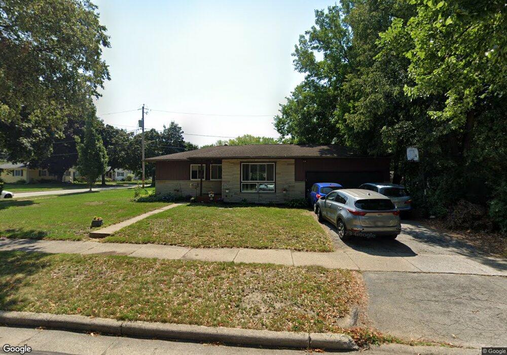
1949 Garland Ave Waukesha, WI 53188
Estimated Value: $351,000 - $379,000
4
Beds
2
Baths
1,854
Sq Ft
$197/Sq Ft
Est. Value
About This Home
This home is located at 1949 Garland Ave, Waukesha, WI 53188 and is currently estimated at $364,994, approximately $196 per square foot. 1949 Garland Ave is a home located in Waukesha County with nearby schools including Lowell Elementary School, Butler Middle School, and North High School.
Ownership History
Date
Name
Owned For
Owner Type
Purchase Details
Closed on
May 15, 2000
Sold by
Shepard Mary C and Shepard Lisa M
Bought by
Rooney Michael J and Rooney Patricia S
Current Estimated Value
Home Financials for this Owner
Home Financials are based on the most recent Mortgage that was taken out on this home.
Original Mortgage
$116,500
Outstanding Balance
$40,218
Interest Rate
8.13%
Estimated Equity
$324,776
Create a Home Valuation Report for This Property
The Home Valuation Report is an in-depth analysis detailing your home's value as well as a comparison with similar homes in the area
Home Values in the Area
Average Home Value in this Area
Purchase History
| Date | Buyer | Sale Price | Title Company |
|---|---|---|---|
| Rooney Michael J | $129,500 | -- |
Source: Public Records
Mortgage History
| Date | Status | Borrower | Loan Amount |
|---|---|---|---|
| Open | Rooney Michael J | $116,500 |
Source: Public Records
Tax History Compared to Growth
Tax History
| Year | Tax Paid | Tax Assessment Tax Assessment Total Assessment is a certain percentage of the fair market value that is determined by local assessors to be the total taxable value of land and additions on the property. | Land | Improvement |
|---|---|---|---|---|
| 2024 | $4,369 | $296,000 | $53,100 | $242,900 |
| 2023 | $4,243 | $296,000 | $53,100 | $242,900 |
| 2022 | $5,368 | $174,900 | $49,200 | $125,700 |
| 2021 | $5,909 | $174,900 | $49,200 | $125,700 |
| 2020 | $4,818 | $174,900 | $49,200 | $125,700 |
| 2019 | $4,893 | $174,900 | $49,200 | $125,700 |
| 2018 | $4,284 | $159,000 | $46,200 | $112,800 |
| 2017 | $4,440 | $159,000 | $46,200 | $112,800 |
| 2016 | $4,278 | $151,400 | $46,200 | $105,200 |
| 2015 | $4,987 | $151,400 | $46,200 | $105,200 |
| 2014 | $2,928 | $144,200 | $46,200 | $98,000 |
| 2013 | $2,928 | $144,200 | $46,200 | $98,000 |
Source: Public Records
Map
Nearby Homes
- 608 N Grandview Blvd
- 630 Westowne Ave
- 704 Western Ave
- 331 Jasper Ln
- 1954 Cascade Dr
- 1505 Elder St
- 2207 Norwood Dr
- 2300 Norwood Dr
- 1223 Wilshire Place
- 1513 N Bel Ayr Dr
- 2012 Sunkist Ave
- 2508 Manchester Ct
- 610 Glendon Way
- 1606 Pleasant View Ave
- 511 N Washington Ave
- 3726 Madison St
- 3710 Madison St
- 3816 Madison St Unit Lt165
- 245 S Hine Ave
- 2824 Burton Dr
- 1952 Garland Ave
- 1959 Garland Ave
- 1960 Garland Ave
- 1946 Garland Ave
- 1940 Garland Ave
- 1932 Garland Ave
- 1969 Garland Ave
- 1933 Garland Ave
- 1966 Garland Ave
- 435 Western Ave
- 440 Garland Ct
- 429 Western Ave
- 434 Garland Ct
- 423 Western Ave
- 428 Garland Ct
- 1928 Garland Ave
- 1972 Garland Ave
- 1923 Garland Ave
- 431 Garland Ct
- 428 Western Ave