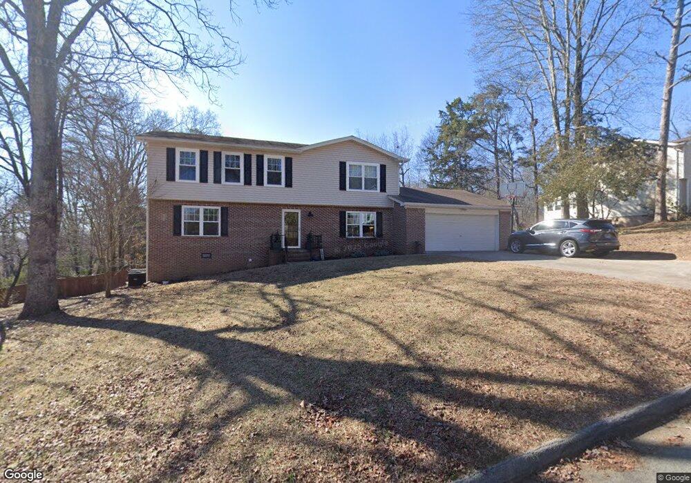
1949 Light Tower Cir Unit 1333 Hixson, TN 37343
Estimated Value: $386,092 - $428,000
--
Bed
1
Bath
2,184
Sq Ft
$186/Sq Ft
Est. Value
About This Home
This home is located at 1949 Light Tower Cir Unit 1333, Hixson, TN 37343 and is currently estimated at $407,023, approximately $186 per square foot. 1949 Light Tower Cir Unit 1333 is a home located in Hamilton County with nearby schools including McConnell Elementary School, Loftis Middle School, and Hixson High School.
Ownership History
Date
Name
Owned For
Owner Type
Purchase Details
Closed on
May 22, 2018
Sold by
Jenkins Sam and Jenkins Patti
Bought by
Potter Daniel J and Potter Susan B
Current Estimated Value
Home Financials for this Owner
Home Financials are based on the most recent Mortgage that was taken out on this home.
Original Mortgage
$174,400
Outstanding Balance
$150,164
Interest Rate
4.4%
Mortgage Type
New Conventional
Estimated Equity
$256,859
Purchase Details
Closed on
Jul 11, 2003
Sold by
Clelland Wilfred and Clelland Mary Ann
Bought by
Jenkins Sam and Jenkins Patti
Home Financials for this Owner
Home Financials are based on the most recent Mortgage that was taken out on this home.
Original Mortgage
$135,000
Interest Rate
5.2%
Mortgage Type
Unknown
Create a Home Valuation Report for This Property
The Home Valuation Report is an in-depth analysis detailing your home's value as well as a comparison with similar homes in the area
Home Values in the Area
Average Home Value in this Area
Purchase History
| Date | Buyer | Sale Price | Title Company |
|---|---|---|---|
| Potter Daniel J | $218,000 | Cumberland Title & Guaranty | |
| Jenkins Sam | $150,000 | -- |
Source: Public Records
Mortgage History
| Date | Status | Borrower | Loan Amount |
|---|---|---|---|
| Open | Potter Daniel J | $174,400 | |
| Previous Owner | Jenkins Sam | $135,000 |
Source: Public Records
Tax History Compared to Growth
Tax History
| Year | Tax Paid | Tax Assessment Tax Assessment Total Assessment is a certain percentage of the fair market value that is determined by local assessors to be the total taxable value of land and additions on the property. | Land | Improvement |
|---|---|---|---|---|
| 2024 | $1,279 | $57,150 | $0 | $0 |
| 2023 | $1,288 | $57,150 | $0 | $0 |
| 2022 | $1,288 | $57,150 | $0 | $0 |
| 2021 | $1,288 | $57,150 | $0 | $0 |
| 2020 | $1,340 | $48,125 | $0 | $0 |
| 2019 | $1,340 | $48,125 | $0 | $0 |
| 2018 | $1,340 | $48,125 | $0 | $0 |
| 2017 | $1,340 | $48,125 | $0 | $0 |
| 2016 | $1,215 | $0 | $0 | $0 |
| 2015 | $1,215 | $43,625 | $0 | $0 |
| 2014 | $1,215 | $0 | $0 | $0 |
Source: Public Records
Map
Nearby Homes
- 1705 Sea Gull Ln
- 1820 Rock Bluff Rd
- 1800 Mountain Bay Dr
- 1924 Bay Pointe Dr
- 6512 Fairview Rd
- 1706 Mountain Bay Dr
- 2227 Bay Pointe Dr
- 6517 Shelter Cove Dr
- 000 Hixson Pike
- 1657 Destiny Dr
- 1689 Destiny Dr
- 1681 Destiny Dr
- 1693 Destiny Dr
- 6577 Fairview Rd
- 6424 Serenade Ln
- Piedmont Plan at Nestledown
- Altamont Plan at Nestledown
- Blue Ridge Plan at Nestledown
- 6453 Serenade Ln
- 2027 Paige Meadows Ct
- 1949 Light Tower Cir Unit 13
- 1901 Light Tower Cir
- 1935 Light Tower Cir
- 1943 Light Tower Cir
- 1931 Light Tower Cir
- 1931 Light Tower Cir Unit 1333
- 1907 Light Tower Cir
- 1948 Light Tower Cir
- 6400 Lighthouse Ln
- 6400 Lighthouse Ln Unit 1333
- 1938 Light Tower Cir
- 1938 Light Tower Cir Unit 1333
- 1909 Light Tower Cir Unit 13
- 1909 Light Tower Cir Unit 1333
- 1934 Light Tower Cir
- 1944 Light Tower Cir
- 1927 Light Tower Cir
- 1927 Light Tower Cir Unit 463
- 1940 Light Tower Cir
- 1902 Light Tower Cir