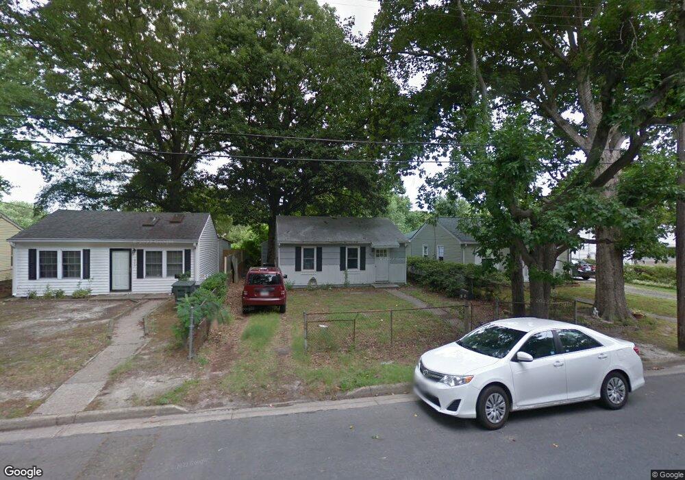
1949 Long Green Ln Hampton, VA 23663
Buckroe Beach NeighborhoodEstimated Value: $169,000 - $194,000
2
Beds
1
Bath
624
Sq Ft
$289/Sq Ft
Est. Value
About This Home
This home is located at 1949 Long Green Ln, Hampton, VA 23663 and is currently estimated at $180,599, approximately $289 per square foot. 1949 Long Green Ln is a home located in Hampton City with nearby schools including Benjamin Syms Middle School, Phoebus High School, and Gloria Dei Lutheran School.
Ownership History
Date
Name
Owned For
Owner Type
Purchase Details
Closed on
Feb 12, 2024
Sold by
Kmt Properties Llc
Bought by
Czaia Victoria
Current Estimated Value
Home Financials for this Owner
Home Financials are based on the most recent Mortgage that was taken out on this home.
Original Mortgage
$7,695
Outstanding Balance
$2,970
Interest Rate
6.62%
Mortgage Type
New Conventional
Estimated Equity
$177,629
Purchase Details
Closed on
May 25, 2016
Sold by
Bushnell Capital Corporation A Virginia
Bought by
Kmt Properties Llc A Virginia Limited Li
Create a Home Valuation Report for This Property
The Home Valuation Report is an in-depth analysis detailing your home's value as well as a comparison with similar homes in the area
Home Values in the Area
Average Home Value in this Area
Purchase History
| Date | Buyer | Sale Price | Title Company |
|---|---|---|---|
| Czaia Victoria | $171,000 | Fidelity National Title | |
| Kmt Properties Llc A Virginia Limited Li | $31,200 | Peninsula Title Company Inc |
Source: Public Records
Mortgage History
| Date | Status | Borrower | Loan Amount |
|---|---|---|---|
| Open | Czaia Victoria | $7,695 | |
| Open | Czaia Victoria | $165,870 |
Source: Public Records
Tax History
| Year | Tax Paid | Tax Assessment Tax Assessment Total Assessment is a certain percentage of the fair market value that is determined by local assessors to be the total taxable value of land and additions on the property. | Land | Improvement |
|---|---|---|---|---|
| 2025 | $2,151 | $189,200 | $53,000 | $136,200 |
| 2024 | $1,849 | $160,800 | $53,000 | $107,800 |
| 2023 | $1,278 | $110,200 | $42,500 | $67,700 |
| 2022 | $1,076 | $91,200 | $42,500 | $48,700 |
| 2021 | $782 | $52,600 | $35,000 | $17,600 |
| 2020 | $598 | $48,200 | $30,600 | $17,600 |
| 2019 | $591 | $47,700 | $30,600 | $17,100 |
| 2018 | $816 | $68,600 | $30,600 | $38,000 |
| 2017 | $945 | $0 | $0 | $0 |
| 2016 | $945 | $68,600 | $0 | $0 |
| 2015 | $945 | $0 | $0 | $0 |
| 2014 | $1,011 | $71,700 | $30,600 | $41,100 |
Source: Public Records
Map
Nearby Homes
- 1928 Long Green Ln
- 1915 Long Green Ln
- 1909 Long Green Ln
- 1923 Rawood Dr
- 1926 Somerville Dr
- 2013 Whitman Place
- 706 Grimes Rd
- 1845 Kensington Dr
- 1814 Somerville Dr
- 1912 Beall Dr
- 1530 Morgan Dr
- 1527 Grove St
- 604 Old Buckroe Rd
- 2000 Egger Cir
- 438 Shelton Rd
- 733 Burgess Ave
- 1918 Nickerson Blvd
- 731 Burgess Ave
- 2007 Egger Cir
- 213 Ireland St
- 1951 Long Green Ln
- 1947 Long Green Ln
- 1945 Long Green Ln
- 1953 Long Green Ln
- 1952 Long Green Ln
- 1943 Long Green Ln
- 703 Redford Rd
- 1950 Long Green Ln
- 701 Redford Rd
- 1948 Long Green Ln
- 1941 Long Green Ln
- 1936 Kensington Dr
- 1946 Long Green Ln
- 705 Redford Rd
- 1944 Long Green Ln
- 1939 Long Green Ln
- 1942 Long Green Ln
- 707 Redford Rd
- 9 Bradley Place
- 1937 Long Green Ln
Your Personal Tour Guide
Ask me questions while you tour the home.