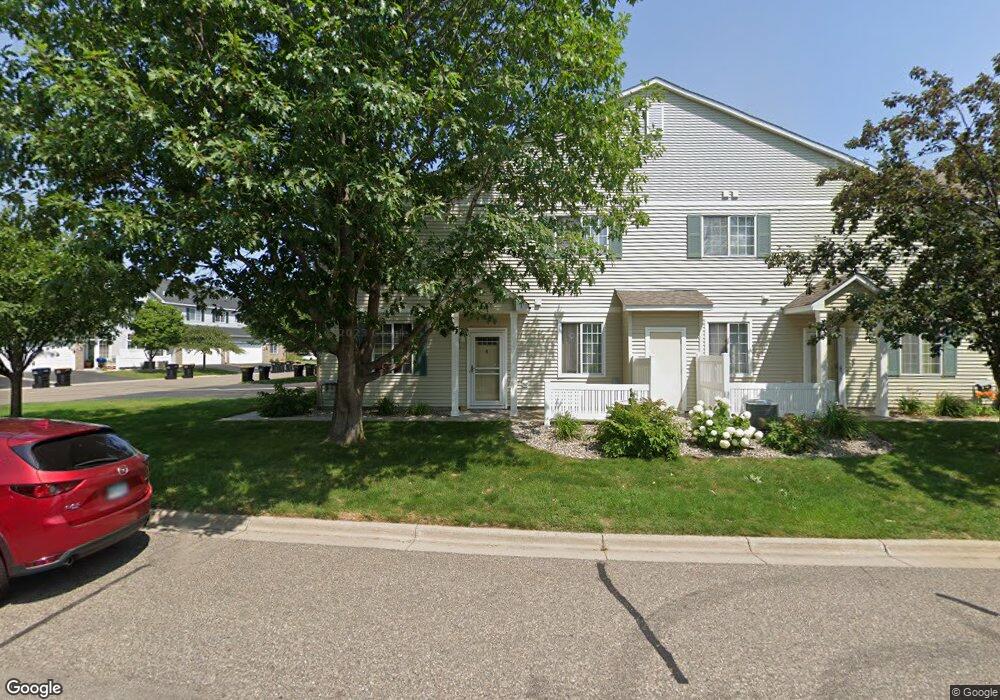
1949 Mockingbird Ave Shakopee, MN 55379
Estimated Value: $260,000 - $271,000
2
Beds
2
Baths
1,562
Sq Ft
$170/Sq Ft
Est. Value
About This Home
This home is located at 1949 Mockingbird Ave, Shakopee, MN 55379 and is currently estimated at $264,890, approximately $169 per square foot. 1949 Mockingbird Ave is a home located in Scott County with nearby schools including Sun Path Elementary School, Shakopee West Middle School, and Shakopee Senior High School.
Ownership History
Date
Name
Owned For
Owner Type
Purchase Details
Closed on
Jul 31, 2018
Sold by
Murphy Todd and Murphy Jennifer
Bought by
Schwaesdall Cassandra A
Current Estimated Value
Home Financials for this Owner
Home Financials are based on the most recent Mortgage that was taken out on this home.
Original Mortgage
$152,000
Outstanding Balance
$132,006
Interest Rate
4.5%
Mortgage Type
New Conventional
Estimated Equity
$132,884
Purchase Details
Closed on
Jun 26, 2017
Sold by
Minnick Stacey A
Bought by
Murphy Todd and Murphy Jennifer
Purchase Details
Closed on
Sep 30, 2004
Sold by
Carlson Ryan M and Carlson Lisa J
Bought by
Minnick Stacey A
Purchase Details
Closed on
Mar 5, 2002
Sold by
Mack Richard L
Bought by
Carlson Ryan M
Purchase Details
Closed on
Nov 30, 1999
Sold by
Centex Homes Minnesota Division
Bought by
Mack Richard L
Create a Home Valuation Report for This Property
The Home Valuation Report is an in-depth analysis detailing your home's value as well as a comparison with similar homes in the area
Home Values in the Area
Average Home Value in this Area
Purchase History
| Date | Buyer | Sale Price | Title Company |
|---|---|---|---|
| Schwaesdall Cassandra A | $190,000 | Trademark Title Services Inc | |
| Murphy Todd | $185,000 | Trademark Title Services Inc | |
| Minnick Stacey A | $185,000 | -- | |
| Carlson Ryan M | $167,900 | -- | |
| Mack Richard L | $137,440 | -- |
Source: Public Records
Mortgage History
| Date | Status | Borrower | Loan Amount |
|---|---|---|---|
| Open | Schwaesdall Cassandra A | $152,000 |
Source: Public Records
Tax History
| Year | Tax Paid | Tax Assessment Tax Assessment Total Assessment is a certain percentage of the fair market value that is determined by local assessors to be the total taxable value of land and additions on the property. | Land | Improvement |
|---|---|---|---|---|
| 2025 | $2,348 | $253,600 | $76,100 | $177,500 |
| 2024 | $2,430 | $241,800 | $72,400 | $169,400 |
| 2023 | $2,500 | $238,400 | $71,000 | $167,400 |
| 2022 | $2,428 | $241,100 | $72,700 | $168,400 |
| 2021 | $2,088 | $204,700 | $57,000 | $147,700 |
| 2020 | $2,246 | $195,800 | $47,300 | $148,500 |
| 2019 | $2,114 | $186,600 | $45,000 | $141,600 |
| 2018 | $1,870 | $0 | $0 | $0 |
| 2016 | $1,842 | $0 | $0 | $0 |
| 2014 | -- | $0 | $0 | $0 |
Source: Public Records
Map
Nearby Homes
- 2066 Mockingbird Ave
- 1596 Chartreux Ave
- 2350 Downing Ave
- 1928 Vierling Dr E
- 2423 Tyrone Dr
- 2399 Tyrone Dr
- 2351 Tyrone Dr
- 1227 Elmwood Ave Unit 85
- 2006 Tyrone Dr
- 2574 Vierling Dr E
- 2655 King Ave
- 2795 Downing Ave
- 2817 Downing Ave
- 2542 Mathias Rd
- 1624 Philipp Way
- 1667 Countryside Dr
- 1542 Philipp Way
- 1777 Countryside Dr
- 1035 Providence Dr
- 2868 Trinity Dr
- 1646 Brittany Dr
- 1955 Mockingbird Ave
- 1642 Brittany Dr Unit 1607
- 1959 Mockingbird Ave
- 1638 Brittany Dr
- 1963 Mockingbird Ave Unit 1604
- 1634 Brittany Dr
- 1940 Mockingbird Ave
- 1652 Brittany Dr Unit 805
- 1917 Mockingbird Ave Unit 1508
- 1921 Mockingbird Ave
- 1921 Mockingbird Ave Unit 1507
- 1925 Mockingbird Ave
- 1924 Mockingbird Ave
- 1944 Mockingbird Ave
- 1656 Brittany Dr
- 1901 Mockingbird Ave Unit 1501
- 1905 Mockingbird Ave Unit 1502
- 1929 Mockingbird Ave
- 1908 Mockingbird Ave Unit 904
Your Personal Tour Guide
Ask me questions while you tour the home.