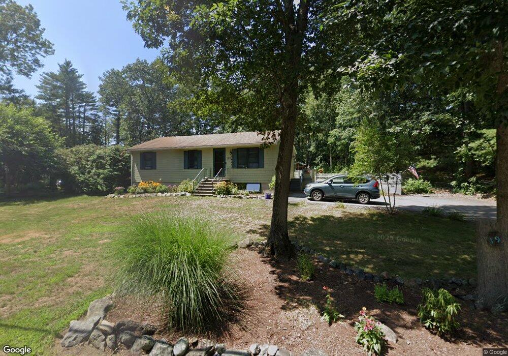
195 King St Groveland, MA 01834
Estimated Value: $545,041 - $583,000
3
Beds
1
Bath
960
Sq Ft
$592/Sq Ft
Est. Value
About This Home
This home is located at 195 King St, Groveland, MA 01834 and is currently estimated at $568,010, approximately $591 per square foot. 195 King St is a home located in Essex County with nearby schools including Pentucket Regional High School.
Ownership History
Date
Name
Owned For
Owner Type
Purchase Details
Closed on
Sep 3, 2023
Sold by
Bosley Robert C
Bought by
Bosley Anke and Bosley Robert
Current Estimated Value
Purchase Details
Closed on
Aug 8, 2020
Sold by
Bosley Melinda A
Bought by
Bosley Robert C
Purchase Details
Closed on
May 29, 1997
Sold by
Meredith Ellen G
Bought by
Riley Darren M and Riley Kelly A
Home Financials for this Owner
Home Financials are based on the most recent Mortgage that was taken out on this home.
Original Mortgage
$115,200
Interest Rate
8.09%
Mortgage Type
Purchase Money Mortgage
Purchase Details
Closed on
Mar 17, 1992
Sold by
Seymour Michael L
Bought by
Bosley Robert C and Bosley Melinda A
Home Financials for this Owner
Home Financials are based on the most recent Mortgage that was taken out on this home.
Original Mortgage
$131,750
Interest Rate
8.64%
Mortgage Type
Purchase Money Mortgage
Purchase Details
Closed on
Nov 23, 1987
Sold by
Orban Chester J
Bought by
Seymour Michael L
Create a Home Valuation Report for This Property
The Home Valuation Report is an in-depth analysis detailing your home's value as well as a comparison with similar homes in the area
Home Values in the Area
Average Home Value in this Area
Purchase History
| Date | Buyer | Sale Price | Title Company |
|---|---|---|---|
| Bosley Anke | -- | None Available | |
| Bosley Robert C | -- | None Available | |
| Riley Darren M | $144,000 | -- | |
| Bosley Robert C | $138,700 | -- | |
| Seymour Michael L | $150,000 | -- |
Source: Public Records
Mortgage History
| Date | Status | Borrower | Loan Amount |
|---|---|---|---|
| Previous Owner | Seymour Michael L | $30,000 | |
| Previous Owner | Seymour Michael L | $148,000 | |
| Previous Owner | Seymour Michael L | $115,200 | |
| Previous Owner | Seymour Michael L | $131,750 |
Source: Public Records
Tax History Compared to Growth
Tax History
| Year | Tax Paid | Tax Assessment Tax Assessment Total Assessment is a certain percentage of the fair market value that is determined by local assessors to be the total taxable value of land and additions on the property. | Land | Improvement |
|---|---|---|---|---|
| 2025 | $6,568 | $517,600 | $229,100 | $288,500 |
| 2024 | $6,507 | $480,600 | $217,200 | $263,400 |
| 2023 | $5,895 | $449,000 | $197,500 | $251,500 |
| 2022 | $5,763 | $398,300 | $173,800 | $224,500 |
| 2021 | $5,270 | $358,000 | $158,000 | $200,000 |
| 2020 | $4,821 | $343,100 | $146,100 | $197,000 |
| 2019 | $4,817 | $335,700 | $146,100 | $189,600 |
| 2018 | $4,713 | $320,800 | $138,200 | $182,600 |
| 2017 | $4,564 | $310,900 | $138,200 | $172,700 |
| 2016 | $4,379 | $290,200 | $130,300 | $159,900 |
| 2015 | $4,136 | $283,100 | $122,400 | $160,700 |
| 2014 | $4,054 | $269,200 | $122,400 | $146,800 |
Source: Public Records
Map
Nearby Homes
- 231 W Main St
- 206 W Main St Unit 3
- 206 W Main St Unit 5
- 206 W Main St Unit 6
- 206 W Main St Unit 4
- 7 Yale St
- 603 Alyssa Dr Unit 603
- 1 Atwood Ln
- Lot 9 Katie Ln
- Lot 8 Katie Ln
- 123 Pond St
- Lot 11A King St
- 89 King St
- 98 King St
- 51 W Main St Unit 6
- 79 Andover St
- 11 Canterbury Dr
- 34 E Main St Unit 2
- 52 E Main St
- 6 Winter St