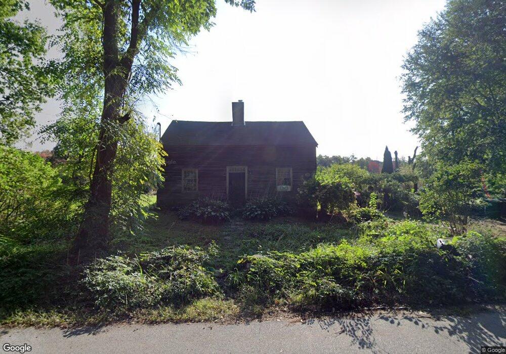
195 Wigwam Rd West Brookfield, MA 01585
Estimated Value: $467,670 - $546,000
2
Beds
1
Bath
2,446
Sq Ft
$210/Sq Ft
Est. Value
About This Home
This home is located at 195 Wigwam Rd, West Brookfield, MA 01585 and is currently estimated at $513,918, approximately $210 per square foot. 195 Wigwam Rd is a home located in Worcester County with nearby schools including Quaboag Regional High School.
Ownership History
Date
Name
Owned For
Owner Type
Purchase Details
Closed on
Nov 22, 1995
Sold by
Jaskoviak Roger Est
Bought by
Hinton Travis and Hinton Joy P
Current Estimated Value
Home Financials for this Owner
Home Financials are based on the most recent Mortgage that was taken out on this home.
Original Mortgage
$95,000
Interest Rate
7.47%
Mortgage Type
Purchase Money Mortgage
Create a Home Valuation Report for This Property
The Home Valuation Report is an in-depth analysis detailing your home's value as well as a comparison with similar homes in the area
Home Values in the Area
Average Home Value in this Area
Purchase History
| Date | Buyer | Sale Price | Title Company |
|---|---|---|---|
| Hinton Travis | $65,500 | -- |
Source: Public Records
Mortgage History
| Date | Status | Borrower | Loan Amount |
|---|---|---|---|
| Open | Hinton Travis | $160,000 | |
| Closed | Hinton Travis | $13,000 | |
| Closed | Hinton Travis | $95,000 |
Source: Public Records
Tax History Compared to Growth
Tax History
| Year | Tax Paid | Tax Assessment Tax Assessment Total Assessment is a certain percentage of the fair market value that is determined by local assessors to be the total taxable value of land and additions on the property. | Land | Improvement |
|---|---|---|---|---|
| 2025 | $3,795 | $352,000 | $87,500 | $264,500 |
| 2024 | $3,953 | $352,000 | $87,500 | $264,500 |
| 2023 | $3,875 | $323,200 | $82,300 | $240,900 |
| 2022 | $3,752 | $283,600 | $79,700 | $203,900 |
| 2021 | $3,665 | $261,200 | $79,700 | $181,500 |
| 2020 | $1,274 | $221,200 | $79,700 | $141,500 |
| 2019 | $3,466 | $221,200 | $79,700 | $141,500 |
| 2018 | $3,460 | $215,300 | $79,700 | $135,600 |
| 2017 | $3,125 | $194,600 | $79,300 | $115,300 |
| 2016 | $2,834 | $182,700 | $79,300 | $103,400 |
| 2015 | $2,737 | $182,700 | $79,300 | $103,400 |
Source: Public Records
Map
Nearby Homes
- 18-20 Old w Brookfield Rd
- 61 Bates St
- 9 Birch Hill Rd
- 11 Shea Rd
- 260 Wickaboag Valley Rd
- 38 Mount Pleasant St
- 9 John Gilbert Rd
- 19 Pine Trail
- 7 Church Street Extension
- 25 Highland Trail
- 12 Cushing St
- 10 Brookfield Rd
- 179 Pierce Rd
- 60 Gilbert St
- 28 N Main St
- 67 E Main St
- 48 Mill Rd Lot 2e
- 82 Grove St
- 8 Elm St
- 4 E Main St
- 218 Wigwam Rd
- 191 Wigwam Rd
- 259 Wigwam Rd
- 232 Wigwam Rd
- 236 Wigwam Rd
- 114 Wigwam Rd
- 127 Wigwam Rd
- 291 Wigwam Rd
- 243 New Braintree Rd
- 246 Wigwam Rd
- 247 New Braintree Rd
- 253 New Braintree Rd
- 15 Wigwam Rd
- UNT 6 Lakeshore Dr Unit 6
- 5 Wigwam Cross Rd
- 240 Wigwam Rd
- 8 Wigwam Cross Rd
- 250 Wigwam Rd
- 12 Wigwam Cross Rd
- 11 Wigwam Rd