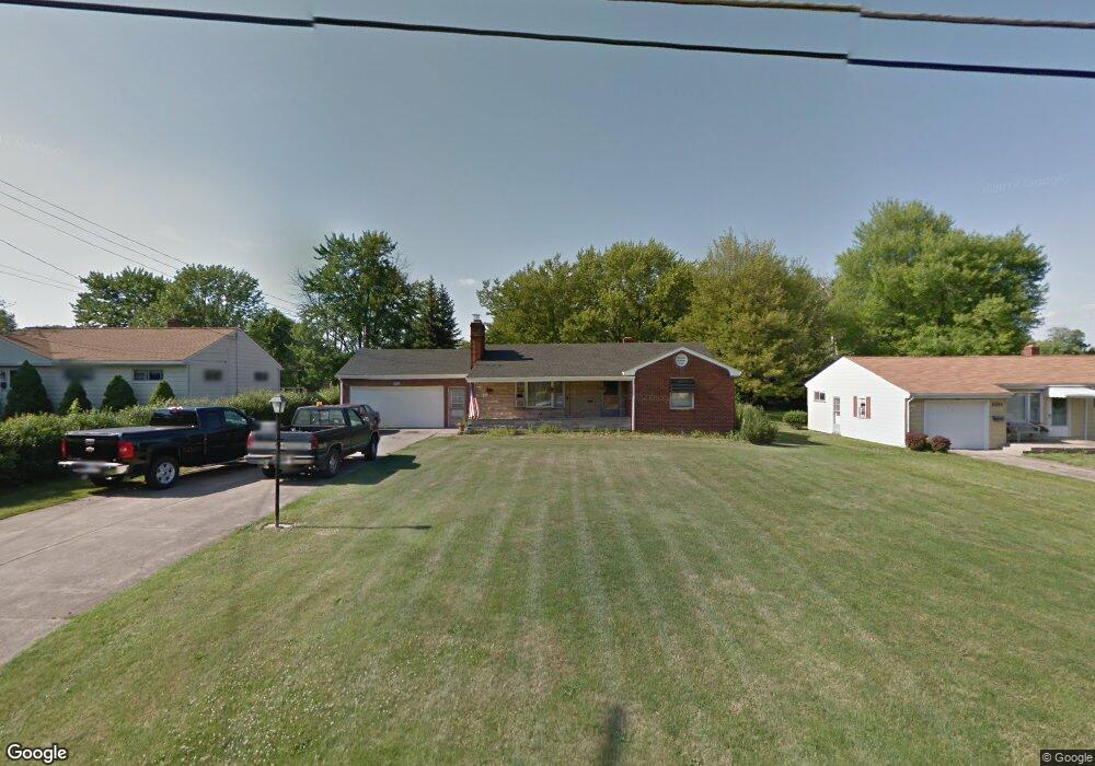
1950 Holbrook Rd Youngstown, OH 44514
Estimated Value: $150,000 - $160,000
3
Beds
2
Baths
1,237
Sq Ft
$125/Sq Ft
Est. Value
About This Home
This home is located at 1950 Holbrook Rd, Youngstown, OH 44514 and is currently estimated at $154,127, approximately $124 per square foot. 1950 Holbrook Rd is a home located in Mahoning County with nearby schools including Paul C. Bunn Elementary School, Clear Horizons Early College High School, and Chaney High School.
Ownership History
Date
Name
Owned For
Owner Type
Purchase Details
Closed on
Dec 20, 2009
Sold by
Kovach Elizabeth A and Schwartz Mary C
Bought by
Fercana Charles L
Current Estimated Value
Home Financials for this Owner
Home Financials are based on the most recent Mortgage that was taken out on this home.
Original Mortgage
$40,500
Outstanding Balance
$26,376
Interest Rate
4.87%
Mortgage Type
New Conventional
Estimated Equity
$127,751
Purchase Details
Closed on
Aug 16, 1988
Bought by
Szabo Helen
Create a Home Valuation Report for This Property
The Home Valuation Report is an in-depth analysis detailing your home's value as well as a comparison with similar homes in the area
Home Values in the Area
Average Home Value in this Area
Purchase History
| Date | Buyer | Sale Price | Title Company |
|---|---|---|---|
| Fercana Charles L | $60,500 | Attorney | |
| Szabo Helen | -- | -- |
Source: Public Records
Mortgage History
| Date | Status | Borrower | Loan Amount |
|---|---|---|---|
| Open | Fercana Charles L | $40,500 |
Source: Public Records
Tax History Compared to Growth
Tax History
| Year | Tax Paid | Tax Assessment Tax Assessment Total Assessment is a certain percentage of the fair market value that is determined by local assessors to be the total taxable value of land and additions on the property. | Land | Improvement |
|---|---|---|---|---|
| 2024 | $1,337 | $33,020 | $7,760 | $25,260 |
| 2023 | $1,363 | $33,020 | $7,760 | $25,260 |
| 2022 | $1,304 | $25,970 | $6,940 | $19,030 |
| 2021 | $1,304 | $25,970 | $6,940 | $19,030 |
| 2020 | $1,310 | $25,970 | $6,940 | $19,030 |
| 2019 | $1,224 | $22,390 | $5,990 | $16,400 |
| 2018 | $1,133 | $22,390 | $5,990 | $16,400 |
| 2017 | $1,660 | $22,390 | $5,990 | $16,400 |
| 2016 | $1,507 | $19,730 | $7,320 | $12,410 |
| 2015 | $1,480 | $19,730 | $7,320 | $12,410 |
| 2014 | $1,471 | $19,730 | $7,320 | $12,410 |
| 2013 | $1,534 | $19,730 | $7,320 | $12,410 |
Source: Public Records
Map
Nearby Homes
- 1933 Brandon Ave
- 1919 Wingate Rd
- 1828 Basil Ave
- 1830 Halbert Dr
- 1913 Country Club Ave
- 0 Woodlawn Ave
- 1841 Wingate Rd
- 0 Oles Ave
- 576 W Harvey St
- 0 Lemoyne Ave
- 1720 Sequoya Dr
- 5710 Youngstown Poland Rd
- 2089 Shetland Ln
- 550 Brandon Ave
- 1890 Mathews Rd
- 525 W Omar St
- 478 W Harvey St
- 1894 Lealand Ave
- 1543 Lynn Ave
- 1514 Thalia Ave
- 1938 Holbrook Rd
- 1962 Holbrook Rd
- 1974 Holbrook Rd
- 1927 Brandon Ave
- 5231 Sheridan Rd
- 1949 Holbrook Rd
- 1986 Holbrook Rd
- 1937 Holbrook Rd
- 5235 Sheridan Rd
- 1961 Holbrook Rd
- 5221 Sheridan Rd
- 1913 Brandon Ave
- 1973 Holbrook Rd
- 5307 Sheridan Rd
- 5209 Sheridan Rd
- 1985 Holbrook Rd
- 1939 Brandon Ave
- 2002 Holbrook Rd
- 5313 Sheridan Rd
- 5205 Sheridan Rd