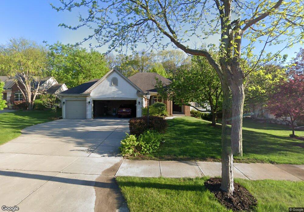
1951 Foxcroft Ln Waukesha, WI 53189
Estimated Value: $562,369 - $642,000
3
Beds
2
Baths
2,524
Sq Ft
$235/Sq Ft
Est. Value
About This Home
This home is located at 1951 Foxcroft Ln, Waukesha, WI 53189 and is currently estimated at $592,342, approximately $234 per square foot. 1951 Foxcroft Ln is a home located in Waukesha County with nearby schools including Heyer Elementary School, Horning Middle School, and South High School.
Ownership History
Date
Name
Owned For
Owner Type
Purchase Details
Closed on
Jun 14, 2002
Sold by
Bielinski Holdings Llc
Bought by
Vancalster Todd A and Vancalster Jill B
Current Estimated Value
Home Financials for this Owner
Home Financials are based on the most recent Mortgage that was taken out on this home.
Original Mortgage
$272,450
Outstanding Balance
$109,560
Interest Rate
6.12%
Mortgage Type
Construction
Estimated Equity
$482,782
Create a Home Valuation Report for This Property
The Home Valuation Report is an in-depth analysis detailing your home's value as well as a comparison with similar homes in the area
Home Values in the Area
Average Home Value in this Area
Purchase History
| Date | Buyer | Sale Price | Title Company |
|---|---|---|---|
| Vancalster Todd A | $78,500 | -- |
Source: Public Records
Mortgage History
| Date | Status | Borrower | Loan Amount |
|---|---|---|---|
| Open | Vancalster Todd A | $272,450 |
Source: Public Records
Tax History Compared to Growth
Tax History
| Year | Tax Paid | Tax Assessment Tax Assessment Total Assessment is a certain percentage of the fair market value that is determined by local assessors to be the total taxable value of land and additions on the property. | Land | Improvement |
|---|---|---|---|---|
| 2024 | $7,848 | $521,200 | $104,400 | $416,800 |
| 2023 | $7,654 | $521,200 | $104,400 | $416,800 |
| 2022 | $7,575 | $388,300 | $102,400 | $285,900 |
| 2021 | $7,774 | $388,300 | $102,400 | $285,900 |
| 2020 | $7,481 | $388,300 | $102,400 | $285,900 |
| 2019 | $7,265 | $388,300 | $102,400 | $285,900 |
| 2018 | $6,849 | $359,500 | $86,200 | $273,300 |
| 2017 | $6,809 | $359,500 | $86,200 | $273,300 |
| 2016 | $6,663 | $329,800 | $80,800 | $249,000 |
| 2015 | $6,616 | $329,800 | $80,800 | $249,000 |
| 2014 | $6,627 | $317,100 | $80,800 | $236,300 |
| 2013 | $6,627 | $317,100 | $80,800 | $236,300 |
Source: Public Records
Map
Nearby Homes
- 1981 Foxcroft Ln
- 2217 Deer Path
- S38W22205 Arlo Dr
- 1614 Legend Hill Ln
- 1632 Auburn Ct
- 2110 Springbrook S
- 1825 E Racine Ave Unit 5
- LT1 Sunset View
- 313 Standing Stone Dr Unit 23-61
- 309 Standing Stone Dr Unit 23-64
- The Cypress Plan at The Glen at Standing Stone
- The Hawthorne Plan at The Glen at Standing Stone
- The Holly Plan at The Glen at Standing Stone
- The Juniper Plan at The Glen at Standing Stone
- The Laurel Plan at The Glen at Standing Stone
- The Willow Plan at The Glen at Standing Stone
- The Tartan Plan at The Glen at Standing Stone
- The Kenzie Plan at The Glen at Standing Stone
- The Calli Plan at The Glen at Standing Stone
- The Bristol Plan at The Glen at Standing Stone
- 1947 Foxcroft Ln
- 1955 Foxcroft Ln
- 1952 Foxcroft Ln
- 1961 Foxcroft Ln
- 1943 Foxcroft Ln
- 1960 Foxcroft Ln
- 1948 Foxcroft Ln
- 1956 Foxcroft Ln
- 1939 Foxcroft Ln
- 1936 Foxcroft Ln
- 1965 Foxcroft Ln
- 1935 Foxcroft Ln
- 1912 Hunter Ct
- 1972 Foxcroft Ln
- 1973 Foxcroft Ln
- 1908 Hunter Ct
- 1904 Hunter Ct
- 1930 Foxcroft Ln
- 1977 Foxcroft Ln
- 1675 Hunter Rd