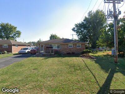
1951 Poplar St Obetz, OH 43207
Far South NeighborhoodEstimated Value: $231,041 - $263,000
2
Beds
1
Bath
1,092
Sq Ft
$225/Sq Ft
Est. Value
About This Home
This home is located at 1951 Poplar St, Obetz, OH 43207 and is currently estimated at $245,260, approximately $224 per square foot. 1951 Poplar St is a home located in Franklin County with nearby schools including Hamilton Elementary School, Hamilton Intermediate School, and Hamilton Middle School.
Ownership History
Date
Name
Owned For
Owner Type
Purchase Details
Closed on
Sep 19, 2019
Sold by
Proctor Lorie A
Bought by
Robinson Laura and Robinson Charles
Current Estimated Value
Home Financials for this Owner
Home Financials are based on the most recent Mortgage that was taken out on this home.
Original Mortgage
$126,400
Interest Rate
3.5%
Mortgage Type
New Conventional
Purchase Details
Closed on
Oct 9, 1990
Bought by
Proctor Rick D and Proctor Lorie A
Purchase Details
Closed on
Feb 1, 1987
Create a Home Valuation Report for This Property
The Home Valuation Report is an in-depth analysis detailing your home's value as well as a comparison with similar homes in the area
Home Values in the Area
Average Home Value in this Area
Purchase History
| Date | Buyer | Sale Price | Title Company |
|---|---|---|---|
| Robinson Laura | $163,000 | First Ohio Title Insurance | |
| Proctor Rick D | $64,900 | -- | |
| -- | -- | -- |
Source: Public Records
Mortgage History
| Date | Status | Borrower | Loan Amount |
|---|---|---|---|
| Open | Robinson Laura | $10,000 | |
| Open | Robinson Laura | $129,000 | |
| Closed | Robinson Laura | $126,400 | |
| Closed | Proctor Rick D | $36,000 |
Source: Public Records
Tax History Compared to Growth
Tax History
| Year | Tax Paid | Tax Assessment Tax Assessment Total Assessment is a certain percentage of the fair market value that is determined by local assessors to be the total taxable value of land and additions on the property. | Land | Improvement |
|---|---|---|---|---|
| 2024 | $3,172 | $67,240 | $24,820 | $42,420 |
| 2023 | $3,124 | $67,235 | $24,815 | $42,420 |
| 2022 | $1,975 | $35,990 | $6,760 | $29,230 |
| 2021 | $1,515 | $35,990 | $6,760 | $29,230 |
| 2020 | $2,037 | $35,990 | $6,760 | $29,230 |
| 2019 | $1,831 | $28,770 | $5,390 | $23,380 |
| 2018 | $1,742 | $28,770 | $5,390 | $23,380 |
| 2017 | $1,758 | $28,770 | $5,390 | $23,380 |
| 2016 | $1,735 | $26,220 | $6,690 | $19,530 |
| 2015 | $1,648 | $26,220 | $6,690 | $19,530 |
| 2014 | $1,639 | $26,220 | $6,690 | $19,530 |
| 2013 | $877 | $29,120 | $7,420 | $21,700 |
Source: Public Records
Map
Nearby Homes
- 1985 Sedan Ave
- 1805 Meriline Ave
- 4461 Lancaster Ave
- 4310 Charlotte Rd
- 1627 Metcalfe Ave
- 4281 Ethel Rd
- 4097 Garrard Dr
- 1625 Meriline Ave
- 1624 Marlboro Ave
- 1559 Obetz Ave
- 2295 Maureen Blvd S
- 2318 Rodger Rd
- 2030 Reese Ave
- 4292 Nipigon Dr
- 1482 Hackworth St
- 0 Alum Creek Dr Unit 225007823
- 1987 Reese Ave
- 1971 Reese Ave
- 1409 Hackworth St
- 3551 Groveport Rd
- 1951 Poplar St
- 1939 Poplar St
- 1969 Poplar St
- 1962 Locust St
- 1972 Locust St
- 1948 Locust St
- 1960 Poplar St
- 1948 Poplar St Unit 950
- 1977 Poplar St
- 1958 Poplar St
- 1940 Locust St
- 1982 Locust St
- 1968 Poplar St Unit 970
- 1936 Poplar St
- 1917 Poplar St
- 4320 Orchard Ln
- 1932 Locust St
- 1987 Poplar St
- 1976 Poplar St Unit 978
- 1914 Poplar St