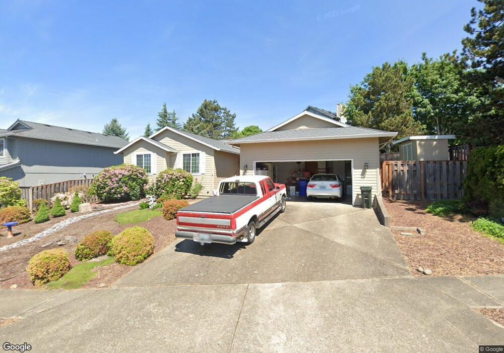
1951 SW 2nd Dr Gresham, OR 97080
Hollybrook NeighborhoodEstimated Value: $459,000 - $493,000
3
Beds
2
Baths
1,570
Sq Ft
$299/Sq Ft
Est. Value
About This Home
This home is located at 1951 SW 2nd Dr, Gresham, OR 97080 and is currently estimated at $470,097, approximately $299 per square foot. 1951 SW 2nd Dr is a home located in Multnomah County with nearby schools including Hollydale Elementary School, Clear Creek Middle School, and Gresham High School.
Ownership History
Date
Name
Owned For
Owner Type
Purchase Details
Closed on
Aug 12, 2024
Sold by
Berger Melvin F and Berger Diane M
Bought by
Berger Family Trust and Berger
Current Estimated Value
Purchase Details
Closed on
Apr 15, 1996
Sold by
Wilkinson James M
Bought by
Berger Melvin F and Berger Diane M
Home Financials for this Owner
Home Financials are based on the most recent Mortgage that was taken out on this home.
Original Mortgage
$84,500
Interest Rate
7.41%
Mortgage Type
Purchase Money Mortgage
Create a Home Valuation Report for This Property
The Home Valuation Report is an in-depth analysis detailing your home's value as well as a comparison with similar homes in the area
Home Values in the Area
Average Home Value in this Area
Purchase History
| Date | Buyer | Sale Price | Title Company |
|---|---|---|---|
| Berger Family Trust | -- | None Listed On Document | |
| Berger Melvin F | $139,500 | Transnation Title Insurance |
Source: Public Records
Mortgage History
| Date | Status | Borrower | Loan Amount |
|---|---|---|---|
| Previous Owner | Berger Melvin F | $84,500 |
Source: Public Records
Tax History
| Year | Tax Paid | Tax Assessment Tax Assessment Total Assessment is a certain percentage of the fair market value that is determined by local assessors to be the total taxable value of land and additions on the property. | Land | Improvement |
|---|---|---|---|---|
| 2025 | $5,562 | $273,300 | -- | -- |
| 2024 | $5,324 | $265,340 | -- | -- |
| 2023 | $4,850 | $257,620 | $0 | $0 |
| 2022 | $4,715 | $250,120 | $0 | $0 |
| 2021 | $4,596 | $242,840 | $0 | $0 |
| 2020 | $4,324 | $235,770 | $0 | $0 |
| 2019 | $4,211 | $228,910 | $0 | $0 |
| 2018 | $4,016 | $222,250 | $0 | $0 |
| 2017 | $3,853 | $215,780 | $0 | $0 |
| 2016 | $3,397 | $209,500 | $0 | $0 |
Source: Public Records
Map
Nearby Homes
- 404 SW Riverview Ave
- 317 SW Angeline Ave
- 1434 SW 5th Place
- 21 NW Mawrcrest Ave
- 63 NW Mawrcrest Ave
- 85 NW Mawrcrest Ave
- 1333 SW 5th Place
- 230 NW Mawrcrest Ave
- 236 NW Mawrcrest Ave
- 256 NW Mawrcrest Ave
- 272 NW Mawrcrest Ave
- 296 NW Mawrcrest Ave
- 284 NW Mawrcrest Ave
- 181 NW Mawrcrest Ave
- 512 SW Eastman Pkwy Unit 13
- 185 NW Mawrcrest Ave
- 1113 W Powell Blvd
- 159 SW Florence Ave Unit 64
- 159 SW Florence Ave
- 2543 NW 2nd Terrace
- 1963 SW 2nd Dr
- 165 SW Willowbrook Place
- 75 SW Willowbrook Place
- 95 SW Willowbrook Place
- 1981 SW 2nd Dr
- 1954 SW 2nd Dr
- 65 SW Willowbrook Place
- 1979 SW 3rd Dr
- 1926 SW 2nd Dr
- 98 SW Riverview Place
- 78 SW Riverview Place
- 158 SW Riverview Place
- 1980 SW 2nd Dr
- 174 SW Willowbrook Place
- 1969 SW 3rd Dr
- 215 SW Willowbrook Dr
- 104 SW Willowbrook Place
- 45 SW Willowbrook Place
- 1895 SW 2nd St
- 202 SW Riverview Ave
Your Personal Tour Guide
Ask me questions while you tour the home.