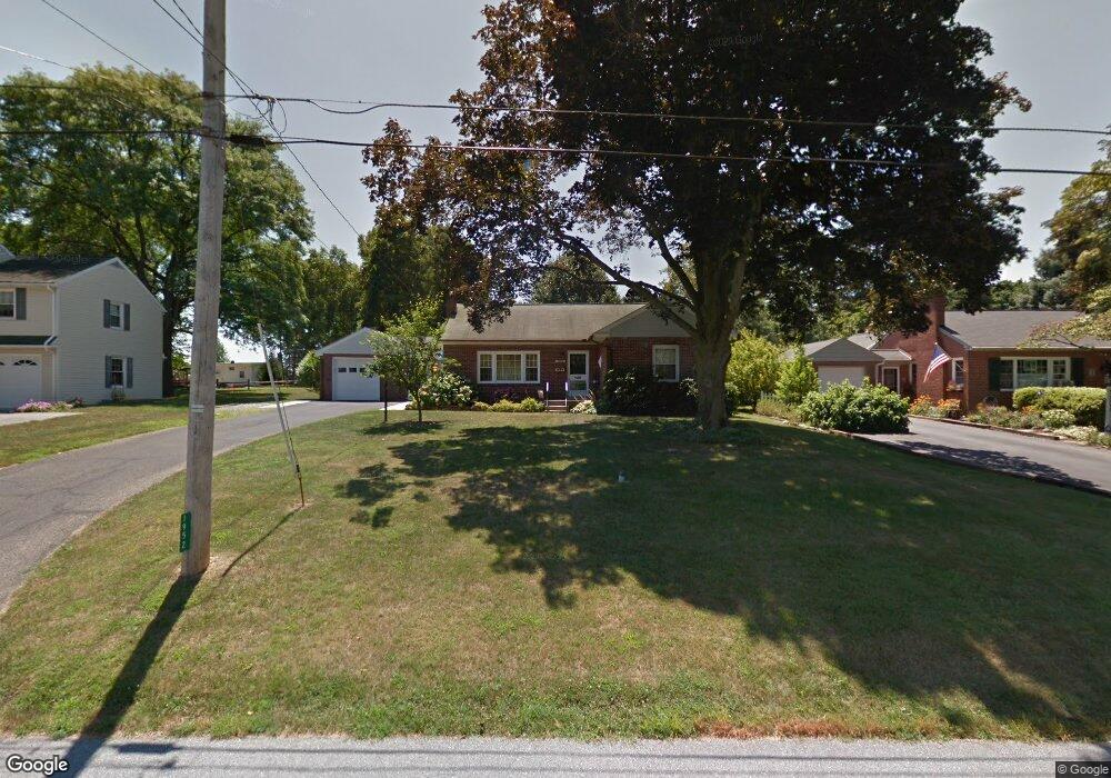
1952 Hemlock Rd Lancaster, PA 17603
Wheatland NeighborhoodEstimated Value: $309,070 - $338,000
2
Beds
2
Baths
1,312
Sq Ft
$248/Sq Ft
Est. Value
About This Home
This home is located at 1952 Hemlock Rd, Lancaster, PA 17603 and is currently estimated at $325,268, approximately $247 per square foot. 1952 Hemlock Rd is a home located in Lancaster County with nearby schools including Hambright Elementary School, Manor Middle School, and Penn Manor High School.
Ownership History
Date
Name
Owned For
Owner Type
Purchase Details
Closed on
May 6, 2019
Sold by
Smith Diane M and Smith Diane Marie
Bought by
Smith Diane M and Diane M Smith Trust
Current Estimated Value
Purchase Details
Closed on
Aug 14, 2009
Sold by
Roach Marie A
Bought by
Smith Ronald L and Smith Diane Marie
Home Financials for this Owner
Home Financials are based on the most recent Mortgage that was taken out on this home.
Original Mortgage
$135,920
Outstanding Balance
$89,296
Interest Rate
5.36%
Mortgage Type
New Conventional
Estimated Equity
$235,972
Purchase Details
Closed on
Jan 31, 2000
Sold by
Green Scott L and Green Johnny D
Bought by
Roach Charles L and Roach Marie A
Home Financials for this Owner
Home Financials are based on the most recent Mortgage that was taken out on this home.
Original Mortgage
$135,000
Interest Rate
7.91%
Create a Home Valuation Report for This Property
The Home Valuation Report is an in-depth analysis detailing your home's value as well as a comparison with similar homes in the area
Home Values in the Area
Average Home Value in this Area
Purchase History
| Date | Buyer | Sale Price | Title Company |
|---|---|---|---|
| Smith Diane M | -- | None Available | |
| Smith Ronald L | $169,900 | Conestoga Title Insurance Co | |
| Roach Charles L | $106,000 | -- |
Source: Public Records
Mortgage History
| Date | Status | Borrower | Loan Amount |
|---|---|---|---|
| Open | Smith Ronald L | $135,920 | |
| Previous Owner | Roach Charles L | $135,000 |
Source: Public Records
Tax History
| Year | Tax Paid | Tax Assessment Tax Assessment Total Assessment is a certain percentage of the fair market value that is determined by local assessors to be the total taxable value of land and additions on the property. | Land | Improvement |
|---|---|---|---|---|
| 2025 | $3,756 | $172,000 | $50,800 | $121,200 |
| 2024 | $3,756 | $172,000 | $50,800 | $121,200 |
| 2023 | $3,756 | $172,000 | $50,800 | $121,200 |
| 2022 | $3,685 | $172,000 | $50,800 | $121,200 |
| 2021 | $3,592 | $172,000 | $50,800 | $121,200 |
| 2020 | $3,592 | $172,000 | $50,800 | $121,200 |
| 2019 | $3,492 | $172,000 | $50,800 | $121,200 |
| 2018 | $2,701 | $172,000 | $50,800 | $121,200 |
| 2017 | $2,795 | $115,200 | $37,600 | $77,600 |
| 2016 | $2,795 | $115,200 | $37,600 | $77,600 |
| 2015 | $575 | $115,200 | $37,600 | $77,600 |
| 2014 | $1,910 | $115,200 | $37,600 | $77,600 |
Source: Public Records
Map
Nearby Homes
- 266 Redwood Dr
- 323 Millersville Rd
- 408 Fairway Dr
- 105 Silverwind Ct S
- 619 621 Millersville Rd
- 203 Thrush Ct N
- 215 Fawn Meadow Crossing
- 121 Pheasant Ridge Cir
- 114 Pheasant Ridge Cir
- 104 Fox Run Ct
- 205 Greyfield Dr
- 203 Oakfield Ct W
- 129 Townhouse Ln
- 62 Oak Ln
- 1529 Springside Dr
- 421 Rohrerstown Rd
- 4 Bunker Hill
- 2210 Berkshire Rd
- 2707 Kimberly Rd
- 518 Big Bend Rd
- 1944 Hemlock Rd
- 1960 Hemlock Rd
- 1936 Hemlock Rd
- 1966 Hemlock Rd
- 1951 Hemlock Rd
- 1943 Hemlock Rd
- 1929 Benmar Dr
- 1910 Hemlock Rd
- 1941 Benmar Dr
- 1965 Hemlock Rd
- 1972 Hemlock Rd
- 1917 Hemlock Rd
- 1917 Benmar Dr
- 225 Redwood Dr
- 1911 Benmar Dr
- 1924 Manor Ridge Dr
- 1890 Manor Ridge Dr
- 1918 Manor Ridge Dr
- 1882 Manor Ridge Dr
- 1898 Manor Ridge Dr
Your Personal Tour Guide
Ask me questions while you tour the home.