Estimated Value: $541,303 - $599,000
3
Beds
3
Baths
2,751
Sq Ft
$210/Sq Ft
Est. Value
About This Home
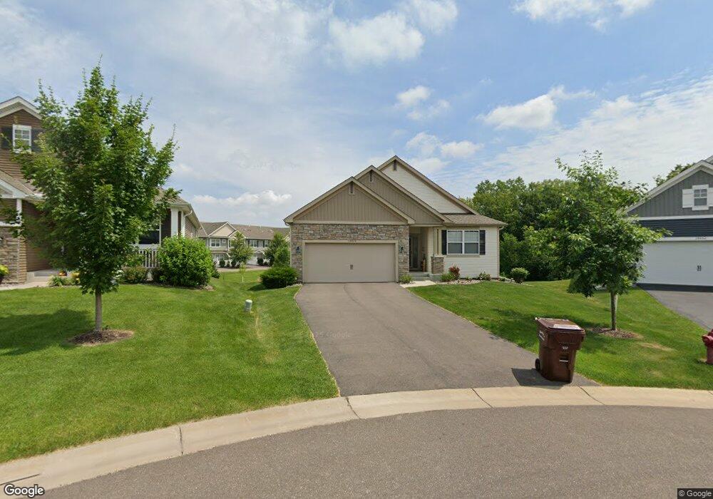
This home is located at 19558 115th Ave N, Osseo, MN 55311 and is currently estimated at $578,326, approximately $210 per square foot. 19558 115th Ave N is a home located in Hennepin County with nearby schools including Hanover Elementary School, Buffalo Community Middle School, and Buffalo Senior High School.
Ownership History
Date
Name
Owned For
Owner Type
Purchase Details
Closed on
Jul 12, 2023
Sold by
Mallin Michael and Mallin Lila
Bought by
Michael Mallin Trust and Lila Mallin Trust
Current Estimated Value
Purchase Details
Closed on
May 6, 2019
Sold by
U S Home Corporation
Bought by
Mallin Michael and Mallin Lila
Home Financials for this Owner
Home Financials are based on the most recent Mortgage that was taken out on this home.
Original Mortgage
$189,000
Interest Rate
4%
Mortgage Type
New Conventional
Purchase Details
Closed on
Jun 7, 2018
Sold by
U S Home Coporation
Bought by
City Of Rogers
Purchase Details
Closed on
May 18, 2018
Sold by
Us Home Corp
Bought by
Laurel Creek Master Homeowners Associati
Create a Home Valuation Report for This Property
The Home Valuation Report is an in-depth analysis detailing your home's value as well as a comparison with similar homes in the area
Home Values in the Area
Average Home Value in this Area
Purchase History
| Date | Buyer | Sale Price | Title Company |
|---|---|---|---|
| Michael Mallin Trust | $500 | None Listed On Document | |
| Mallin Michael | $414,000 | First American Title Ins Co | |
| City Of Rogers | -- | None Available | |
| City Of Rogers | -- | None Available | |
| Laurel Creek Master Homeowners Associati | -- | None Available |
Source: Public Records
Mortgage History
| Date | Status | Borrower | Loan Amount |
|---|---|---|---|
| Previous Owner | Mallin Michael | $189,000 |
Source: Public Records
Tax History Compared to Growth
Tax History
| Year | Tax Paid | Tax Assessment Tax Assessment Total Assessment is a certain percentage of the fair market value that is determined by local assessors to be the total taxable value of land and additions on the property. | Land | Improvement |
|---|---|---|---|---|
| 2024 | $6,043 | $502,000 | $105,000 | $397,000 |
| 2023 | $5,771 | $504,400 | $105,000 | $399,400 |
| 2022 | $5,384 | $469,000 | $84,000 | $385,000 |
| 2021 | $5,405 | $424,000 | $79,000 | $345,000 |
| 2020 | $2,591 | $420,000 | $79,000 | $341,000 |
| 2019 | $661 | $204,100 | $78,800 | $125,300 |
| 2018 | $227 | $41,800 | $41,800 | $0 |
Source: Public Records
Map
Nearby Homes
- 11500 Brookview Dr
- 19690 116th Ave N
- 11460 Grassland Way
- 18660 Territorial Rd
- 11633 Minnesota Ln N
- XXX Brockton Ln N
- 12117 Malisa Ct
- 20949 Peony Ln
- 21310 Poate Ct
- 19674 105th Ave
- 19638 105th Ave
- 19614 105th Ave
- 19590 105th Ave
- 19602 105th Ave
- 12091 Ivy St
- 19337 103rd Ave
- 22441 Olivia Ct
- 12114 Aurora Ave
- 12102 Ivy St
- 22911 Hazel Ln
- 19568 115th Ave N
- 19590 115th Ave N
- 19551 115th Ave N
- 19516 Butternut Ct
- 19510 Butternut Ct
- 19504 Butternut Ct
- 19565 115th Ave N
- 19628 115th Ave N
- 11552 Laurel Springs Path N
- 19485 Tamarack Point
- 19517 Tamarack Point N
- 19490 Butternut Ct
- 19505 Tamarack Point
- 19579 115th Ave N
- 19503 Tamarack Point
- 19486 Butternut Ct
- 19585 115 Th Ave N
- 19585 115th Ave N
- 19605 115th Ave N
- 19632 115th Ave N