1957 W Woodward Ave Manteca, CA 95337
Estimated payment $15,001/month
About This Lot
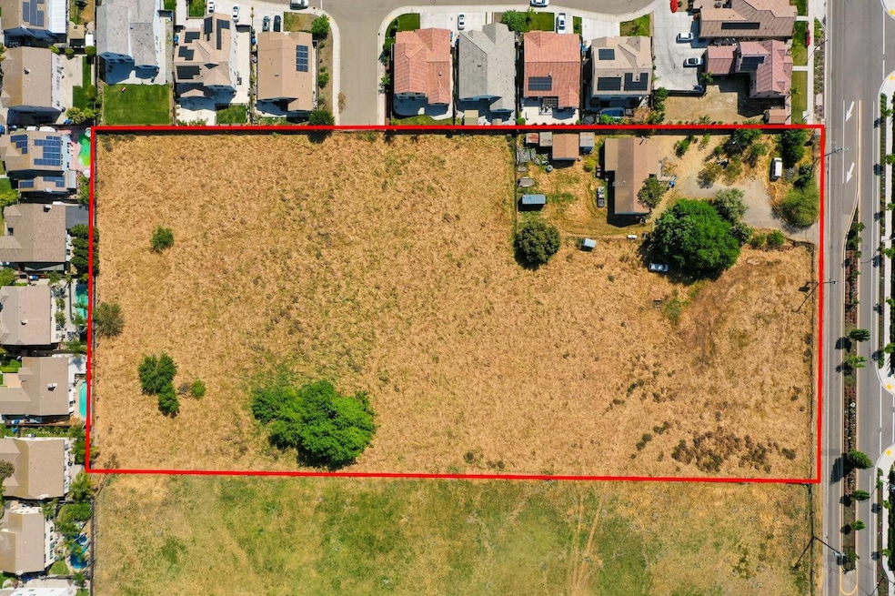
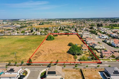
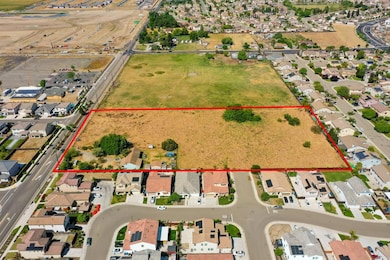
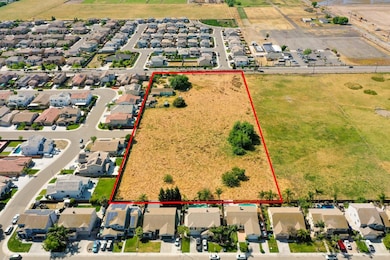
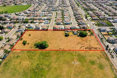
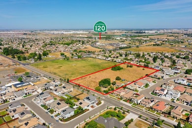
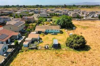
Welcome to 1957 W Woodward Avea rare and unique opportunity located on 4.39 acres in a highly versatile and desirable area. Currently featuring a single-family home, this expansive property offers endless potential with its R-2 zoning, allowing for a wide range of residential developments including additional single-family homes, multi-family units, townhomes, and condominiums. Whether you're a home builder, investor, or developer, this parcel presents a prime chance to bring your vision to life. Don't miss out on one of the few properties in the area with this level of flexibility and size.
Property Details
Property Type
- Land
Est. Annual Taxes
- $2,562
Lot Details
- 4.39 Acre Lot
- Possible uses of the property include Residential, Subdivision, Other
- Subdivision Possible
- Property is zoned R2
Utilities
- Private Company Owned Well
- Septic Tank
Community Details
- No Home Owners Association
- Net Lease
Listing and Financial Details
- Assessor Parcel Number 226-160-10
Map
Home Values in the Area
Average Home Value in this Area
Tax History
| Year | Tax Paid | Tax Assessment Tax Assessment Total Assessment is a certain percentage of the fair market value that is determined by local assessors to be the total taxable value of land and additions on the property. | Land | Improvement |
|---|---|---|---|---|
| 2025 | $2,562 | $176,299 | $109,806 | $66,493 |
| 2024 | $2,464 | $172,843 | $107,653 | $65,190 |
| 2023 | $2,086 | $169,455 | $105,543 | $63,912 |
| 2022 | $1,996 | $166,133 | $103,474 | $62,659 |
| 2021 | $1,976 | $162,877 | $101,446 | $61,431 |
| 2020 | $1,902 | $161,208 | $100,406 | $60,802 |
| 2019 | $1,879 | $158,048 | $98,438 | $59,610 |
| 2018 | $1,855 | $154,950 | $96,508 | $58,442 |
| 2017 | $1,830 | $151,913 | $94,616 | $57,297 |
| 2016 | $1,789 | $148,935 | $92,761 | $56,174 |
| 2014 | $1,573 | $143,825 | $89,578 | $54,247 |
Property History
| Date | Event | Price | List to Sale | Price per Sq Ft |
|---|---|---|---|---|
| 04/24/2025 04/24/25 | For Sale | $2,799,985 | 0.0% | $1,778 / Sq Ft |
| 04/24/2025 04/24/25 | For Sale | $2,799,985 | -- | -- |
Purchase History
| Date | Type | Sale Price | Title Company |
|---|---|---|---|
| Deed In Lieu Of Foreclosure | -- | Old Republic Title | |
| Gift Deed | -- | Old Republic Title | |
| Interfamily Deed Transfer | -- | None Available | |
| Interfamily Deed Transfer | -- | None Available | |
| Interfamily Deed Transfer | -- | None Available | |
| Interfamily Deed Transfer | -- | None Available |
Source: MetroList
MLS Number: 225052251
APN: 226-160-10
Disclaimer: Certain information contained herein is derived from information provided by parties other than Homes.com. All information provided is deemed reliable, but is not guaranteed to be accurate and should be independently verified.
![]() IDX information is provided exclusively for personal, non-commercial use, and may not be used for any purpose other than to identify prospective properties consumers may be interested in purchasing. Information is deemed reliable but not guaranteed.
IDX information is provided exclusively for personal, non-commercial use, and may not be used for any purpose other than to identify prospective properties consumers may be interested in purchasing. Information is deemed reliable but not guaranteed.
- 2018 Peregrine St
- 1565 Blue Lupine Ln
- 1602 Oleander Ave
- 1676 Red Ribbons Ln
- Residence 4 Plan at Machado Ranch - Eastwood
- Residence 4 Plan at Machado Ranch - Heston
- Residence 1 Plan at Machado Ranch - Heston
- Residence 3 Plan at Machado Ranch - Eastwood
- Residence 2 Plan at Machado Ranch - Eastwood
- Residence 1 Plan at Machado Ranch - Eastwood
- Residence 3 Plan at Machado Ranch - Heston
- Residence 2 Plan at Machado Ranch - Heston
- 1435 W Woodward Ave
- 1432 Meridian St
- 2369 Sather St
- 2372 Emma Dr
- 2377 Emma Dr
- 1394 Burton Way
- 2377 Sather St
- 2883 Pixley Ct
- 1241 Countryside Ln
- 1797 Eagle River Ave
- 1429 Rosy Dawn Ln
- 717 W Atherton Dr
- 803 El Portal Ave
- 1710 Halo Ave
- 1744 Halo Ave
- 443 Half Dome Dr
- 141 El Portal Ave
- 1212 W Center St
- 1451 W Center St
- 1155 W Center St
- 438 Miwok Ln
- 367 N Union Rd
- 217 Tannehill Dr
- 2476 Cellar St
- 2469 Cellar St
- 350 N Union Rd
- 1257 Crom St
- 2146 Vermentino St
