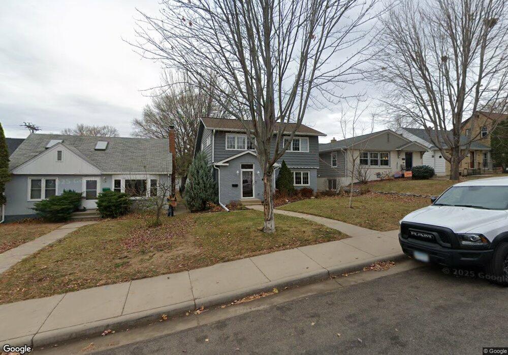
1959 Pinehurst Ave Saint Paul, MN 55116
Highland Park NeighborhoodEstimated Value: $519,000 - $642,000
3
Beds
2
Baths
1,142
Sq Ft
$493/Sq Ft
Est. Value
About This Home
This home is located at 1959 Pinehurst Ave, Saint Paul, MN 55116 and is currently estimated at $562,739, approximately $492 per square foot. 1959 Pinehurst Ave is a home located in Ramsey County with nearby schools including Horace Mann School, Highland Park Middle School, and Highland Park Senior High.
Ownership History
Date
Name
Owned For
Owner Type
Purchase Details
Closed on
Apr 25, 2018
Sold by
Langford Christine
Bought by
Radtke Rebecca and Kugler Lynelle
Current Estimated Value
Home Financials for this Owner
Home Financials are based on the most recent Mortgage that was taken out on this home.
Original Mortgage
$317,600
Outstanding Balance
$186,738
Interest Rate
4.45%
Mortgage Type
VA
Estimated Equity
$376,001
Create a Home Valuation Report for This Property
The Home Valuation Report is an in-depth analysis detailing your home's value as well as a comparison with similar homes in the area
Home Values in the Area
Average Home Value in this Area
Purchase History
| Date | Buyer | Sale Price | Title Company |
|---|---|---|---|
| Radtke Rebecca | $397,000 | Titlesmart Inc |
Source: Public Records
Mortgage History
| Date | Status | Borrower | Loan Amount |
|---|---|---|---|
| Open | Radtke Rebecca | $317,600 |
Source: Public Records
Tax History
| Year | Tax Paid | Tax Assessment Tax Assessment Total Assessment is a certain percentage of the fair market value that is determined by local assessors to be the total taxable value of land and additions on the property. | Land | Improvement |
|---|---|---|---|---|
| 2025 | $7,060 | $518,600 | $151,700 | $366,900 |
| 2023 | $7,060 | $453,100 | $151,700 | $301,400 |
| 2022 | $6,204 | $464,100 | $151,700 | $312,400 |
| 2021 | $6,280 | $380,700 | $151,700 | $229,000 |
| 2020 | $6,480 | $398,400 | $151,700 | $246,700 |
| 2019 | $6,490 | $383,000 | $151,700 | $231,300 |
| 2018 | $5,924 | $378,800 | $151,700 | $227,100 |
| 2017 | $5,366 | $357,000 | $151,700 | $205,300 |
| 2016 | $5,284 | $0 | $0 | $0 |
| 2015 | $4,806 | $319,800 | $130,100 | $189,700 |
| 2014 | $5,350 | $0 | $0 | $0 |
Source: Public Records
Map
Nearby Homes
- 1885 Eleanor Ave
- 1827 Eleanor Ave
- 2077 Scheffer Ave
- 1845 Rome Ave
- 1751 Beechwood Ave
- 1715 Scheffer Ave
- 1756 Saunders Ave
- 1679 Bayard Ave
- 1691 Hartford Ave
- 850 Mount Curve Blvd Unit L
- 850 Mount Curve Blvd Unit H
- 875 Falls Passage W Unit C
- TBD Scheffer Ave
- 1717 Yorkshire Ave
- 507 Montrose Ln
- 1025 Colby St
- 850 S Woodlawn Ave
- 842 S Woodlawn Ave
- 848 Woodlawn Ave
- 838 Woodlawn Ave
- 1965 Pinehurst Ave
- 1955 Pinehurst Ave
- 1951 Pinehurst Ave
- 1971 Pinehurst Ave
- 1947 Pinehurst Ave
- 1958 Highland Pkwy
- 1962 Highland Pkwy
- 1977 Pinehurst Ave
- 1954 Highland Pkwy
- 1964 Highland Pkwy
- 1943 Pinehurst Ave
- 1950 Highland Pkwy
- 1966 Highland Pkwy
- 1954 Pinehurst Ave
- 1968 Pinehurst Ave
- 1960 Pinehurst Ave
- 1981 Pinehurst Ave
- 1941 Pinehurst Ave
- 1972 Pinehurst Ave
- 1950 Pinehurst Ave
Your Personal Tour Guide
Ask me questions while you tour the home.