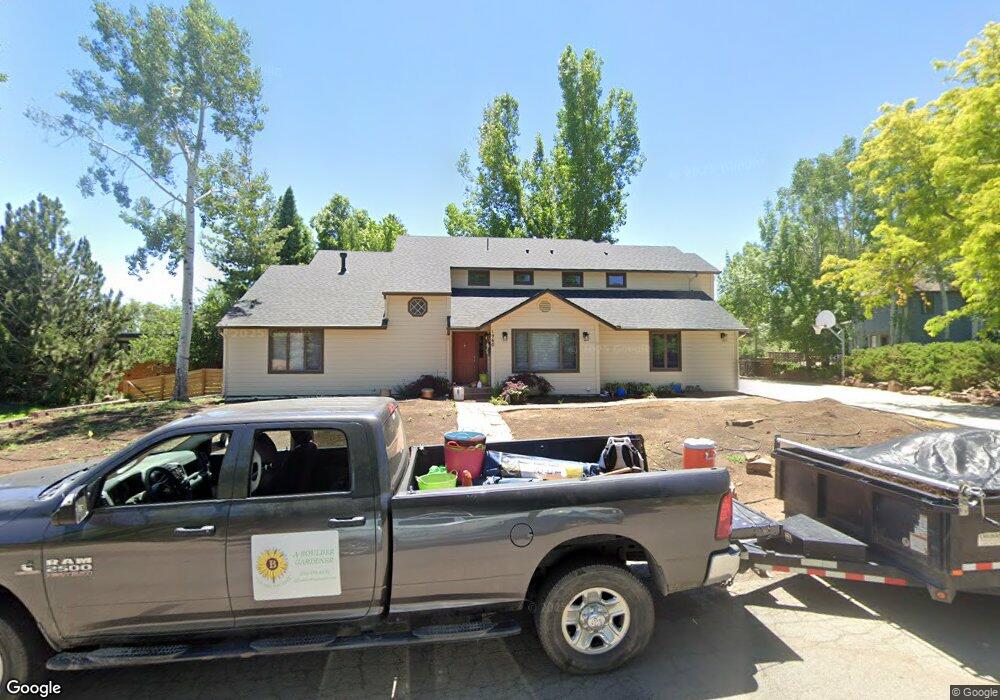
1960 Poplar Ave Boulder, CO 80304
North Boulder NeighborhoodEstimated Value: $1,710,847 - $1,964,000
4
Beds
3
Baths
2,613
Sq Ft
$721/Sq Ft
Est. Value
About This Home
This home is located at 1960 Poplar Ave, Boulder, CO 80304 and is currently estimated at $1,883,462, approximately $720 per square foot. 1960 Poplar Ave is a home located in Boulder County with nearby schools including Crest View Elementary School, Centennial Middle School, and Boulder High School.
Ownership History
Date
Name
Owned For
Owner Type
Purchase Details
Closed on
Jun 10, 1987
Bought by
Hurst Anne
Current Estimated Value
Purchase Details
Closed on
Jan 22, 1981
Bought by
Hurst Anne
Purchase Details
Closed on
May 15, 1979
Bought by
Hurst Anne
Create a Home Valuation Report for This Property
The Home Valuation Report is an in-depth analysis detailing your home's value as well as a comparison with similar homes in the area
Home Values in the Area
Average Home Value in this Area
Purchase History
| Date | Buyer | Sale Price | Title Company |
|---|---|---|---|
| Hurst Anne | -- | -- | |
| Hurst Anne | $35,000 | -- | |
| Hurst Anne | $30,000 | -- |
Source: Public Records
Tax History
| Year | Tax Paid | Tax Assessment Tax Assessment Total Assessment is a certain percentage of the fair market value that is determined by local assessors to be the total taxable value of land and additions on the property. | Land | Improvement |
|---|---|---|---|---|
| 2025 | $10,375 | $113,101 | $71,988 | $41,113 |
| 2024 | $10,375 | $113,101 | $71,988 | $41,113 |
| 2023 | $10,195 | $124,754 | $74,417 | $54,022 |
| 2022 | $8,550 | $99,024 | $60,034 | $38,990 |
| 2021 | $8,153 | $101,874 | $61,762 | $40,112 |
| 2020 | $6,471 | $81,489 | $55,627 | $25,862 |
| 2019 | $6,372 | $81,489 | $55,627 | $25,862 |
| 2018 | $6,177 | $78,451 | $41,112 | $37,339 |
| 2017 | $5,984 | $86,733 | $45,452 | $41,281 |
| 2016 | $4,995 | $65,662 | $38,686 | $26,976 |
| 2015 | $4,730 | $54,534 | $24,596 | $29,938 |
| 2014 | $3,916 | $54,534 | $24,596 | $29,938 |
Source: Public Records
Map
Nearby Homes
- 1885 Quince Ave
- 1945 Norwood Ave
- 1801 Redwood Ave
- 1695 Orchard Ave
- 1800 Sumac Ave
- 1620 Oak Ave
- 3633 21st St
- 1690 Wilson Ct
- 2558 Premier Place
- 2345 Spotswood Place
- 1505 Oak Ave
- 1560 Sumac Ave
- 3621 21st St
- 2055 Kalmia Ave
- 2362 Spotswood Place
- 3877 15th St
- 3737 26th St
- 1487 Periwinkle Dr
- 2116 Vine Ave
- 2126 Vine Ave
- 1940 Poplar Ave
- 1990 Poplar Ave
- 1941 Orchard Ave
- 1925 Orchard Ave
- 1951 Orchard Ave
- 1920 Poplar Ave
- 1959 Poplar Ave
- 1957 Poplar Ln
- 1961 Poplar Ave
- 1915 Orchard Ave
- 1945 Poplar Ln
- 2000 Poplar Ave
- 3932 20th St
- 1955 Poplar Ln
- 2001 Orchard Ave
- 1904 Poplar Ave
- 3900 19th St
- 1901 Poplar Ave
- 1950 Orchard Ave
- 1930 Orchard Ave
Your Personal Tour Guide
Ask me questions while you tour the home.