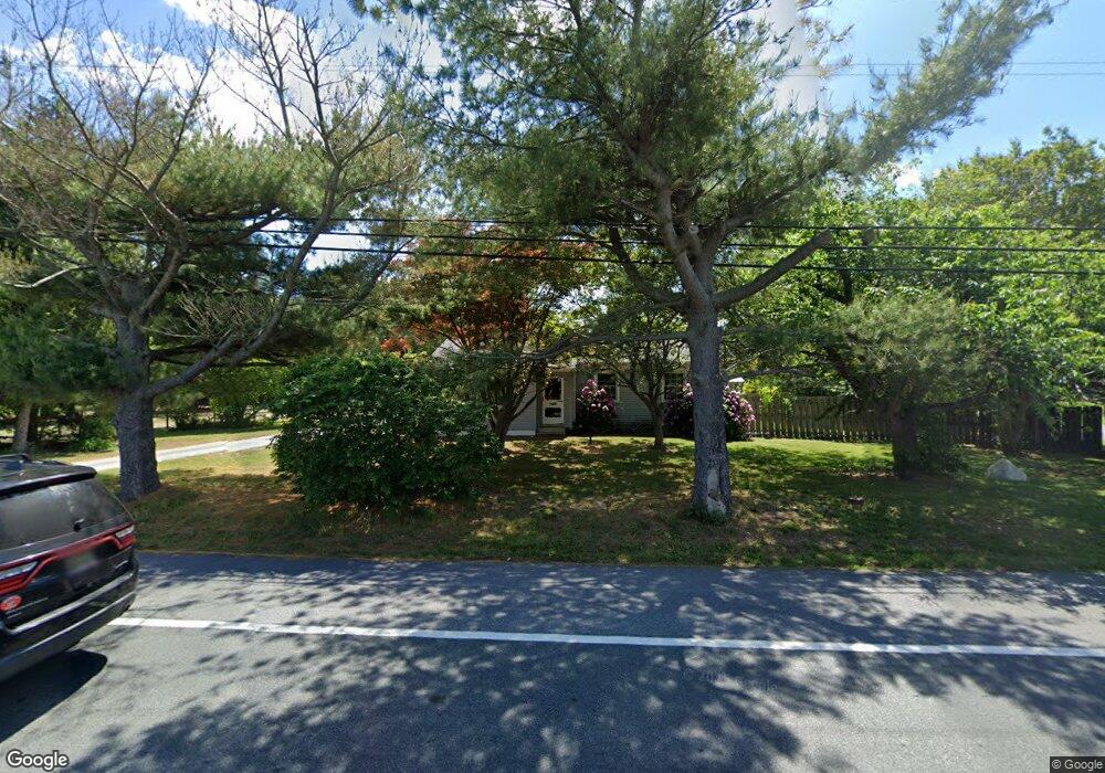
1960 Wheatleys Pond Rd Smyrna, DE 19977
Estimated Value: $275,908 - $348,000
3
Beds
1
Bath
1,144
Sq Ft
$284/Sq Ft
Est. Value
About This Home
This home is located at 1960 Wheatleys Pond Rd, Smyrna, DE 19977 and is currently estimated at $324,477, approximately $283 per square foot. 1960 Wheatleys Pond Rd is a home located in Kent County with nearby schools including Sunnyside Elementary School, John Bassett Moore Intermediate School, and Smyrna Middle School.
Ownership History
Date
Name
Owned For
Owner Type
Purchase Details
Closed on
Apr 29, 2021
Sold by
Scott Harvey W and Scott Jennifer L
Bought by
Duncan Jason J
Current Estimated Value
Home Financials for this Owner
Home Financials are based on the most recent Mortgage that was taken out on this home.
Original Mortgage
$150,000
Outstanding Balance
$135,725
Interest Rate
3%
Mortgage Type
New Conventional
Estimated Equity
$188,752
Purchase Details
Closed on
Apr 29, 2019
Sold by
Scott Cindy S
Bought by
Scott Harvey W and Scott Jennifer L
Home Financials for this Owner
Home Financials are based on the most recent Mortgage that was taken out on this home.
Original Mortgage
$100,000
Interest Rate
4.3%
Mortgage Type
Seller Take Back
Purchase Details
Closed on
Jan 1, 1989
Bought by
Scott Harvey W
Create a Home Valuation Report for This Property
The Home Valuation Report is an in-depth analysis detailing your home's value as well as a comparison with similar homes in the area
Home Values in the Area
Average Home Value in this Area
Purchase History
| Date | Buyer | Sale Price | Title Company |
|---|---|---|---|
| Duncan Jason J | $200,000 | None Available | |
| Scott Harvey W | -- | None Available | |
| Scott Harvey W | $63,000 | -- |
Source: Public Records
Mortgage History
| Date | Status | Borrower | Loan Amount |
|---|---|---|---|
| Open | Duncan Jason J | $150,000 | |
| Previous Owner | Scott Harvey W | $100,000 |
Source: Public Records
Tax History Compared to Growth
Tax History
| Year | Tax Paid | Tax Assessment Tax Assessment Total Assessment is a certain percentage of the fair market value that is determined by local assessors to be the total taxable value of land and additions on the property. | Land | Improvement |
|---|---|---|---|---|
| 2025 | $1,167 | $276,600 | $94,800 | $181,800 |
| 2024 | $1,167 | $276,600 | $94,800 | $181,800 |
| 2023 | $903 | $34,000 | $8,600 | $25,400 |
| 2022 | $873 | $34,000 | $8,600 | $25,400 |
| 2021 | $855 | $34,000 | $8,600 | $25,400 |
| 2020 | $749 | $34,000 | $8,600 | $25,400 |
| 2019 | $756 | $34,000 | $8,600 | $25,400 |
| 2018 | $756 | $34,000 | $8,600 | $25,400 |
| 2017 | $754 | $34,000 | $0 | $0 |
| 2016 | $765 | $34,000 | $0 | $0 |
| 2015 | $768 | $34,000 | $0 | $0 |
| 2014 | $719 | $34,000 | $0 | $0 |
Source: Public Records
Map
Nearby Homes
- 3 Summit Dr
- 49 Summit Dr
- 31 Summit Dr Unit HANCOCK
- 31 Summit Dr Unit LEGEND
- 31 Summit Dr Unit JEFFERSON GRAND
- 31 Summit Dr Unit GATSBY
- 31 Summit Dr Unit GLADWYN
- 31 Summit Dr Unit CHARLESTON GRAND
- 31 Summit Dr Unit BRANDYWINE
- 31 Summit Dr Unit PHILADELPHIAN
- 342 Bryn Ln
- 381 Grayton Dr
- 181 Arrowood Dr
- 160 Needham Dr
- 97 Needham Dr
- 165 Oriole Ln
- 48 Gainscott Place
- 24 Gainscott Place
- 15 Gainscott Place
- 209 E Constitution Dr
- 1930 Wheatleys Pond Rd
- 1990 Wheatleys Pond Rd
- 2020 Mount Friendship Rd
- 0 Alley Corner Rd
- 2032 Wheatleys Pond Rd
- 1982 Mount Friendship Rd
- 0 Alley Corner Rd Unit 5549614
- 1 Alley Corner Rd
- 0 Alley Corner Rd Unit 6188729
- 0 Alley Corner Rd Unit DEKT249166
- 1856 Wheatleys Pond Rd
- 2062 Wheatleys Pond Rd
- 1980 Wheatleys Pond Rd
- 1952 Mount Friendship Rd
- 2081 Wheatleys Pond Rd
- 2090 Wheatleys Pond Rd
- 1926 Mount Friendship Rd
- 1961 Mount Friendship Rd
- 1826 Wheatleys Pond Rd
- 1964 Wheatleys Pond Rd