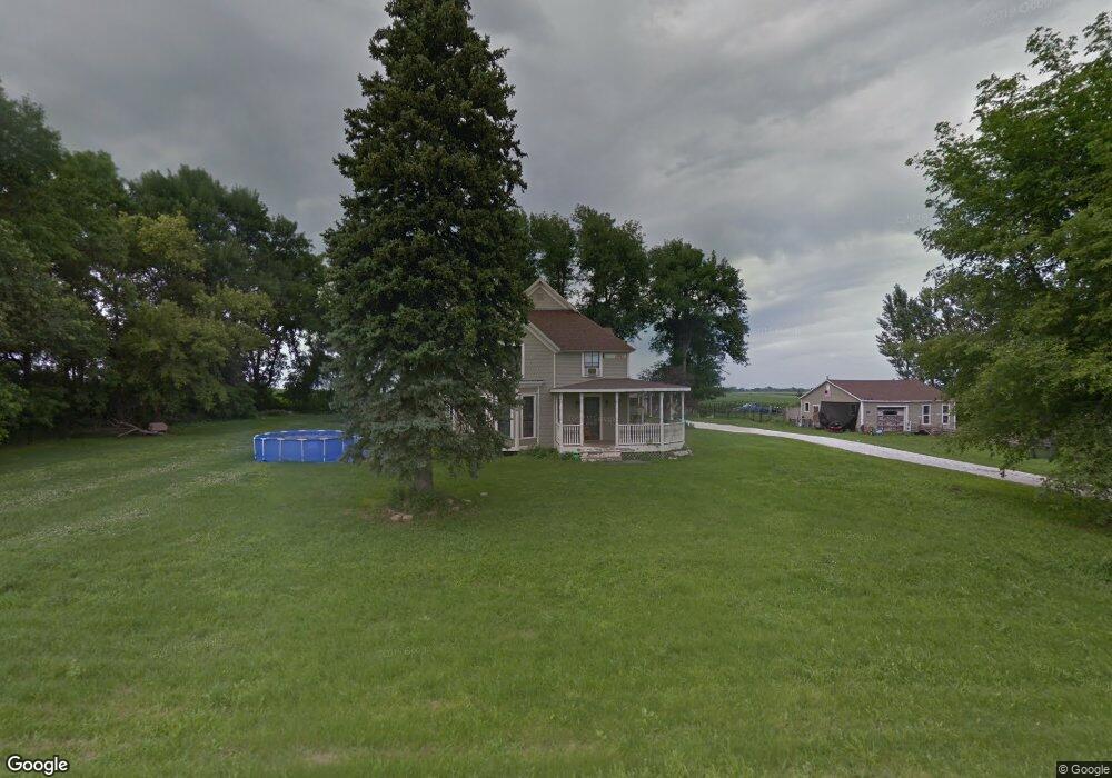
1961 130th St Humboldt, IA 50548
Estimated Value: $245,000 - $499,000
4
Beds
3
Baths
2,631
Sq Ft
$135/Sq Ft
Est. Value
About This Home
This home is located at 1961 130th St, Humboldt, IA 50548 and is currently estimated at $355,118, approximately $134 per square foot. 1961 130th St is a home located in Webster County with nearby schools including Manson Northwest Webster Elementary School and Manson Northwest Webster Junior/Senior High School.
Ownership History
Date
Name
Owned For
Owner Type
Purchase Details
Closed on
Jul 9, 2015
Sold by
Anderson William E and Anderson Julie A
Bought by
Amen Craig M and Amen Crystal M
Current Estimated Value
Home Financials for this Owner
Home Financials are based on the most recent Mortgage that was taken out on this home.
Original Mortgage
$242,250
Outstanding Balance
$191,786
Interest Rate
3.86%
Mortgage Type
New Conventional
Estimated Equity
$163,333
Create a Home Valuation Report for This Property
The Home Valuation Report is an in-depth analysis detailing your home's value as well as a comparison with similar homes in the area
Home Values in the Area
Average Home Value in this Area
Purchase History
| Date | Buyer | Sale Price | Title Company |
|---|---|---|---|
| Amen Craig M | $255,000 | None Available |
Source: Public Records
Mortgage History
| Date | Status | Borrower | Loan Amount |
|---|---|---|---|
| Open | Amen Craig M | $242,250 |
Source: Public Records
Tax History Compared to Growth
Tax History
| Year | Tax Paid | Tax Assessment Tax Assessment Total Assessment is a certain percentage of the fair market value that is determined by local assessors to be the total taxable value of land and additions on the property. | Land | Improvement |
|---|---|---|---|---|
| 2025 | $3,184 | $317,830 | $31,800 | $286,030 |
| 2024 | $3,184 | $291,830 | $25,600 | $266,230 |
| 2023 | $2,590 | $291,830 | $25,600 | $266,230 |
| 2022 | $2,500 | $218,170 | $25,600 | $192,570 |
| 2021 | $2,532 | $218,170 | $25,600 | $192,570 |
| 2020 | $2,532 | $211,170 | $25,600 | $185,570 |
| 2019 | $2,188 | $208,410 | $28,160 | $180,250 |
| 2018 | $2,174 | $180,840 | $25,600 | $155,240 |
| 2017 | $2,174 | $173,840 | $0 | $0 |
| 2016 | $2,112 | $173,840 | $0 | $0 |
| 2015 | $2,112 | $173,560 | $0 | $0 |
| 2014 | $2,088 | $173,560 | $0 | $0 |
Source: Public Records
Map
Nearby Homes
- 2244 141st St
- 2227 Lakewood Trail
- 1111 Hayes Ave
- 1222 Garfield Ave
- 420 E Front St
- TBD Fairbanks Ave
- 66 4th St NE
- 114 6th St SE
- 76 6th St SE
- 507 1st Ave NE
- 113 6th St SE
- Parcel 0613352005
- 1527 28th Ave N
- 1040 25th Ave N
- 2731 N 13th Place
- 1161 25th Ave N
- 2517 N 15th Place
- 2454 170th St
- 353 4th St NW
- 1268 N 7th St
- 1992 130th St
- 1337 Johnson Ave
- 1303 Deer Creek Dr
- 1318 Deercreek Dr
- 1322 Deer Creek
- 1322 Deer Creek Dr
- 1322 Deercreek Dr
- 1328 Deercreek Dr
- 1328 Deer Creek Dr
- 1349 Johnson Ave
- 1333 Deer Creek Dr
- 1332 Deercreek Dr
- 1332 Deer Creek Dr
- 2014 Oak Cir
- 2016 Oak Cir
- 1901 130th St
- 1336 Deercreek Dr
- 2012 Oak Cir
- 1361 Johnson Ave
- 2013 Deer Run