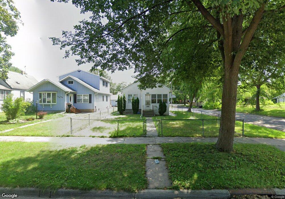
1962 Orange Ave E Saint Paul, MN 55119
Southern Hayden Heights NeighborhoodEstimated Value: $173,000 - $206,000
2
Beds
1
Bath
748
Sq Ft
$256/Sq Ft
Est. Value
About This Home
This home is located at 1962 Orange Ave E, Saint Paul, MN 55119 and is currently estimated at $191,815, approximately $256 per square foot. 1962 Orange Ave E is a home located in Ramsey County with nearby schools including The Heights Community School, Txuj Ci HMong Language and Culture Upper Campus, and Johnson Senior High School.
Ownership History
Date
Name
Owned For
Owner Type
Purchase Details
Closed on
Dec 3, 2020
Sold by
Osorio Edith and Osorio Eduardo
Bought by
Medina Irma
Current Estimated Value
Home Financials for this Owner
Home Financials are based on the most recent Mortgage that was taken out on this home.
Original Mortgage
$95,000
Outstanding Balance
$68,960
Interest Rate
2.7%
Mortgage Type
New Conventional
Estimated Equity
$122,855
Purchase Details
Closed on
Apr 1, 2002
Sold by
Johansen Laurel A and Johansen Daniel O
Bought by
Medina Irma and Osorio Edith
Create a Home Valuation Report for This Property
The Home Valuation Report is an in-depth analysis detailing your home's value as well as a comparison with similar homes in the area
Home Values in the Area
Average Home Value in this Area
Purchase History
| Date | Buyer | Sale Price | Title Company |
|---|---|---|---|
| Medina Irma | -- | Titleserv Inc | |
| Medina Irma | $113,298 | -- |
Source: Public Records
Mortgage History
| Date | Status | Borrower | Loan Amount |
|---|---|---|---|
| Open | Medina Irma | $95,000 |
Source: Public Records
Tax History Compared to Growth
Tax History
| Year | Tax Paid | Tax Assessment Tax Assessment Total Assessment is a certain percentage of the fair market value that is determined by local assessors to be the total taxable value of land and additions on the property. | Land | Improvement |
|---|---|---|---|---|
| 2025 | $2,830 | $173,700 | $30,000 | $143,700 |
| 2023 | $2,830 | $171,700 | $25,000 | $146,700 |
| 2022 | $2,670 | $192,100 | $25,000 | $167,100 |
| 2021 | $2,510 | $150,500 | $25,000 | $125,500 |
| 2020 | $2,066 | $144,900 | $18,000 | $126,900 |
| 2019 | $2,076 | $120,100 | $18,000 | $102,100 |
| 2018 | $1,640 | $129,500 | $18,000 | $111,500 |
| 2017 | $1,584 | $111,200 | $18,000 | $93,200 |
| 2016 | $1,394 | $0 | $0 | $0 |
| 2015 | $1,396 | $91,400 | $18,000 | $73,400 |
| 2014 | $1,054 | $0 | $0 | $0 |
Source: Public Records
Map
Nearby Homes
- 1976 Orange Ave E
- 1931 Hawthorne Ave E
- 2032 Hyacinth Ave E
- 1891 Maryland Ave E
- 1868 Ivy Ave E
- 1406 Furness Pkwy
- 2112 Cottage Ave E
- 2102 Sherwood Ave
- 2311 Nokomis Ave
- 1806 Sherwood Ave
- 1828 Arlington Ave E
- 1126 Breen St
- 1732 Maryland Ave E
- 1711 Maryland Ave E
- 1111 Breen St
- 1250 Mcknight Rd N
- 1905 Montana Ave E
- 1729 Sherwood Ave
- 1950 Case Ave E
- 1675 Maryland Ave E
- 1966 Orange Ave E
- 1970 Orange Ave E
- 1974 Orange Ave E
- 1952 Orange Ave E
- 1959 Hawthorne Ave E
- 1963 Hawthorne Ave E
- 1967 Hawthorne Ave E
- 1976 1976 Orange-Avenue-e
- 1955 Hawthorne Ave E
- 1948 Orange Ave E
- 1971 Hawthorne Ave E
- 1959 Orange Ave E
- 1963 Orange Ave E
- 1980 Orange Ave E
- 1980 1980 Orange-Avenue-e
- 1951 Hawthorne Ave E
- 1977 Hawthorne Ave E
- 1955 Orange Ave E
- 1971 Orange Ave E
- 1944 Orange Ave E