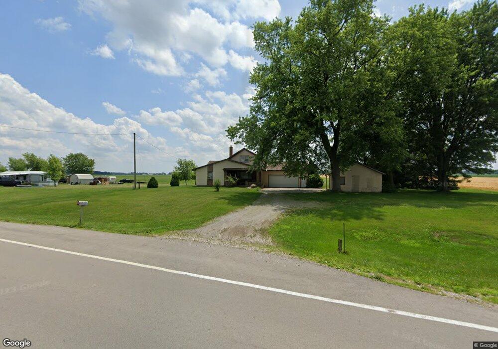
19626 Lincoln Hwy Middle Point, OH 45863
Estimated Value: $174,135 - $266,000
3
Beds
1
Bath
1,760
Sq Ft
$119/Sq Ft
Est. Value
About This Home
This home is located at 19626 Lincoln Hwy, Middle Point, OH 45863 and is currently estimated at $209,284, approximately $118 per square foot. 19626 Lincoln Hwy is a home located in Van Wert County with nearby schools including Lincolnview Elementary School and Lincolnview Junior/Senior High School.
Ownership History
Date
Name
Owned For
Owner Type
Purchase Details
Closed on
Apr 29, 2025
Sold by
Menke Theresa L
Bought by
Theresa L Menke Irrevocable Trust and Mcclurg
Current Estimated Value
Purchase Details
Closed on
Dec 28, 2007
Sold by
Estate Of John E Menke
Bought by
Menke Theresa L
Create a Home Valuation Report for This Property
The Home Valuation Report is an in-depth analysis detailing your home's value as well as a comparison with similar homes in the area
Home Values in the Area
Average Home Value in this Area
Purchase History
| Date | Buyer | Sale Price | Title Company |
|---|---|---|---|
| Theresa L Menke Irrevocable Trust | -- | Baker Mcclure Law & Title | |
| Theresa L Menke Irrevocable Trust | -- | Baker Mcclure Law & Title | |
| Menke Theresa L | -- | None Available |
Source: Public Records
Tax History Compared to Growth
Tax History
| Year | Tax Paid | Tax Assessment Tax Assessment Total Assessment is a certain percentage of the fair market value that is determined by local assessors to be the total taxable value of land and additions on the property. | Land | Improvement |
|---|---|---|---|---|
| 2024 | $1,483 | $46,980 | $6,520 | $40,460 |
| 2023 | $1,483 | $46,980 | $6,520 | $40,460 |
| 2022 | $1,390 | $32,320 | $5,670 | $26,650 |
| 2021 | $1,399 | $32,320 | $5,670 | $26,650 |
| 2020 | $1,394 | $32,320 | $5,670 | $26,650 |
| 2019 | $1,079 | $27,480 | $4,700 | $22,780 |
| 2018 | $1,065 | $27,480 | $4,700 | $22,780 |
| 2017 | $978 | $27,480 | $4,700 | $22,780 |
| 2016 | $885 | $25,800 | $4,700 | $21,100 |
| 2015 | $872 | $25,800 | $4,700 | $21,100 |
| 2014 | $905 | $25,800 | $4,700 | $21,100 |
| 2013 | $1,089 | $25,800 | $4,700 | $21,100 |
Source: Public Records
Map
Nearby Homes
- 112 W Railroad St
- 104 W Railroad St
- TBD Dog Creek Rd
- 104 W South St
- 8951 Brickner Rd
- 11630 Clearview Dr
- 7510 State Route 66
- 616 W 5th St
- 604 W 6th St
- 409 N Bredeick St
- 503 W 6th St
- 606 S Cass St
- 13945 Lincoln Hwy
- 610 N Washington St
- 634 S Clay St
- 810 N Franklin St
- 14162 Overholt Rd
- 704 N Franklin St
- 221 S Main St
- 210 E 3rd St
- 19532 Lincoln Hwy
- 19565 Lincoln Hwy
- 9146 Middle Point Rd
- 19905 Lincoln Hwy
- 9320 Middle Point Wetzel Rd
- 19243 Lincoln Hwy
- 19229 Lincoln Hwy
- 19184 Lincoln Hwy
- 8831 Middle Point Wetzel Rd
- 8783 Middle Point Wetzel Rd
- 9750 Middle Point Rd
- 9794 Middle Point Rd
- 18963 Lincoln Hwy
- 9339 Dog Creek Rd
- 20255 Lincoln Hwy
- 9170 Dog Creek Rd
- 8615 Middle Point Wetzel Rd
- 610 Adams St