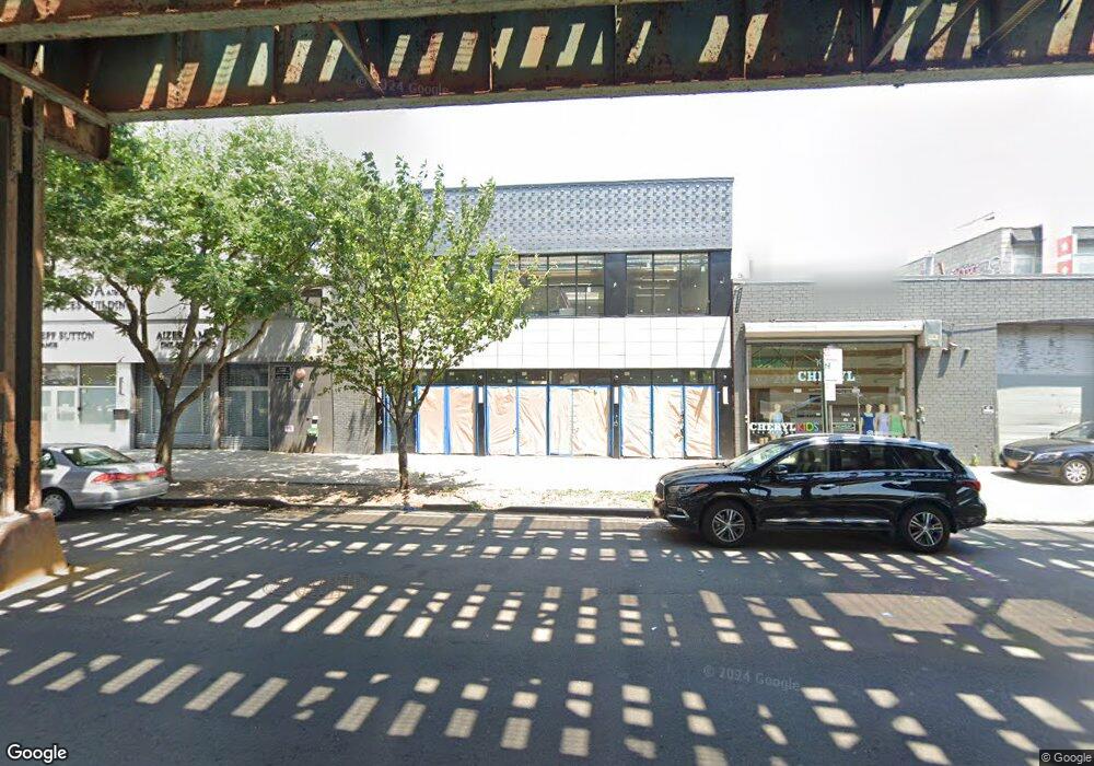
1963 McDonald Ave Brooklyn, NY 11223
Gravesend NeighborhoodEstimated Value: $3,894,679
--
Bed
--
Bath
13,460
Sq Ft
$289/Sq Ft
Est. Value
About This Home
This home is located at 1963 McDonald Ave, Brooklyn, NY 11223 and is currently estimated at $3,894,679, approximately $289 per square foot. 1963 McDonald Ave is a home located in Kings County with nearby schools including P.S. 215 Morris H Weiss, Is 228 David A Boody, and James Madison High School.
Ownership History
Date
Name
Owned For
Owner Type
Purchase Details
Closed on
Feb 28, 2023
Sold by
1963 Mcdonald Owner Llc
Bought by
Sbh Community Services Network Inc
Current Estimated Value
Purchase Details
Closed on
Mar 19, 2019
Sold by
1963 Mcdonald Llc
Bought by
1963 Mcdonald Owner Llc
Home Financials for this Owner
Home Financials are based on the most recent Mortgage that was taken out on this home.
Original Mortgage
$0
Interest Rate
4.3%
Mortgage Type
Unknown
Purchase Details
Closed on
Dec 1, 2010
Sold by
Giuseppe'S 315 Ave U Llc
Bought by
1963 Mcdonald Llc
Home Financials for this Owner
Home Financials are based on the most recent Mortgage that was taken out on this home.
Original Mortgage
$1,350,000
Interest Rate
4.24%
Mortgage Type
Commercial
Purchase Details
Closed on
Aug 11, 2010
Sold by
Empire Plaza Llc
Bought by
Giuseppe'S 315 Ave U Llc
Purchase Details
Closed on
Oct 6, 2000
Sold by
Levy Ofer Joe
Bought by
Levy Eyal
Purchase Details
Closed on
May 5, 1999
Sold by
Menechino Michael
Bought by
Levy Ofer Joe
Create a Home Valuation Report for This Property
The Home Valuation Report is an in-depth analysis detailing your home's value as well as a comparison with similar homes in the area
Home Values in the Area
Average Home Value in this Area
Purchase History
| Date | Buyer | Sale Price | Title Company |
|---|---|---|---|
| Sbh Community Services Network Inc | $3,225,000 | -- | |
| Sbh Community Services Network Inc | $3,225,000 | -- | |
| 1963 Mcdonald Owner Llc | $3,225,000 | -- | |
| 1963 Mcdonald Owner Llc | $3,225,000 | -- | |
| 1963 Mcdonald Llc | $1,600,000 | -- | |
| 1963 Mcdonald Llc | $1,600,000 | -- | |
| Giuseppe'S 315 Ave U Llc | $800,000 | -- | |
| Giuseppe'S 315 Ave U Llc | $800,000 | -- | |
| Levy Eyal | -- | Commonwealth Land Title Ins | |
| Levy Eyal | -- | Commonwealth Land Title Ins | |
| Levy Ofer Joe | $80,000 | -- | |
| Levy Ofer Joe | $80,000 | -- |
Source: Public Records
Mortgage History
| Date | Status | Borrower | Loan Amount |
|---|---|---|---|
| Previous Owner | 1963 Mcdonald Owner Llc | $0 | |
| Previous Owner | 1963 Mcdonald Owner Llc | $537,568 | |
| Previous Owner | 1963 Mcdonald Llc | $1,350,000 |
Source: Public Records
Tax History Compared to Growth
Tax History
| Year | Tax Paid | Tax Assessment Tax Assessment Total Assessment is a certain percentage of the fair market value that is determined by local assessors to be the total taxable value of land and additions on the property. | Land | Improvement |
|---|---|---|---|---|
| 2025 | $130,885 | $1,427,850 | $228,150 | $1,199,700 |
| 2024 | -- | $1,298,700 | $228,150 | $1,070,550 |
| 2023 | $38,978 | $1,235,700 | $228,150 | $1,007,550 |
| 2022 | $20,487 | $1,795,500 | $106,200 | $1,689,300 |
| 2021 | $34,384 | $1,095,300 | $106,200 | $989,100 |
| 2020 | $15,567 | $1,407,600 | $106,200 | $1,301,400 |
| 2019 | $79,488 | $1,020,150 | $106,200 | $913,950 |
| 2018 | $81,577 | $890,100 | $106,200 | $783,900 |
| 2017 | $76,893 | $808,650 | $106,200 | $702,450 |
| 2016 | $74,344 | $760,950 | $106,200 | $654,750 |
| 2015 | $3,617 | $752,400 | $106,200 | $646,200 |
| 2014 | $3,617 | $667,350 | $48,150 | $619,200 |
Source: Public Records
Map
Nearby Homes
- 431 Kings Hwy
- 1734 E 2nd St
- 412 Kings Hwy Unit 6C
- 1652 Dahill Rd
- 393 Avenue S Unit 4H
- 393 Avenue S Unit 1G
- 387 Ave S Unit 4E
- 393 Avenue S Unit 3G
- 367 Avenue S Unit 4A
- 367 Avenue S Unit 2E
- 367 Avenue S Unit 1E
- 387 Avenue S Unit 4E
- 1800 Ocean Pkwy Unit E11
- 1728 W 2nd St
- 394 Avenue S Unit 2E
- 83 Van Sicklen St
- 1902 E 1st St
- 388 Avenue S Unit 2C
- 388 Avenue S Unit 1B
- 388 Avenue S Unit 1A
- 1965 McDonald Ave
- 1955-1957 McDonald Ave
- 1967 McDonald Ave
- 1826 E 2nd St
- 1830 E 2nd St
- 1824 E 2nd St
- 1834 E 2nd St
- 1945-1949 McDonald Ave
- 1820 E 2nd St
- 1836 E 2nd St
- 1838 E 2nd St
- 1818 E 2nd St
- 481 Kings Hwy
- 1840 E 2nd St
- 491 Kings Hwy
- 1814 E 2nd St
- 1941 McDonald Ave
- 1810 E 2nd St
- 495 Kings Hwy
- 1939 McDonald Ave