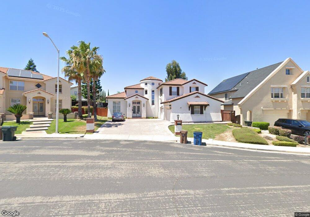
1966 Mount Henry Ct Antioch, CA 94531
Lone Tree Valley NeighborhoodEstimated Value: $806,000 - $943,000
4
Beds
3
Baths
3,579
Sq Ft
$243/Sq Ft
Est. Value
About This Home
This home is located at 1966 Mount Henry Ct, Antioch, CA 94531 and is currently estimated at $867,996, approximately $242 per square foot. 1966 Mount Henry Ct is a home located in Contra Costa County with nearby schools including Lone Tree Elementary School, Dallas Ranch Middle School, and Deer Valley High School.
Ownership History
Date
Name
Owned For
Owner Type
Purchase Details
Closed on
Nov 6, 2025
Sold by
Revels William R and Lundy Vicki M
Bought by
Revels Lundy Trust and Revels
Current Estimated Value
Purchase Details
Closed on
Oct 2, 2003
Sold by
Black Diamond Knolls Ltd
Bought by
Revels William R and Lundy Vicki M
Home Financials for this Owner
Home Financials are based on the most recent Mortgage that was taken out on this home.
Original Mortgage
$462,500
Interest Rate
4.75%
Mortgage Type
Purchase Money Mortgage
Purchase Details
Closed on
Oct 16, 2002
Sold by
South Terra Corp
Bought by
Black Diamond Knolls Ltd
Create a Home Valuation Report for This Property
The Home Valuation Report is an in-depth analysis detailing your home's value as well as a comparison with similar homes in the area
Home Values in the Area
Average Home Value in this Area
Purchase History
| Date | Buyer | Sale Price | Title Company |
|---|---|---|---|
| Revels Lundy Trust | -- | None Listed On Document | |
| Revels William R | $530,500 | Old Republic Title | |
| Black Diamond Knolls Ltd | -- | Old Republic Title Company |
Source: Public Records
Mortgage History
| Date | Status | Borrower | Loan Amount |
|---|---|---|---|
| Previous Owner | Revels William R | $462,500 | |
| Closed | Revels William R | $57,800 |
Source: Public Records
Tax History
| Year | Tax Paid | Tax Assessment Tax Assessment Total Assessment is a certain percentage of the fair market value that is determined by local assessors to be the total taxable value of land and additions on the property. | Land | Improvement |
|---|---|---|---|---|
| 2025 | $8,667 | $757,231 | $149,281 | $607,950 |
| 2024 | $8,182 | $742,384 | $146,354 | $596,030 |
| 2023 | $8,182 | $727,829 | $143,485 | $584,344 |
| 2022 | $8,051 | $713,559 | $140,672 | $572,887 |
| 2021 | $7,476 | $666,500 | $131,395 | $535,105 |
| 2019 | $7,173 | $632,000 | $124,594 | $507,406 |
| 2018 | $6,934 | $622,500 | $122,721 | $499,779 |
| 2017 | $6,362 | $567,500 | $111,878 | $455,622 |
| 2016 | $5,804 | $515,500 | $101,627 | $413,873 |
| 2015 | $6,170 | $515,500 | $101,627 | $413,873 |
| 2014 | $7,101 | $500,000 | $98,571 | $401,429 |
Source: Public Records
Map
Nearby Homes
- 1653 Observation Ct
- 5488 Southwood Ct
- 5448 Southwood Way
- 1803 Sanger Peak Way
- 1246 Oak Haven Way
- 1821 Kern Mountain Way
- 2096 Mokelumne Dr
- 1879 Mount Conness Way
- 1256 Mokelumne Ct
- 5388 Southwood Way
- 2487 Stanford Way
- 2500 Vallecito Way
- 5081 Mesa Ridge Dr
- 2469 Sparrow Ct
- 5106 Watkings Way
- 2512 Forty Niner Way
- 1157 Rockspring Way
- 1505 Barkley Mountain Way
- 2117 Mark Twain Dr
- 2625 Orange Way
- 1964 Mount Henry Ct
- 1968 Mount Henry Ct
- 1968 Windy Peak Ct
- 1966 Windy Peak Ct
- 1962 Mount Henry Ct
- 1970 Windy Peak Ct
- 1970 Mount Henry Ct
- 1964 Windy Peak Ct
- 1974 Mount Henry Ct
- 1976 Mount Henry Ct
- 1960 Mount Henry Ct
- 1978 Mount Henry Ct
- 1972 Mount Henry Ct
- 1962 Windy Peak Ct
- 1971 Windy Peak Ct
- 1980 Mount Henry Ct
- 1967 Windy Peak Ct
- 1965 Windy Peak Ct
- 1986 Mount Wilson Ct
- 1969 Windy Peak Ct
Your Personal Tour Guide
Ask me questions while you tour the home.