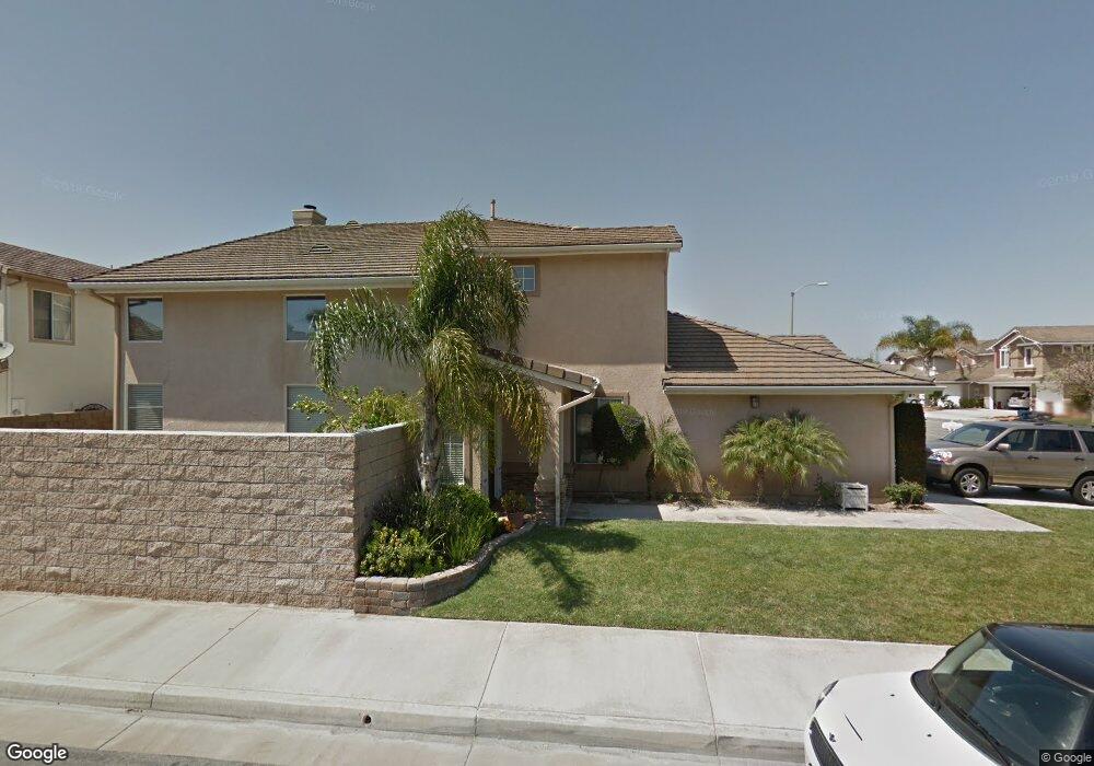
19661 Ashworth Cir Huntington Beach, CA 92646
Adams NeighborhoodEstimated Value: $1,340,000 - $1,834,000
5
Beds
3
Baths
2,337
Sq Ft
$706/Sq Ft
Est. Value
About This Home
This home is located at 19661 Ashworth Cir, Huntington Beach, CA 92646 and is currently estimated at $1,650,726, approximately $706 per square foot. 19661 Ashworth Cir is a home located in Orange County with nearby schools including Isojiro Oka Elementary, Talbert Middle School, and Huntington Beach High School.
Ownership History
Date
Name
Owned For
Owner Type
Purchase Details
Closed on
Mar 1, 2023
Sold by
Anderson Joni D
Bought by
Anderson Family Trust
Current Estimated Value
Purchase Details
Closed on
Sep 24, 2003
Sold by
Rindone Carolyn L
Bought by
Anderson Curtis A and Anderson Joni D
Home Financials for this Owner
Home Financials are based on the most recent Mortgage that was taken out on this home.
Original Mortgage
$225,750
Interest Rate
5.98%
Mortgage Type
Purchase Money Mortgage
Purchase Details
Closed on
Jul 28, 1997
Sold by
Presley Homes
Bought by
Rindone Carolyn L
Home Financials for this Owner
Home Financials are based on the most recent Mortgage that was taken out on this home.
Original Mortgage
$267,200
Interest Rate
7.54%
Create a Home Valuation Report for This Property
The Home Valuation Report is an in-depth analysis detailing your home's value as well as a comparison with similar homes in the area
Home Values in the Area
Average Home Value in this Area
Purchase History
| Date | Buyer | Sale Price | Title Company |
|---|---|---|---|
| Anderson Family Trust | -- | -- | |
| Anderson Curtis A | $716,000 | Orange Coast Title Company | |
| Rindone Carolyn L | $334,000 | First American Title Ins Co |
Source: Public Records
Mortgage History
| Date | Status | Borrower | Loan Amount |
|---|---|---|---|
| Previous Owner | Anderson Curtis A | $225,750 | |
| Previous Owner | Rindone Carolyn L | $267,200 |
Source: Public Records
Tax History Compared to Growth
Tax History
| Year | Tax Paid | Tax Assessment Tax Assessment Total Assessment is a certain percentage of the fair market value that is determined by local assessors to be the total taxable value of land and additions on the property. | Land | Improvement |
|---|---|---|---|---|
| 2025 | $11,218 | $1,017,640 | $724,172 | $293,468 |
| 2024 | $11,218 | $997,687 | $709,973 | $287,714 |
| 2023 | $10,956 | $978,125 | $696,052 | $282,073 |
| 2022 | $10,799 | $958,947 | $682,404 | $276,543 |
| 2021 | $10,589 | $940,145 | $669,024 | $271,121 |
| 2020 | $10,527 | $930,505 | $662,164 | $268,341 |
| 2019 | $10,306 | $912,260 | $649,180 | $263,080 |
| 2018 | $10,107 | $894,373 | $636,451 | $257,922 |
| 2017 | $9,945 | $876,837 | $623,972 | $252,865 |
| 2016 | $9,512 | $859,645 | $611,738 | $247,907 |
| 2015 | $9,367 | $846,733 | $602,549 | $244,184 |
| 2014 | $9,113 | $823,640 | $590,746 | $232,894 |
Source: Public Records
Map
Nearby Homes
- 19774 Cambridge Ln
- 9831 Continental Dr
- 19843 Coventry Ln
- 19860 Claremont Ln
- 10022 Bismark Dr
- 9745 Cornwall Dr
- 19880 Berkshire Ln
- 9594 Pettswood Dr Unit 4
- 9667 Durham Dr
- 19846 Lures Ln
- 19361 Brookhurst St Unit 87
- 19361 Brookhurst St Unit 50
- 19361 Brookhurst St Unit 184
- 19361 Brookhurst St Unit 22
- 19361 Brookhurst St Unit 159
- 19361 Brookhurst St Unit 21
- 19361 Brookhurst St Unit 33
- 19361 Brookhurst St Unit 143
- 19901 Burnley Ln
- 9695 Adams Ave
- 19651 Ashworth Cir
- 9775 Constitution Dr
- 19641 Ashworth Cir
- 9792 Constitution Dr
- 9782 Constitution Dr
- 9802 Constitution Dr
- 19662 Ashworth Cir
- 19662 Clancy Ln
- 19631 Ashworth Cir
- 19652 Clancy Ln
- 19652 Ashworth Cir
- 9772 Constitution Dr
- 19642 Clancy Ln
- 9812 Constitution Dr
- 19642 Ashworth Cir
- 9762 Constitution Dr
- 9822 Constitution Dr
- 19621 Ashworth Cir
- 19632 Ashworth Cir
- 19632 Clancy Ln